Rain Followed By Wind Cold Through Friday Warmer Easter Weekend

Weather in 5/Joe & Joe Weather Show Latest Podcast
Rain Followed By Wind Cold Through Friday Warmer Easter Weekend
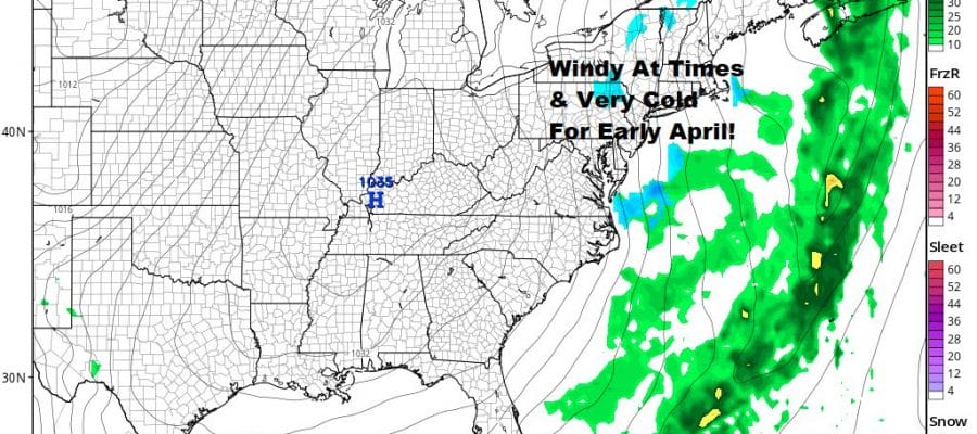
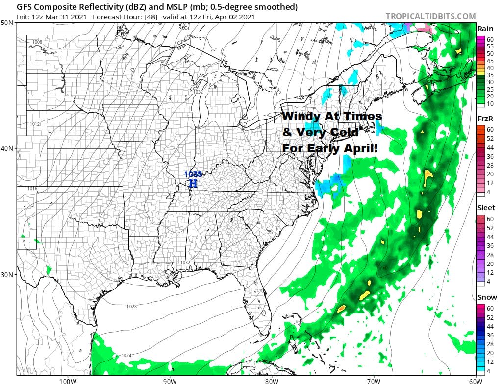
A cold front is getting closer and we are seeing clouds coming in from the west. Showers are in a narrow band to the west crossing Pennsylvania and they we will reach the coast this evening. Look for a few heavy downpours and perhaps even a rumble or two of thunder. The Storm Prediction Center has a marginal risk of severe weather a little further south now taking it out of Southern New Jersey though there is a risk of general thunderstorms extending northward to just north of NYC.
SATELLITE

Temperatures are reaching the 60s ahead of the front away from the ocean. Once the front passes later this evening the first round of showers will be done. Then a wave develops on the front and that brings another round of rain later tonight into Thursday morning.
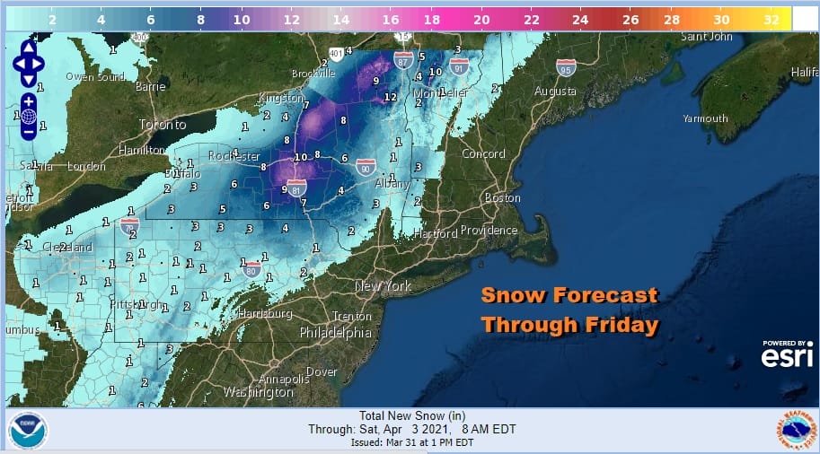
For you snow lovers and late season skiers head north upstate where snow could accumulate over a foot in the higher elevations north oF i-90. Elsewhere Thursday after the rain ends it will become breezy and turn colder with temperatures in the 40s. We will be heading down to the 20s by Friday morning with a gusty wind making it feel like it is in the teens. Skies should partially clear out.

For the beginning of April, highs in the upper 30s and lower 40s are 15 degrees below average. These are normal highs for late February! Add to that the wind which will be gusting 30 mph or more and Friday will have a rather harsh feel to it. We should see some sunshine though clouds will be around especially inland as an upper trough passes through and then moves to the East.
While the gradient will be tight, it should be just loose enough to keep us under wind advisory criteria. Another cold night lies ahead for Friday night with most lows in the upper 20s to mid 30s. The Easter Weekend looks okay but not perfect. Saturday we should see a rebound in temperatures with highs in the 50s. We should also have some sunshine though clouds will likely increase some in the afternoon and evening. There is a weak trough moving through Saturday night that might produce a few scattered showers. Many of you won’t see much if anything at all. Easter Sunday starts with clouds but it should go partly sunny with highs in the 60s.
BE SURE TO DOWNLOAD THE FREE METEOROLOGIST JOE CIOFFI WEATHER APP &
ANGRY BEN’S FREE WEATHER APP “THE ANGRY WEATHERMAN!
MANY THANKS TO TROPICAL TIDBITS FOR THE USE OF MAPS
Please note that with regards to any severe weather, tropical storms, or hurricanes, should a storm be threatening, please consult your local National Weather Service office or your local government officials about what action you should be taking to protect life and property.


