Rain Exits Later Today A Mostly Quiet Week Ahead No Major Systems

Rain Exits Later Today A Mostly Quiet Week Ahead No Major Systems

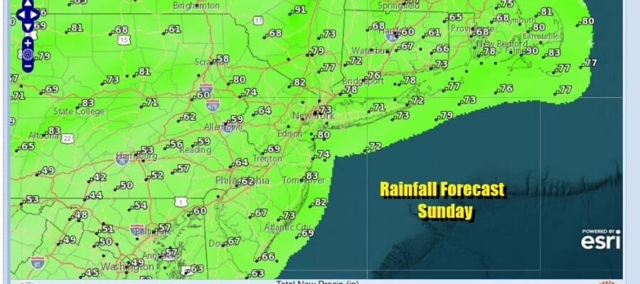
We have a rainy start to our Sunday. Low pressure is moving northward up the Appalachians and a ew center develops in Southern New England and slides east later today. Rainfall amounts will be on the order of a half to three quarters of an inch in total. Rains will end from southwest to northeast late morning and early afternoon with leftover clouds to follow.
SATELLITE WITH LIGHTNING STRIKES

WEATHER RADAR

Southern New England and Long Island will see the rains end a little later, mid to late afternoon seems likely. As for temperatures Sunday we will see a bit of a range where clouds and rain linger a while longer highs will be in the upper 40s and lower 60s. Southern New Jersey and points south will see the rain end earlier and that should allow temperatures to top in the middle to possibly some upper 50s.

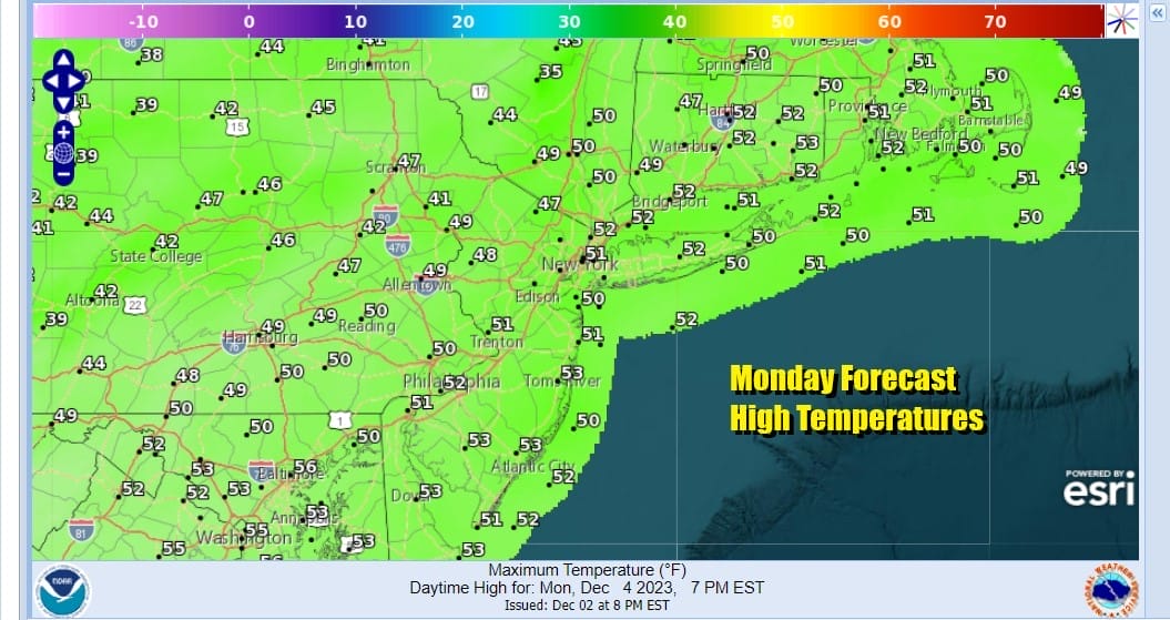
We should partially clear out Sunday night with lows in the upper 30s to mid 40s. There isn’t much in the way of cold air around to start off the week. Monday looks to be a day of clouds and some sunshine. Temperatures Monday should be lower in general than Sunday but highs will be a little above average reaching the lower 50s in the afternoon.
This week ahead features no major systems to worry about. Even the minor ones aren’t anything to speak of. Tuesday into early Wednesday weak low pressue and an upper trough will head southeast from the Great Lakes. A small dying area of rain and snow will exit the Ohio Valley and basically fall apart as a new low forms offshore midweek. This will help to pull down some colder air and temperatures will trend lower.

There will be some clouds around Tuesday along with some sunshine in the mix. Temperatures will be lower Tuesday as we top out in the 40s. As the low develops offshore colder air filters southward from Eastern Canada south to the Mid Atlantic. All the precipiation with this system offshore remains offshore with no issues.

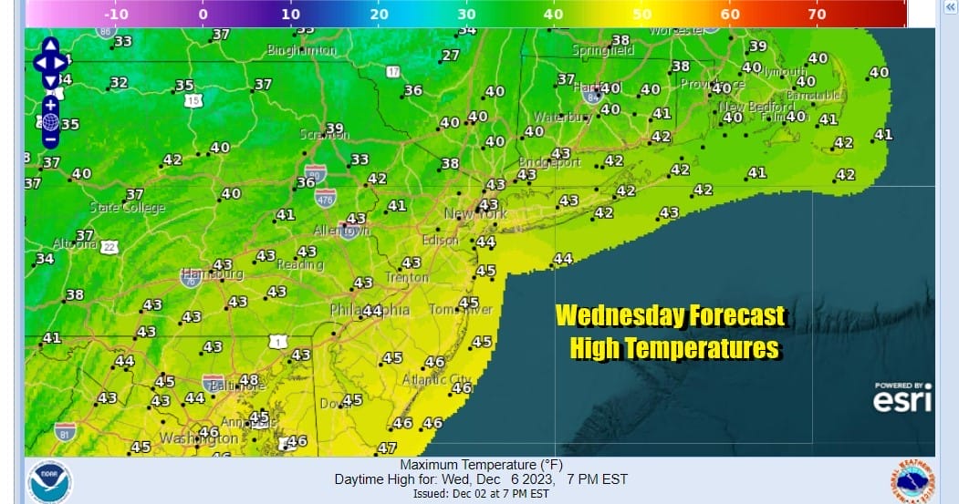
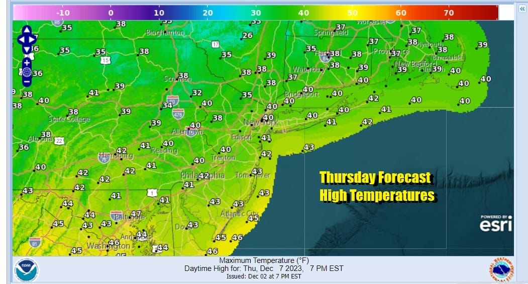
Wednesday and Thursday will be the two coldest days this week but that is a relative term with average temperatures for early December. We will see some sunshine Wednesday and it will probably get a little breezy especially along the coast. Highs will be in the low to mid 40s. Thursday will be a sunny chilly day with highs in the upper 30s and lower 40s.
A weak warm front will go by early Friday and temperatures will come up a bit with some sun breaking through morning clouds and highs reaching into the 50s. Next week attention turns to a storm system heading to our west with a strong cold front heading for the East Coast. Right now I would think Saturday will be okay and perhaps we may see some rain approach later next Sunday but for now the timing is a little difficult to figure with this at this early stage.
BE SURE TO DOWNLOAD THE FREE METEOROLOGIST JOE CIOFFI WEATHER APP &
ANGRY BEN’S FREE WEATHER APP “THE ANGRY WEATHERMAN!
MANY THANKS TO TROPICAL TIDBITS FOR THE USE OF MAPS
Please note that with regards to any severe weather, tropical storms, or hurricanes, should a storm be threatening, please consult your local National Weather Service office or your local government officials about what action you should be taking to protect life and property.
(Amazon is an affilate of Meteorologist Joe Cioffi & earns commissions on sales.)


