On & Off Rain Through the Weekend
Next Week Sees Weak Systems Moving Through

On & Off Rain Through the Weekend
Next Week Sees Weak Systems Moving Through

We have come to the end of the work week and the warm up that began yesterday continues today. Clouds are thickening up and the satellite and radars are showing rain heading east and overspreading Eastern Pennsylvania to Southern New England this afternoon into tonight. This system that has come out of the Southern Plains and into the Ohio Valley is nothing special so we don’t expect anything substantial rainfall wise. Between now and Saturday morning when the rain should be long gone, rainfall amounts will be in the order of a quarter of an inch or less. Temperatures today will be in the 50s.
SATELLITE WITH LIGHTNING STRIKES

WEATHER RADAR

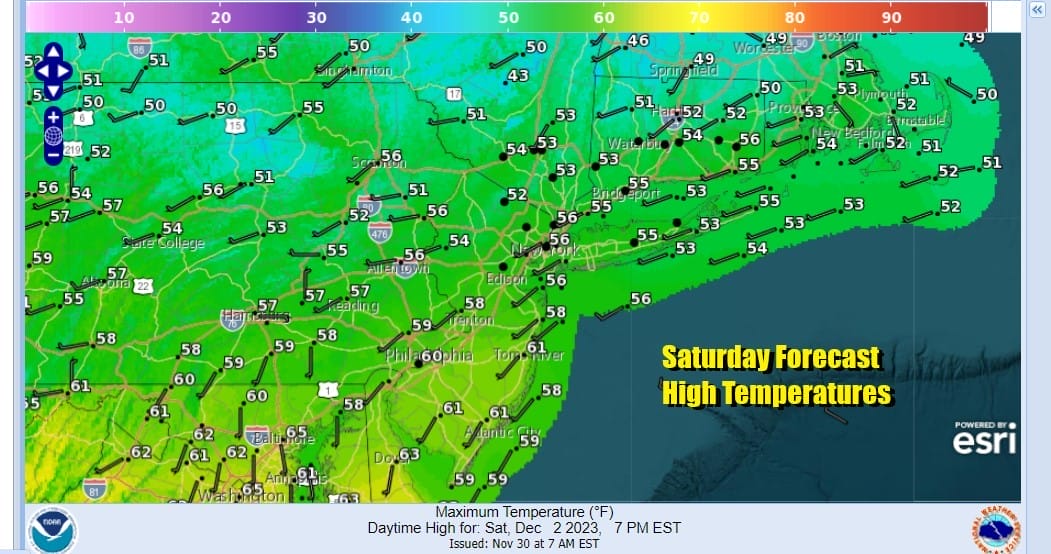
Much of the rain actually will be coming to an end this evening from west to east leaving us in leftover clouds overnight with lows in the upper 30s to mid 40s. Saturday looks to be a cloudy day as we wait for the next weather system moving along in the flow. Much of the dayside will be dry with highs reaching the upper 50s and lower 60s.
This next weather system will have a bit more to it as low pressure moves east from the Ohio Valley and moisture moves up the Eastern Seaboard. Rain will develop from south to north Saturday evening and last into Sunday morning before ending from south to north midday or at the latest early afternoon.

Most highs Sunday will be in the 50s. We should see some slow improvement Sunday afternoon and skies will partially clear Sunday night. Next week brings two weather systems diving southeast from the Plains to the Mid Atlantic states. The first one comes Tuesday into Wednesday and appears to be on the weak side.

The first system will likely not produce much in the way of precipitation but as it develops offshore it will bring down colder air for the middle and latter portion of the week. For now we will go with clouds and some sun for Monday with highs in the low to mid 50s. Tuesday will be cooler with highs in the 40s and by the time we get to Wednesday highs will be just in the 30s. The second system may come in time for the weekend but here too we have what could be an overdone system by models. The system is shown to weaken as it moves southeast so we won’t get too worked up about this for now.
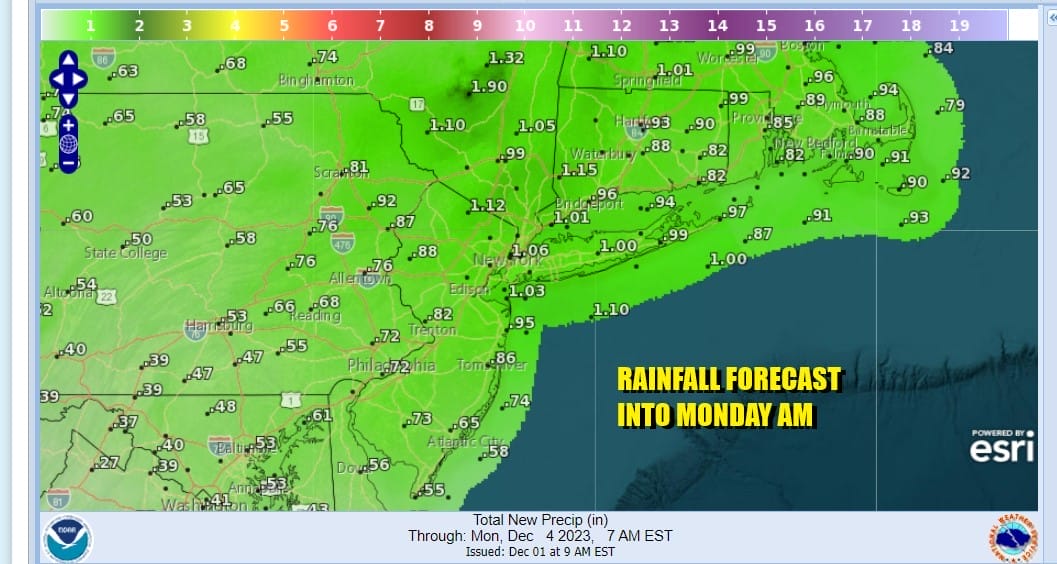
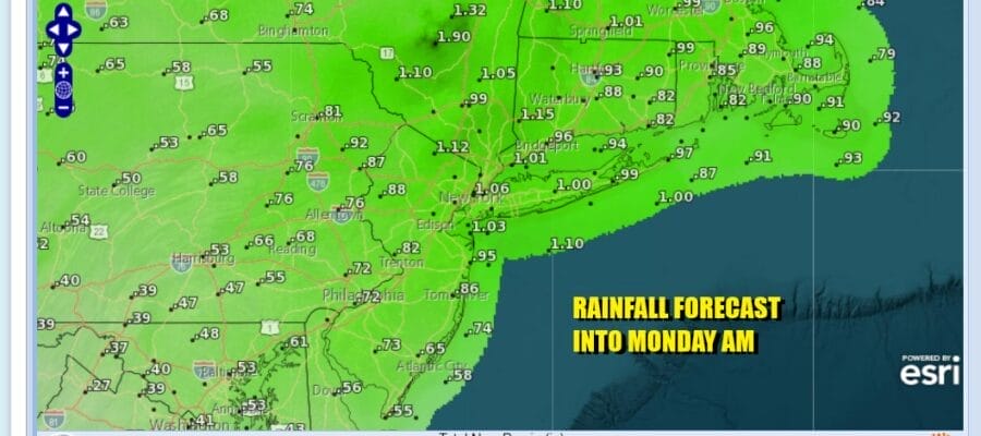
Back to the systems for this weekend, as far as rainfall is concerned, rainfall amounts in total will be on the order of 3/4 inch to 1.25 inches in most places with the heaviest rains from NYC eastward however this is spread out over 3 days should it should not be a big issue for those of you travelling around this weekend.
BE SURE TO DOWNLOAD THE FREE METEOROLOGIST JOE CIOFFI WEATHER APP &
ANGRY BEN’S FREE WEATHER APP “THE ANGRY WEATHERMAN!
MANY THANKS TO TROPICAL TIDBITS FOR THE USE OF MAPS
Please note that with regards to any severe weather, tropical storms, or hurricanes, should a storm be threatening, please consult your local National Weather Service office or your local government officials about what action you should be taking to protect life and property.
(Amazon is an affilate of Meteorologist Joe Cioffi & earns commissions on sales.)


