Dry Work Week Ahead Strong Cold Front Coming Late in the Weekend

Dry Work Week Ahead Strong Cold Front Coming Late in the Weekend
Low pressure is slowing moving away from Northern New England and that leaves us in a place where a stairstep decline in temperatures will occur over the next 3 days.This is going to be a quiet weather week with not much happening precipitation wise. Clouds and some sun will be the story today with temperatures on the warm side of average as highs will be generally in the lower 50s. While radars are busy in Northern New England with snow across much Maine, radars locally will be nice and quiet for much of this week.
SATELLITE WITH LIGHTNING STRIKES

WEATHER RADAR

We will probably see clouds decrease tonight and skies will be partially clear for the most part with most lows in the 30s. Tuesday looks to be a partly sunny day as an upper trough approaches. Weak low pressure will fall part as it head southeast from the Great Lakes and eventually redevelops as an offshore storm.

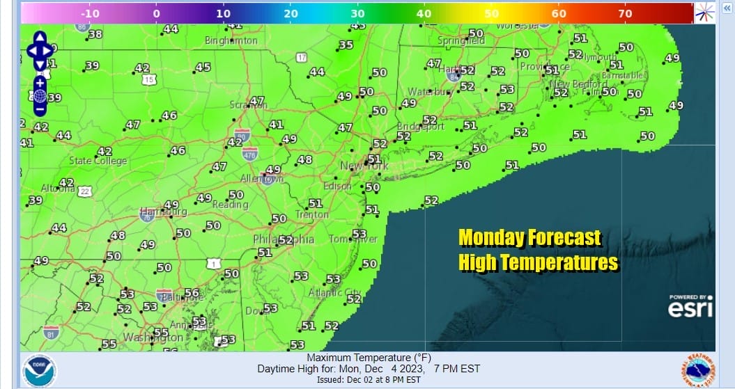
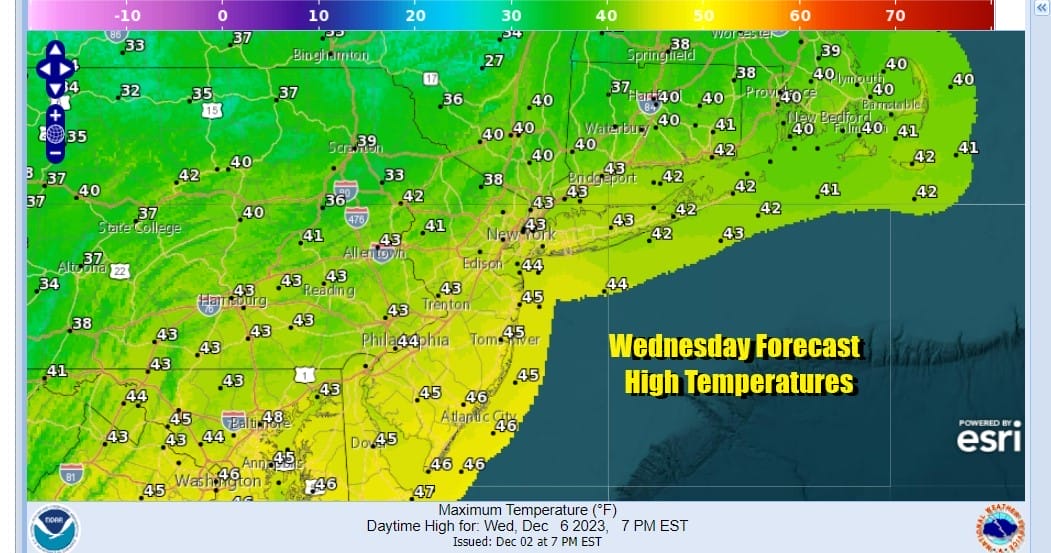
Tuesday high temperatures will be in the low to middle 40s for the most part and then we drop into the 30s Tuesday night into Wednesday morning with 20s inland. Wednesday will be partly sunny and on the cold side as temperatures nudge a little lower and highs will be in the upper 30s and lower 40s with lows Thursday morning in the 20s to lower 30s.
Thursday the core of this round of colder air will move eastward and we will start to see temperatures move higher. We see Thursday as being a sunny day with high temperatures in the upper 30s and lower 40s. Friday we will move much higher into the 50s and a southwest flow develops and we should finish the week with no worse than partly sunny skies.

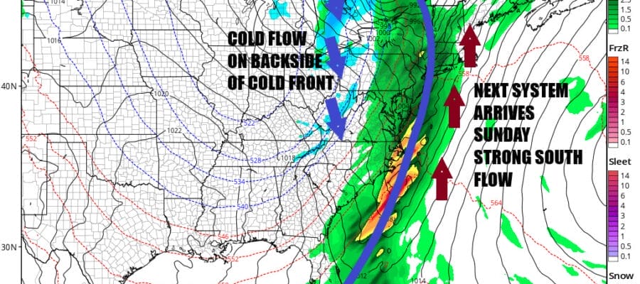
Cold air remains transitory as air masses come and go and low pressure coming out of the Rockies and Southern Plains this week will head to the Ohio Valley and eventually move into Southeastern Canada. The strengthening storm will produce a strong cold front that will move eastward over the weekend. Saturday right now looks to be dry and warm with highs in the 50s and no worse than partly sunny skies. Sunday we will see deteriorating weather conditions with an increasing south wind and rain likely later in the day into Sunday night. We could see 60s for highs Sunday especially inland before the front passes through. As far as snow is concerned, the pattern right now is unfavorable for an early winter snowfall for at least the next 10 days or so.
BE SURE TO DOWNLOAD THE FREE METEOROLOGIST JOE CIOFFI WEATHER APP &
ANGRY BEN’S FREE WEATHER APP “THE ANGRY WEATHERMAN!
MANY THANKS TO TROPICAL TIDBITS FOR THE USE OF MAPS
Please note that with regards to any severe weather, tropical storms, or hurricanes, should a storm be threatening, please consult your local National Weather Service office or your local government officials about what action you should be taking to protect life and property.
(Amazon is an affilate of Meteorologist Joe Cioffi & earns commissions on sales.)


