Quiet Weather Until Sunday When A Cold Front
Produces Strong Winds & Heavy Rain

Quiet Weather Until Sunday When A Cold Front
Produces Strong Winds & Heavy Rain

We are moving along what is going to be a rather uneventful week until we get to the second half of the weekend when things will get a bit rough and stormy. Today we have an upper trough moving southeast in the Ohio Valley with an area of light rain and wet snow but we expect this to move southeast and not be an issue for Eastern Pennsylvania to Southern New England. There will be clouds however in the mix along with some sunshine and temperatures today will continue their trend of going lower with highs today mostly in the 40s. Local radars are nice and quiet and should remain so.
SATELLITE WITH LIGHTNING STRIKES

WEATHER RADAR

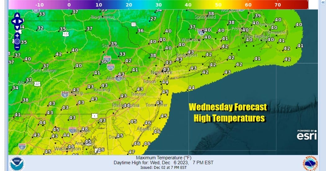
As a north wind kicks in we will see colder air draining southward from Eastern Canada and with partially clear skies, lows Wednesday morning will be mostly in the mid 20s to lower 30s except middle 30s in the warmest urban settings. Wednesday we see a low developing offshore and heading east. We will have sunshine and clouds along with a northerly breeze. Highs will be mainly in the upper 30s and lower 40s.
There is the odd outside chance for an isolated rain or snow shower but the chances of this are very low. As the offshore low moves away Wednesday night skies will clear with lows again across Eastern Pennsylvania to Southern New England will be in the cold 20s. Thursday will be a nice day with more sunshine, fewer clouds, and highs in the upper 30s and lower 40s.
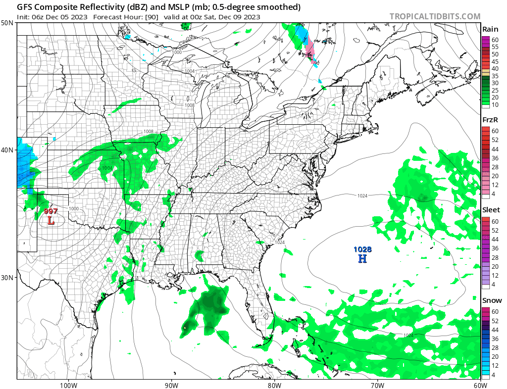
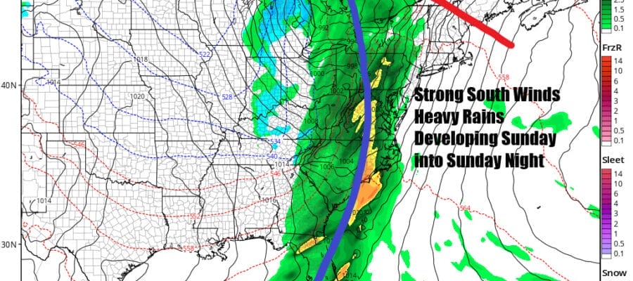
Friday begins a warm up as a cold high moves out to the east and a southerly flow begins so temperatures will bounce into the 50s area wide. Skies should be partly to mostly sunny. Saturday defintely will be the better of the two weekend days as highs reach the upper 50s and even some lower 60s with sunshine. The south wind increases as the gradient tightens up. High pressure near Bermuda and a strong developing low that runs from the Sourthern Plains to the Great Lakes and then into Southeastern Canada will create a very tight pressure gradient. Strong south winds will develop Sunday with gusts of 30 to 40 mph or higher. Rain develops from west to east during midday and afternoon Sunday lasting into Sunday night. Some of the rain will be heavy. Highs will be in the 50s to lower 60s with warmer temperatures inland. Most of the rain should be done late Sunday evening from west to east and we will see improving weather conditions come next Monday. This system could produce rainfall amounts of an inch to an inch and a half in some places. Next week looks to be a dry colder weak but no true arctic air is in the cards.
BE SURE TO DOWNLOAD THE FREE METEOROLOGIST JOE CIOFFI WEATHER APP &
ANGRY BEN’S FREE WEATHER APP “THE ANGRY WEATHERMAN!
MANY THANKS TO TROPICAL TIDBITS FOR THE USE OF MAPS
Please note that with regards to any severe weather, tropical storms, or hurricanes, should a storm be threatening, please consult your local National Weather Service office or your local government officials about what action you should be taking to protect life and property.
(Amazon is an affilate of Meteorologist Joe Cioffi & earns commissions on sales.)


