Colder Into Thursday Then Warmer Followed By
Stormy Conditions Late Sunday Into Monday

Colder Into Thursday Then Warmer Followed By
Stormy Conditions Late Sunday Into Monday

Low pressure is developing offshore today and moving away to the east. It is drawing down colder air from Eastern Canada down the coast. We do see lots of clouds on the satellite and this looks to be a day where it will be partly sunny to mostly cloudy. There is the odd chance for a rain or snow shower as an upper trough moves through. There have been some snow showers over Southeastern New England but those will wind down today. Otherwise it is just the odd chance across Eastern Pennsylvania to Southern New England. Temperatures today will top mostly in the upper 30s and lower 40s.
SATELLITE WITH LIGHTNING STRIKES

WEATHER RADAR

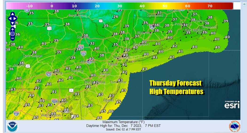
The north wind will make it feel a little colder today as it will be breezy especially along the coast. Skies will clear out tonight and by Thursday morning, lows will be in the 20s just about everywhere. Thursday is going to be a sunny day with high temperatures again in the upper 30s and lower 40s.
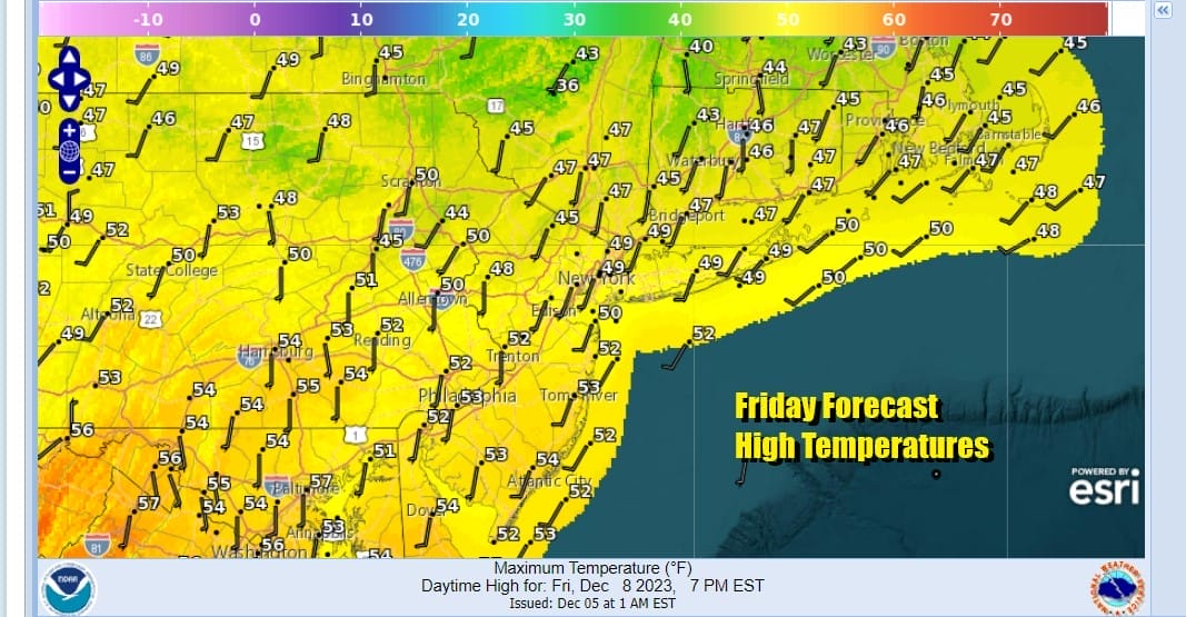
High pressure will be moving off the South Atlantic coast Thursday night and Friday and this will turn winds to west and then southwest and that means a warmup gets underway. We are going to have a good deal of sunshine and temperatures should be able to climb to the upper 40s and lower 50s.
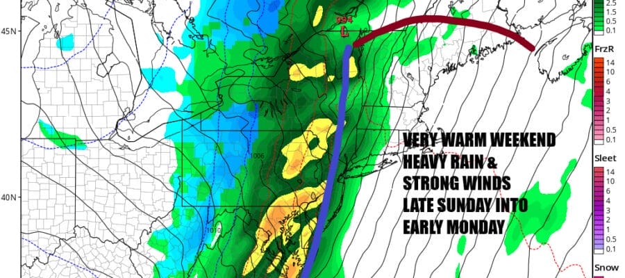
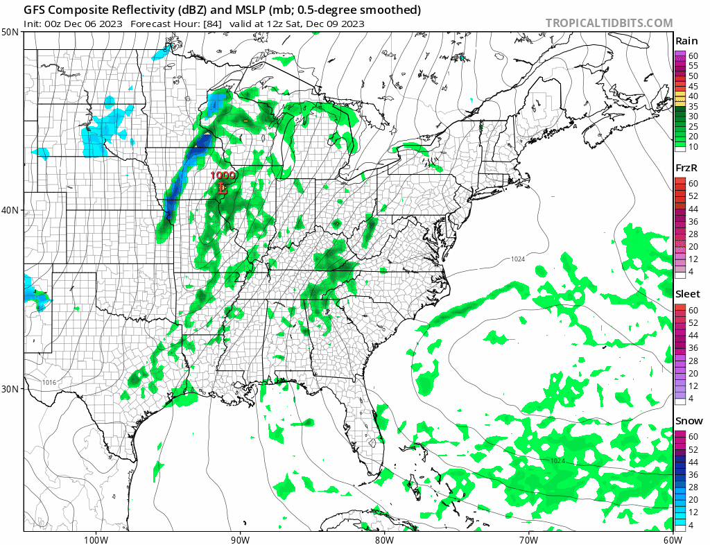
As far as the weekend is concerned, we are going to have to deal with a strong cold front and a tightening pressure gradient for late Sunday into early Monday morning. However we still have Saturday which will be the better of the two weekend days. High pressure offshore holds on while low pressure from the Southern Plains runs into the Great Lakes.
 That lead low will weaken but the front and upper air energy will ignite another wave. The gradient gets super tight during Sunday afternoon into Monday morning and we will see southerly winds pick up to 25 to 35 mph with gusts over 50 mph possible. The European model is forecasting gusts above 70 mph but we aren’t ready to embrace that idea at the moment.

This leaves us with a mainly sunny Saturday with highs in the upper 50s and lower 60s. I think we will start Sunday with some sun before clouds increasing and winds pick up considerably. The worst of the wind will be late Sunday afternoon into Monday morning and we will see a 6 hour or so period of heavy rain that produces 1 to 2 inches in some places. A little lightning and thunder is also possible.

Sunday’s highs will reach the low to middle 60s. Once the front passes offshore by early Monday morning weather conditions improve and next week looks dry with mostly average temperatures for the early part of the week.
BE SURE TO DOWNLOAD THE FREE METEOROLOGIST JOE CIOFFI WEATHER APP &
ANGRY BEN’S FREE WEATHER APP “THE ANGRY WEATHERMAN!
MANY THANKS TO TROPICAL TIDBITS FOR THE USE OF MAPS
Please note that with regards to any severe weather, tropical storms, or hurricanes, should a storm be threatening, please consult your local National Weather Service office or your local government officials about what action you should be taking to protect life and property.
(Amazon is an affilate of Meteorologist Joe Cioffi & earns commissions on sales.)


