
Rain Ending & Much Colder Into Wednesday Late Week Rain Chances Increase
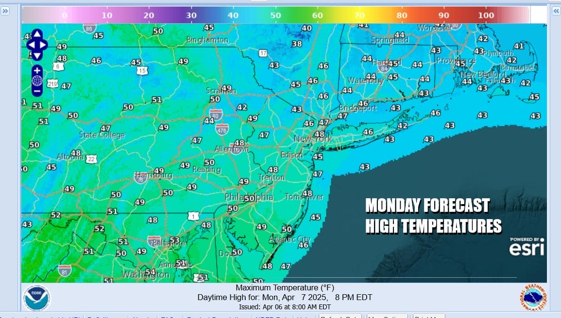
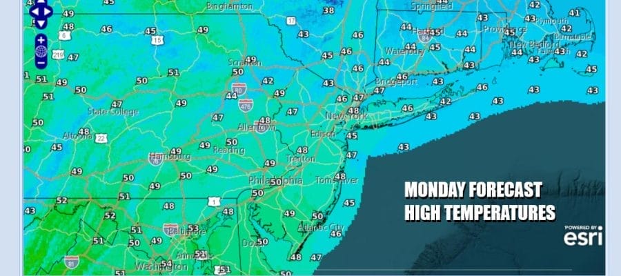
Colder air is arriving and we still have some work to do with regards to rain. A slow moving cold front is edging to the east and a wave on the front is creating rain this morning. Later today and into tonight the front will be far enough offshore that the rain will end from west to east and we will begin to see gradual improvement in weather conditions. The front will be pushed along by an upper trough and low pressure in Southeastern Canada moving eastward.

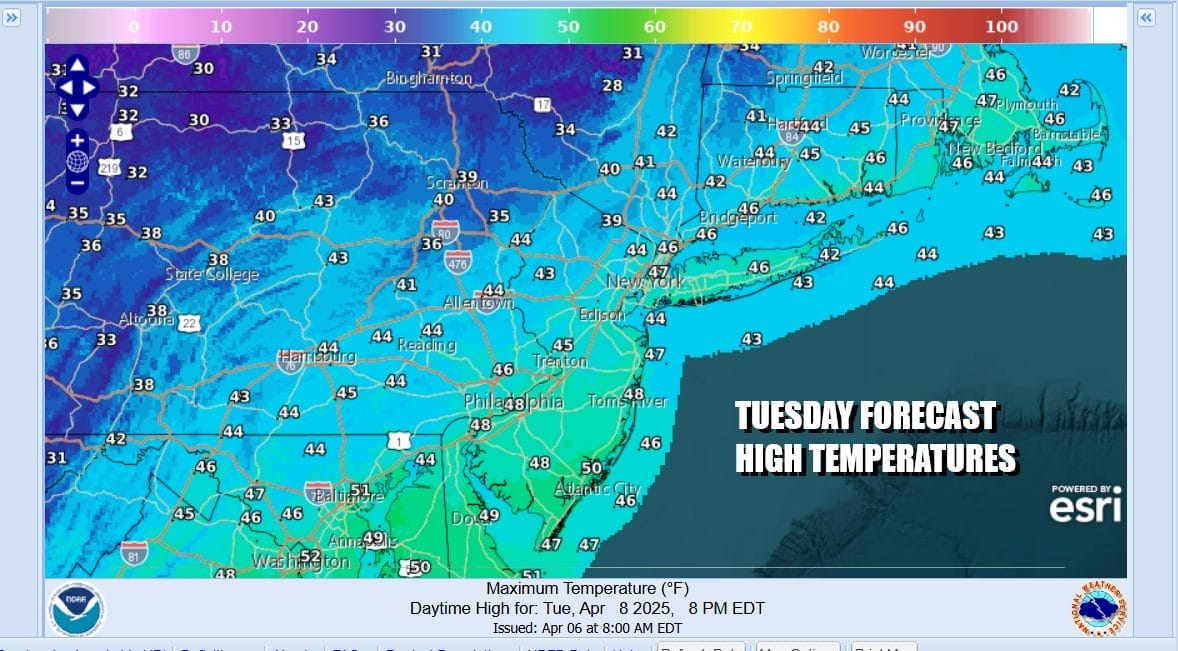
Northwest winds will begin to pick up and that is going to bring down a cold air mass that will be with us through midweek. Temperatures today are settling in the 40s and will stay there all day long giving you that raw chilly feeling. As skies clear out tonight and northwest winds increase, we will see temperatures drop into the 30s everywhere by Tuesday morning. Radars are on the busy side but the heaviest rain will likely be more to the south.
SATELLITE WITH LIGHTNING STRIKES

WEATHER RADAR

The air mass for Tuesday and Wednesday will be producing temperatures that will run 15 or so degrees below average. To put this in perspective, an air mass like this in January would mean temperatures in the teens and 20s by day and single digits at night. Clearly this is not January. It is April. That leaves us with a day of gusty winds and some sunshine Tuesday but high temperatures will be just in the 40s. Average highs this time of year should be in the upper 50s and lower 60s.
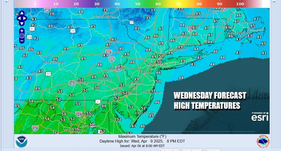
Tuesday night into Wednesday morning we are looking at clear skies and it will still be on the breezy side with Wednesday morning lows in the mid 20s to lower 30s. Wednesday dayside should see less wind and some sunshine. Highs again though will be struggling to get out of the 40s.
Weather conditions will start to deteriorate Wednesday night into Thursday as a warm front cold front combination struggles to move through and bringing with it a chance for showers as well as moderating temperatures in the 50s. The front is forecast to stall out up and down the Eastern Seaboard. A series of upper troughs will be diving into the Eastern US and this will lead to low pressure developing on the front and moving northward up the Appalachians Friday into early Saturday.

A southerly flow along the East Coast remains along the east coast over the weekend and as more energy piles into the Carolinas and Virginia, a second low develops offshore and moves northward up the coast. This is not looking good as far as the weekend is concerned as we set up for northeast winds and more rain for Saturday night and Sunday.
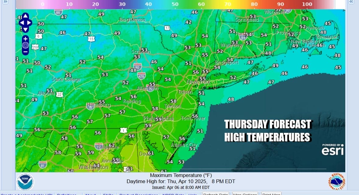
Thursday brings clouds and a few showers with tempratures back into the 50s. A short break follows before we get into more rain later Friday into early Saturday. Then another short break followed by more rain late Saturday and Sunday. This second low could bring with it some issues with coastal flooding depending on how strong the low gets as it moves northward. These late week systems have the potential to produce a few inches of rain across much of Eastern Pennsylvania to Southern New England.
BE SURE TO DOWNLOAD THE FREE METEOROLOGIST JOE CIOFFI WEATHER APP &
ANGRY BEN’S FREE WEATHER APP “THE ANGRY WEATHERMAN!
MANY THANKS TO TROPICAL TIDBITS FOR THE USE OF MAPS
Please note that with regards to any severe weather, tropical storms, or hurricanes, should a storm be threatening, please consult your local National Weather Service office or your local government officials about what action you should be taking to protect life and property.


