Rain Arrives Ending This Evening Low Humidity Sunshine Wednesday

Weather in 5/Joe & Joe Weather Show Latest Podcast
Rain Arrives Ending This Evening Low Humidity Sunshine Wednesday
Yesterday’s cold front that triggered off widespread severe weather inland stalled to the west of the coast last night and this morning. It is being held up by what is left of Tropical Storm Claudette which you can see the remnant circulation on the upper right. A wave develops on the front today that will bring about 6 hours or so of rain during today. It will be quick but some of the rain could be heavy at times and for some areas this could bring about some localized flooding issues.
SATELLITE

Radar is beginning to pick up on the rain as the echoes move northeastward while the entire are is sliding to the east. The regional radar shows that rain extends southward down the Appalachians. Rain will reach Eastern Pennsylvania before noon time and should be over Southern New England and Long Island by 2 or 3pm. From the time the rain starts just add about 6 hours to get the end time. The western edge of the rain should be at the coast by 7pm or so.
WEATHER RADAR


Weather conditions will improve tonight as the front pushes offshore. Skies will clear out and temperatures will settle in the 50s to lower 60s by morning. The dew points will be taking a big drop much like we saw last week.
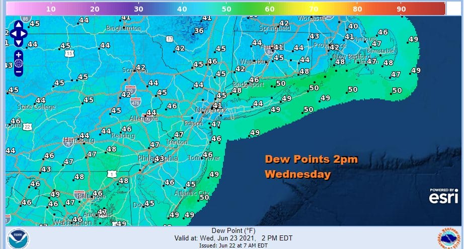
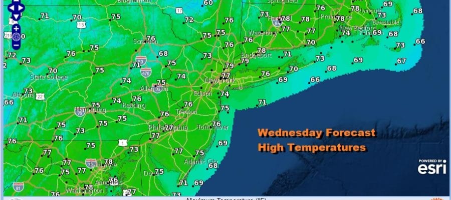
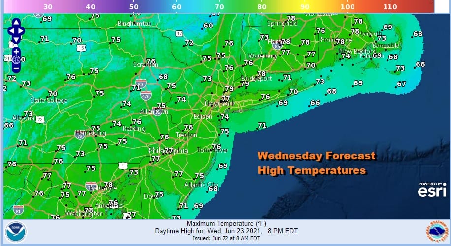
Those low dew points relative to the temperature will mean humidity levels down in the 30% range or in some cases even less. Temperature will be cool with highs only in the 70s. There will be lots of sunshine all day long making for a pleasant early summer day.
A nice cool night Wednesday night will lead to another nice day on Thursday with sunshine. The high will be to the east but at least initially the dry air will hold on. Dew points Thursday will still be in the 40s and highs will be in the mid 70s to around 80 degrees. Humidity levels will start to rise on Friday back into the upper 50s to lower 60s and temperatures will be in the 80s with some sunshine and a few clouds.
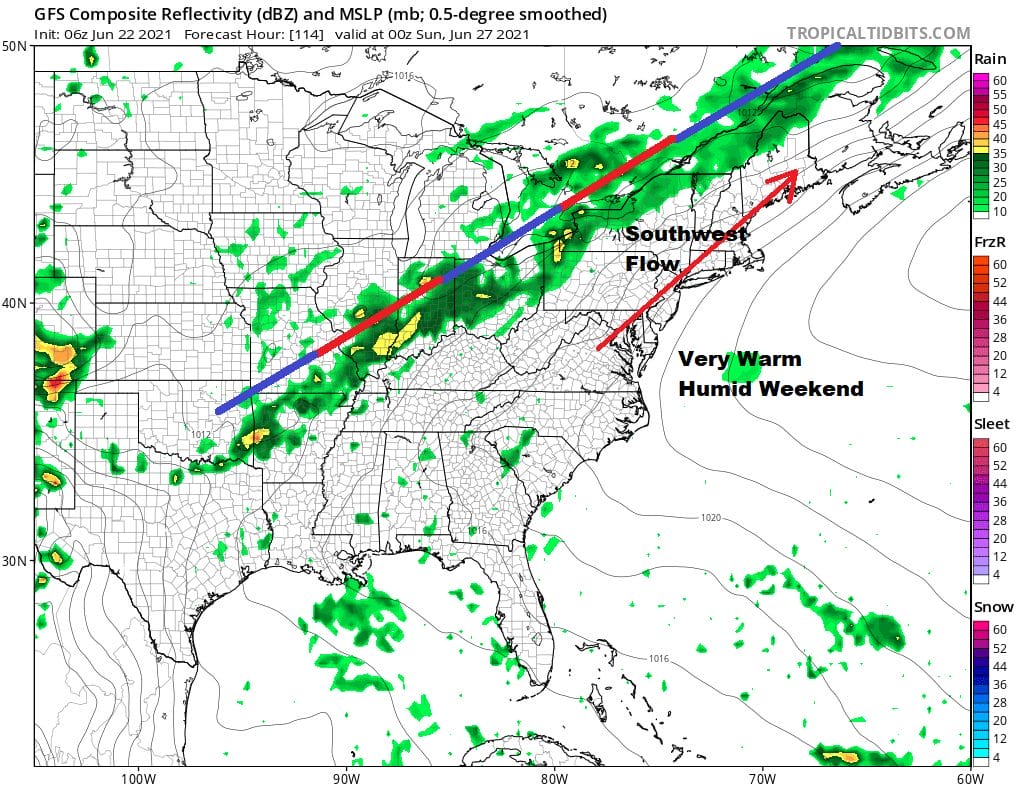
Putting it simply it is going to be a very warm and very humid weekend. High pressure to the east is building and getting stronger which keeps the next cold front stalled out well to the northwest. This opens up a moist southwest flow of very warm air. Saturday and Sunday will be days of hazy sunshine with very warm temperatures. Highs each day will be in the mid to upper 80s. Temperatures will be a little cooler at the shore. We will throw in the chance for an isolated downpour or a thunderstorm just for good measure but for most of you it will be a rain free last weekend of June.
BE SURE TO DOWNLOAD THE FREE METEOROLOGIST JOE CIOFFI WEATHER APP &
ANGRY BEN’S FREE WEATHER APP “THE ANGRY WEATHERMAN!

MANY THANKS TO TROPICAL TIDBITS & F5 WEATHER FOR THE USE OF MAPS
Please note that with regards to any severe weather, tropical storms, or hurricanes, should a storm be threatening, please consult your local National Weather Service office or your local government officials about what action you should be taking to protect life and property.


