Long Island Will Likely Miss Severe Storms Though Leftovers Will Move Through

Weather in 5/Joe & Joe Weather Show Latest Podcast
Long Island Will Likely Miss Severe Storms Though Leftovers Will Move Through
Once again it looks like Long Island will miss the severe thunderstorms that are out to our west crossing New Jersey. The presence of Tropical Storm Claudette to the east managed to stabilize the atmosphere by putting high clouds over head this afternoon cutting down the daytime heating. Also the marine layer this morning was a mitigating factor as is the ocean wind from the south keeping temperatures in the 70s most of the day.
SATELLITE

The thunderstorms are moving through New Jersey and the radars are showing them at peak intensity now. We have seen numerous severe thunderstorm warnings this afternoon and evening to the west. Cells will start to weaken but the leftovers could survive and produce some downpours tonight as the line of storms winds down.
WEATHER RADAR


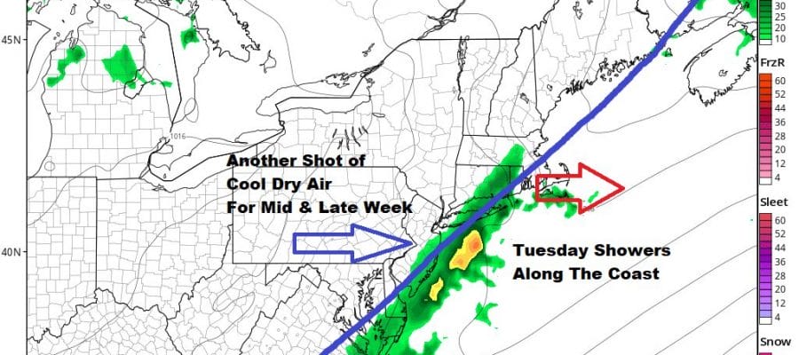
The cold front moving east will stall along the coast Thursday keeping us in clouds much of the day. There could be some showers during the afternoon as one last wave of low pressure moves northward and finally kicks the front out to the east. Temperatures Tuesday will be in the 70s.

The payoff comes Wednesday as another shot of very dry air heads into the Eastern US bringing us sunshine and another round of very low humidity. Temperatures will be cool Wednesday with most highs just in the low to mid 70s. Thursday will be another beautiful day of sunshine and very low humidity. Highs will be in the 70s to near 80 with cooler readings along the shore. The high moves out to the east leaving us dry on Friday but we will have to watch and see whether some clouds come in from the onshore flow. For now we will call Friday a mix of sun and clouds with highs in the 70s.
BE SURE TO DOWNLOAD THE FREE METEOROLOGIST JOE CIOFFI WEATHER APP &
ANGRY BEN’S FREE WEATHER APP “THE ANGRY WEATHERMAN!

MANY THANKS TO TROPICAL TIDBITS & F5 WEATHER FOR THE USE OF MAPS
Please note that with regards to any severe weather, tropical storms, or hurricanes, should a storm be threatening, please consult your local National Weather Service office or your local government officials about what action you should be taking to protect life and property.