Rain Advancing Northward Through Sunday Morning Thanksgiving Week Weather Gets Busy
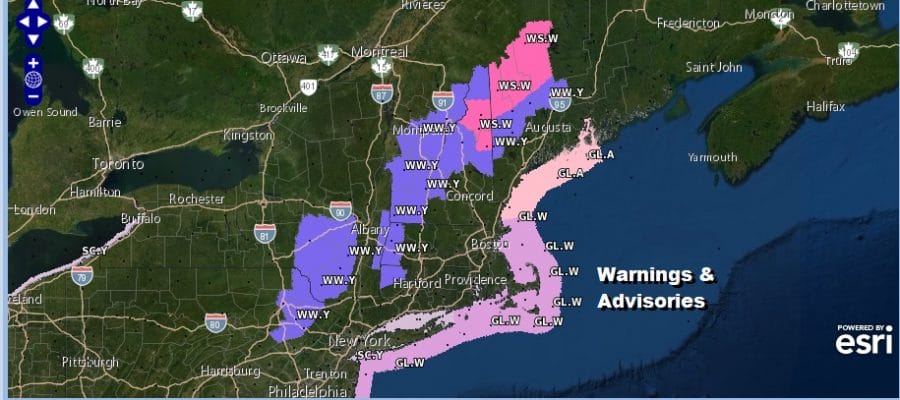
Winter Weather Advisory Northeast Pennsylvania & the Catskills
We managed to keep rain away from us today but no such luck tonight. The satellite picture shows clouds beginning to increase and thicken up overhead as they have advanced into Central New England. Meanwhile inland sections tonight well north and west of the coast could see some light freezing rain in elevated areas above 1000-1500 feet in NW New Jersey & the Hudson Valley along and north of Route 84.

In Northeast Pennsylvania northeastward into the Catskills we have Winter Weather Advisories up where we could see two to three inches of snow and ice with glazing on some roadways. Temperatures in these areas are mainly in the low to mid 30s this evening so some winter weather is likely.
Winter Storm Warnings are up further north into New England where higher snow amounts are expected. In some areas across Northern New England 6 inches or more will accumulate. Then again it is Northern New England!
SATELLITE

REGIONAL RADAR

Regional radar is loading up now with rain across all of Virginia and beginning to move into Maryland and Southern Pennsylvania right on schedule. The rains should starting coming into range of the local radars in the next few hours reaching NYC before midnight and in the Hudson Valley and Southern New England shortly after midnight.
LOCAL RADAR NEW YORK CITY

LOCAL RADAR PHILADELPHIA


For much of the area south and west of NYC the rain could be all over with by sunrise. Clouds will linger here and there could be another few showers going by in the afternoon as the low moves into Southeastern New England.

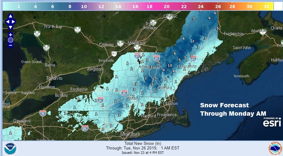
You can see the arc of snow on the NAM model for Sunday across Northeast Pennsylvania, the middle and upper Hudson Valley to Northeast NY and Northern New England. it is rain everywhere else and the models support the idea of a half inch to as much as an inch in some places before the low pulls away. Temperatures won’t stray far from the 30s inland and the 40s along the coast and probably hold in the 40s all day Sunday.
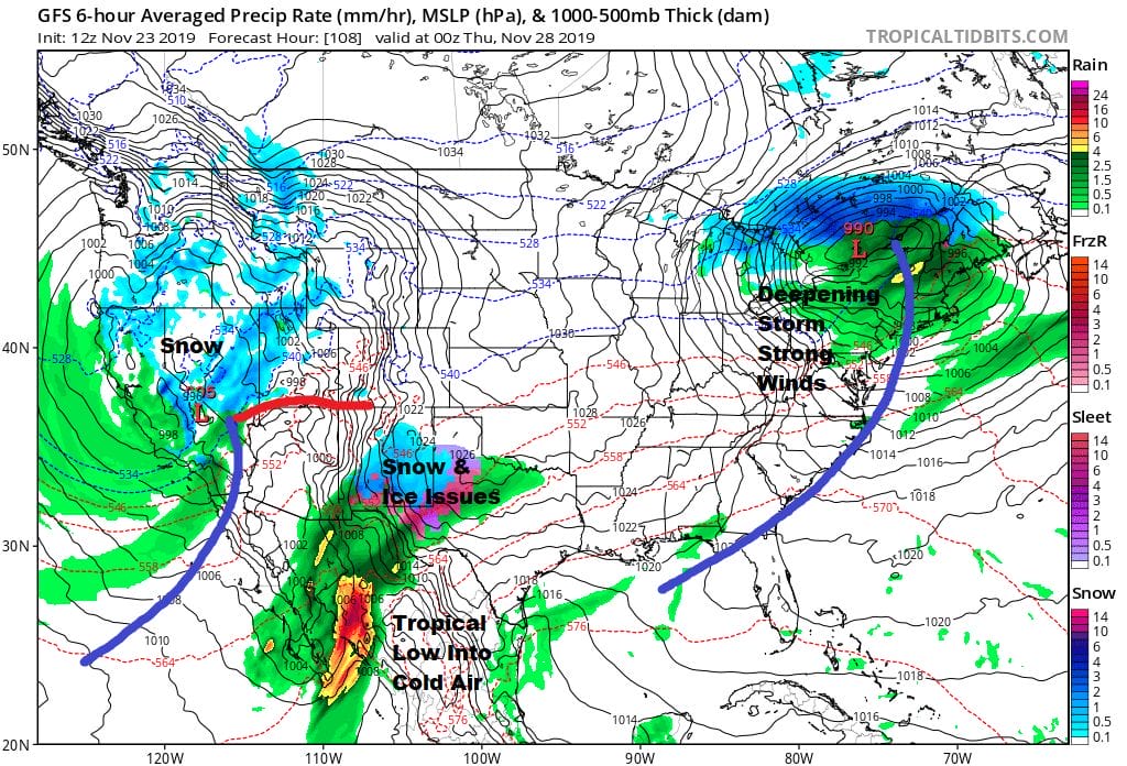
There are no important changesin the outlook for Thanksgiving week. Monday and Tuesday should be nice days with some sun. Highs Monday in the 40s to near 50 and into the 50s on Tuesday. The map above shows the nation’s weather gets busy on Wednesday especially in the West and Southwestern US where ample amounts of rain and snow are forecast. In out neck of the woods while there could be a passing shower or two Wednesday with the cold front and highs reaching the upper 50s and lower 60s, strong northwest winds will kick in behind the front and they will be howling Wednesday night into Thursday morning, Low pressure moves to Nova Scotia and intensifies into a major storm while strong high pressure builds into the Great Lakes. That sets up a very tight pressure gradient and we could see winds of 30 to 40 mph in gusts on Thanksgiving day which creates issues for baloons in the Macy’s Thanksgiving Day Parade. The day will be dry with some sunshine and highs in the 40s. Winds will still be with us on Friday and possible into Saturday though they should be a shade lower. We will see sunshine for Friday and Saturday with highs just into the 40s.

The atmosphere is undergoing a big change in the weather pattern this week thanks to Wednesday’s storm system. It slows down and we have a blocking pattern setting up as cold air spreads out across Canada. It looks like the first week of December will be an interesting one weatherwise across the country including the Northeast US. We explore those long range possibilities on our subscription weather platform on Patreon.
BE SURE TO DOWNLOAD THE FREE METEOROLOGIST JOE CIOFFI WEATHER APP &
ANGRY BEN’S FREE WEATHER APP “THE ANGRY WEATHERMAN!
MANY THANKS TO TROPICAL TIDBITS FOR THE USE OF MAPS
Please note that with regards to any severe weather, tropical storms, or hurricanes, should a storm be threatening, please consult your local National Weather Service office or your local government officials about what action you should be taking to protect life and property.


