Quiet Weather Through Saturday Showers Arrive Saturday Night Into Sunday

Quiet Weather Through Saturday Showers Arrive Saturday Night Into Sunday
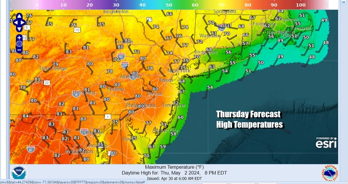
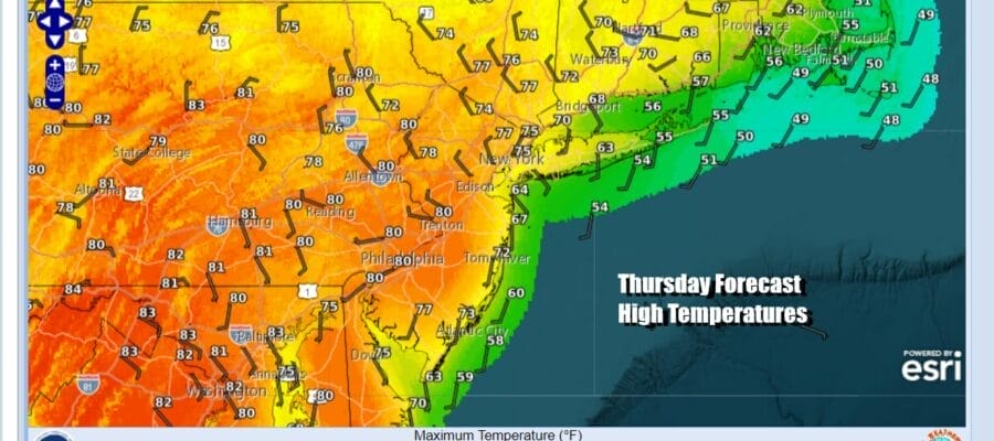
We are in a pattern where nights feature low clouds and days start out with clouds and then go partly sunny. This is due to weak pressure patterns with no one type of air mass dominating. Today will also be the warmest day of the next several days. Low pressure is moving across Northern New England with some showers there today. For Eastern Pennsylvania to Southern New England it leaves there area with mostly west or northwest winds. Once we go to partly sunny skies, temperatures will reach the mid 70s to lower 80s this afternoon. Radars are nice and quiet with no issues rain wise for the next few days.
SATELLITE WITH LIGHTNING STRIKES

WEATHER RADAR

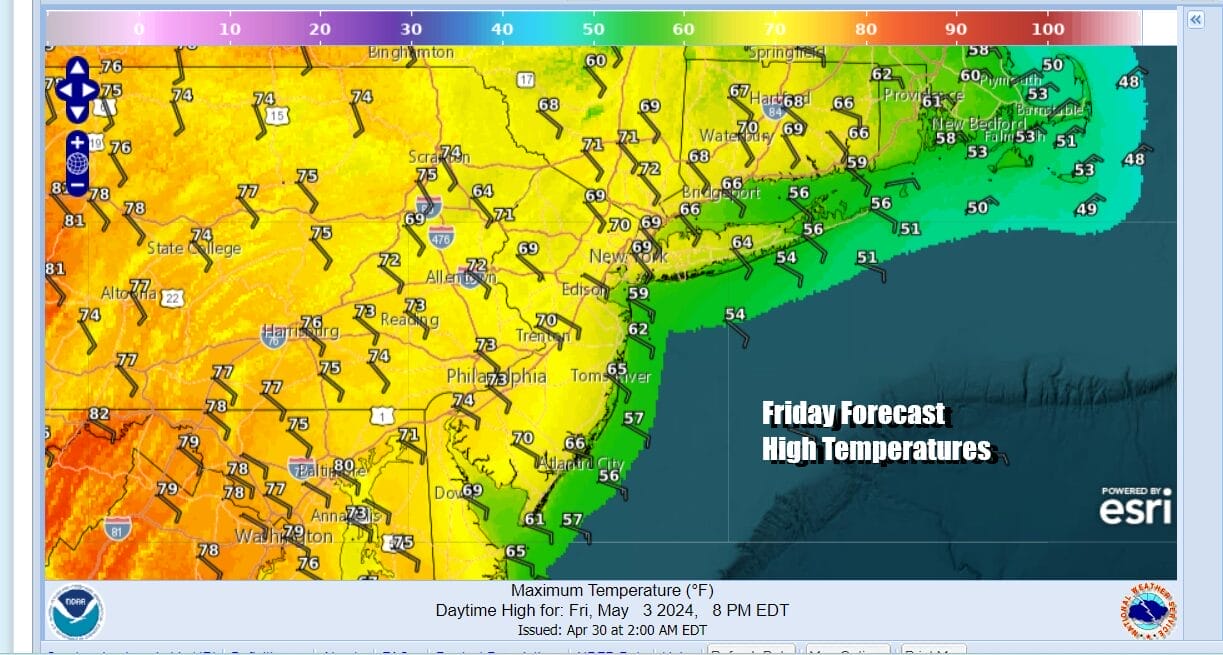
Tonight we will have clear skies mixed with a few clouds. Most lows will be in the 40s to lower 50s. Friday look for skies to be no worse than partly sunny. Winds are going to turn southeast area wide so that will hold temperatures down somewhat. Most highs will be in the upper 60s and lower 70s. Coolest temperatures will be along south and east facing shorelines.
The weekend sees weather conditions deteriorating but Saturday dayside should be dry (fingers crossed). Low pressure will be heading our way and getting squeezed underneath high pressure in Northern New England. This is going to set up a gloom & doom type pattern for Saturday night and Sunday. Also after this system pulls away later Sunday night, another system follows right behind it.

Saturday will be a day which probably starts off with sunshine but they we see increasing clouds as we move through the day. Winds will be onshore (from the east or southeast off the ocean) and that is going to keep temperatures from going anywhere. Most highs Saturday will be just in the 60s at best.

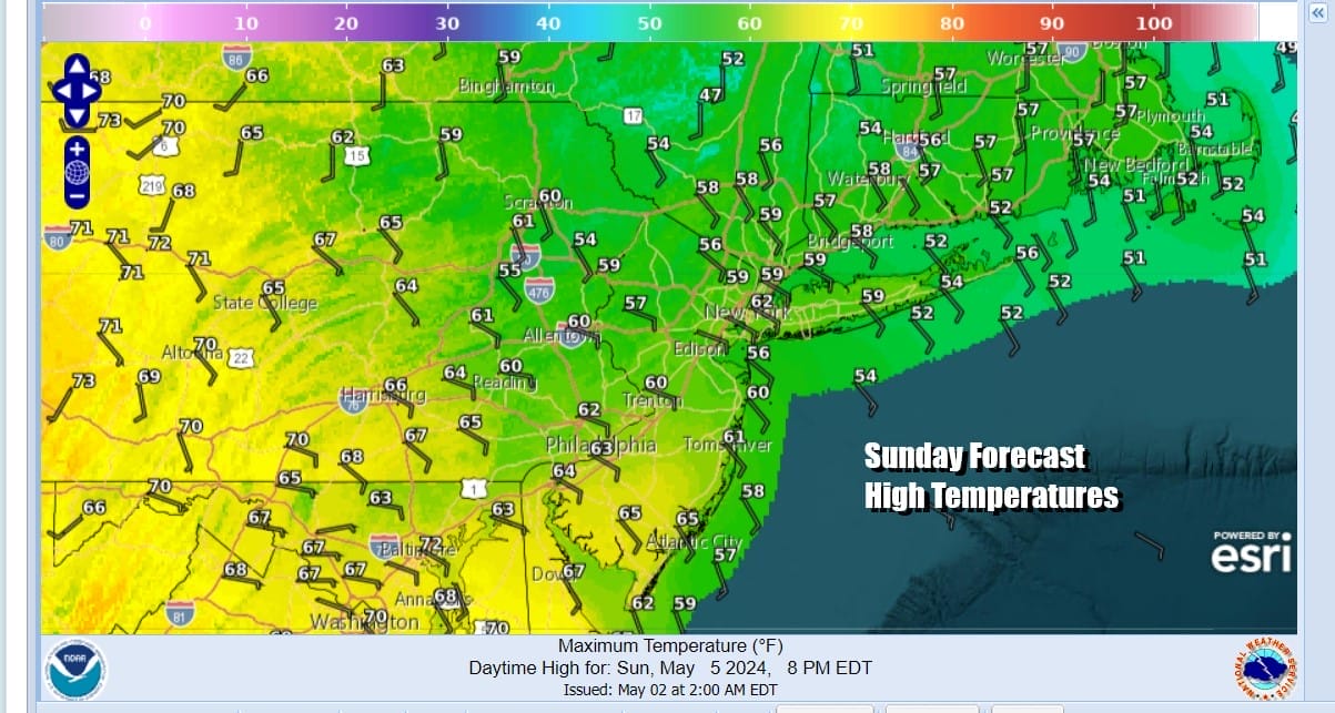
Rain could come close late Saturday afternoon but if the rain is delayed, it will still move in for Saturday night. Sunday is looking like a miserable day of gloom & doom cloudy skies with showery rains and a raw wind from off the ocean. Many areas especially north and east of NYC probably won’t get out of the 50s. Elsewhere most highs will be in the upper 50s and lower 60s.
We might catch a short break on Monday but a series of low pressure areas will be heading to the Eastern US and that could bring chances for rain later Monday into early Tuesday and again Tuesday night into Wednesday. There might be some thunderstorms in the mix as well. Another system follows late in the week.
BE SURE TO DOWNLOAD THE FREE METEOROLOGIST JOE CIOFFI WEATHER APP &
ANGRY BEN’S FREE WEATHER APP “THE ANGRY WEATHERMAN!
MANY THANKS TO TROPICAL TIDBITS FOR THE USE OF MAPS
Please note that with regards to any severe weather, tropical storms, or hurricanes, should a storm be threatening, please consult your local National Weather Service office or your local government officials about what action you should be taking to protect life and property.
(Amazon is an affilate of Meteorologist Joe Cioffi & earns commissions on sales.)


