One Last Dry Day Before Weather Goes Slowly Down Hill Active Pattern Next Week

One Last Dry Day Before Weather Goes Slowly Down Hill Active Pattern Next Week
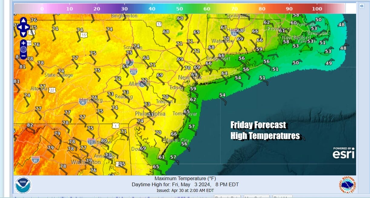
After a very warm Thursday, we are seeing a change today thanks to a developing onshore flow. Other than clouds along the coast and in Southern New England, to the west we have breaks in the cloud cover. On the whole we will call this a cloudy to partly sunny type of day. Depending on how much cloud cover you have and for how long, temperatures will have tougher time today. Along the coast highs will just be in the 60s. Inland areas will do a bit better with highs in the upper 60s to some lower 70s but this is a good 15 degrees lower than what we saw yesterday. Radars are quiet today and not an issue.
SATELLITE WITH LIGHTNING STRIKES

WEATHER RADAR

Over the next several days we seeing the weather pattern turning to one that is more active with weather systems coming along on regular basis every 2 days or so. They will also be slow to get in and slow to get out so there may not be much dry time in between. The systems for the weekend are weak ones and they won’t produce much rain. Next week we see stronger systems play out in the Plains and Mississippi Valley with frequent rounds of severe weather.

Saturday will be the better of the two weekend days but it will not be picture perfect by any means. Clouds will be around for much of the day. perhaps some sun could cut through the clouds early on but gradually as the day rolls, we see more clouds. Light showers will develop in Southern Pennsylvania and Southern New Jersey south to Maryland but they will struggle initially to move northward.

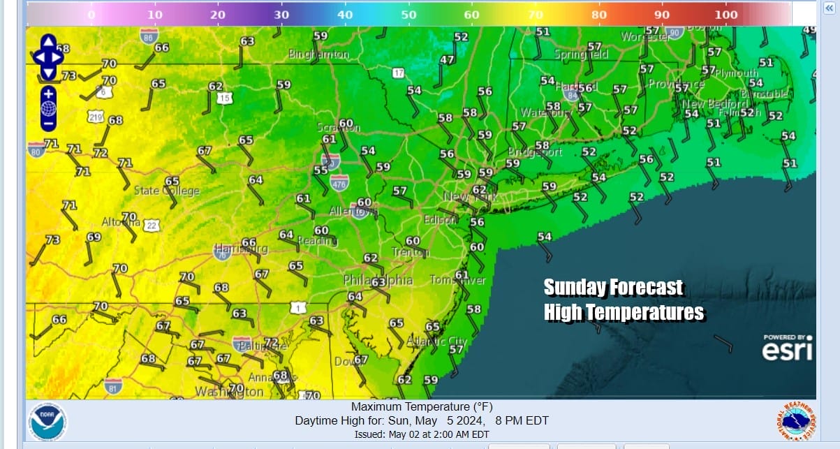
East winds and little to no sun will mean that temperatures will struggle in the low to mid 60s during Saturday. During Saturday night, as the front draws closer, we look for showery rains to develop but it will somewhat uneven so some places will see more and others less. Sunday will be a cloudy raw day with showery rains from time to time going into the evening. High temperatures will just be in the upper 50s to lower 60s.
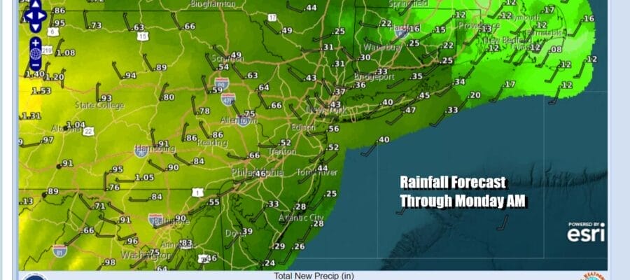
Rainfall amounts over the weekend will average around a half inch or so with slightly higher amounts inland and slightly lower amounts near the coast. Next week will not be all gloom and doom even though we will have showers and possible thunderstorms to deal with. Monday should see some improvement with highs back in the 70s but there could be some showers around Monday night into Tuesday morning and again Tuesday night into Wendesday. More chances for showers or thunderstorms will come late in the week but it will be the kind of week where it doesn’t rain all the time and there will be some periods of sunshine and dry weather in between systems.
BE SURE TO DOWNLOAD THE FREE METEOROLOGIST JOE CIOFFI WEATHER APP &
ANGRY BEN’S FREE WEATHER APP “THE ANGRY WEATHERMAN!
MANY THANKS TO TROPICAL TIDBITS FOR THE USE OF MAPS
Please note that with regards to any severe weather, tropical storms, or hurricanes, should a storm be threatening, please consult your local National Weather Service office or your local government officials about what action you should be taking to protect life and property.
(Amazon is an affilate of Meteorologist Joe Cioffi & earns commissions on sales.)


