
Clouds & Showers Around Today & Sunday Along With Onshore Flow

Clouds & Showers Around Today & Sunday Along With Onshore Flow
This is not going to be the best of weekends but I wouldn’t necessarily describe it as a completel washout. Will we see some rain? Probably yes with showery rains from time to time likely to pass through from time to time. However today seems to be more no than yes on the shower front. We are also likely to see an increase in cloud cover as onshore winds bring Atlantic moisture and low pressure plus a weather front move in from the west.
SATELLITE WITH LIGHTNING STRIKES

WEATHER RADAR

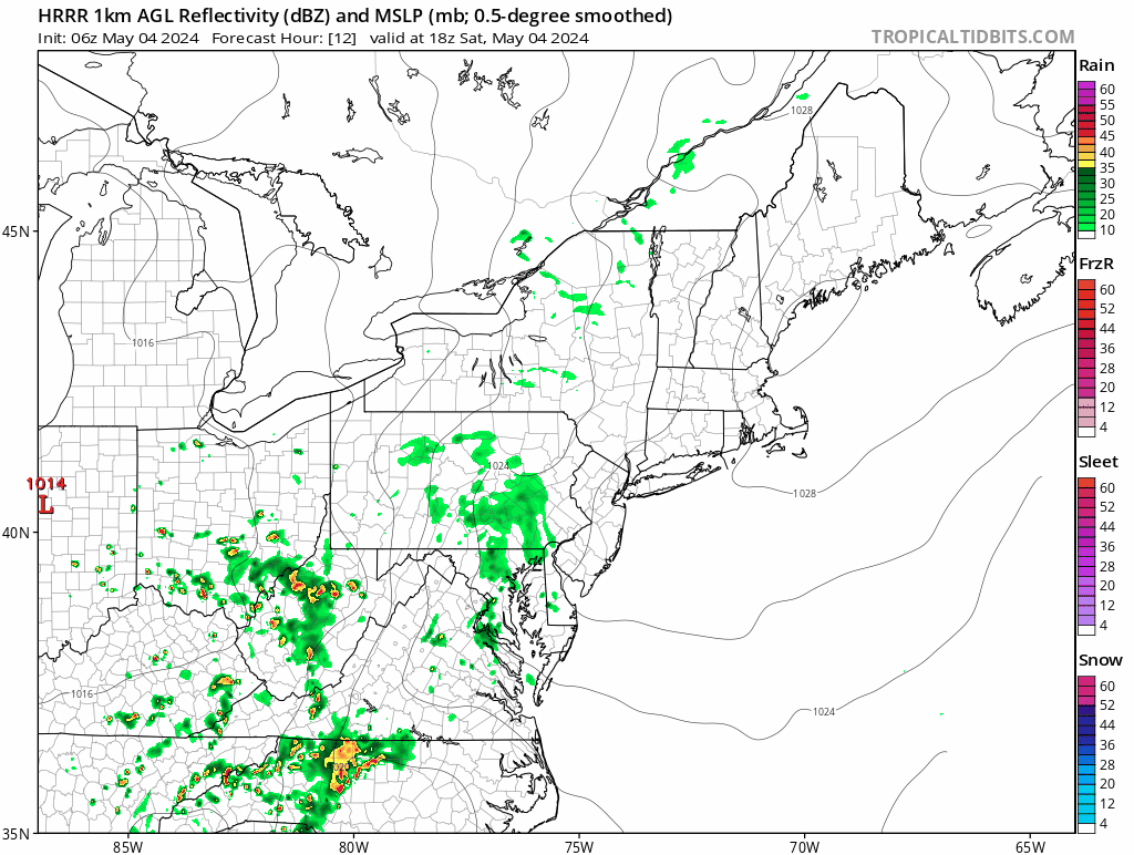
Showers are showing up on the regional radar from Maryland northwestward into Pennsylvania and while some of this will move northward today, it is likely to stay more inland and west rather than up and down the coastal plain. Ocean winds and increasing clouds mean that temperatures will be lower today than yesterday and most highs will be in the low to mid 60s. 50s will be common right along the immediate shore.

The better chance for rain seems to be later tonight and Sunday as the front gets closer and the moisture flow increases. The onshore winds will be there tonight and Sunday from the east and southeast and that plus the addition of showery rains means that temperatures Sunday are likely to be struggling in the upper 50s and lower 60s all day.
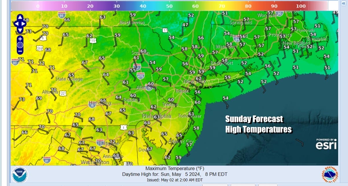
Rainfall amounts from the weekend will be generally on the light side on the order of a quarter to a half inch or so. Lower amounts will fall near the coast and higher amounts inland and west where it is likely to rain a bit longer. Monday brings a break but the week ahead offers only short periods of dry weather as weather systems look to be rather active all week long.
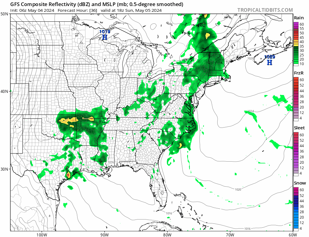
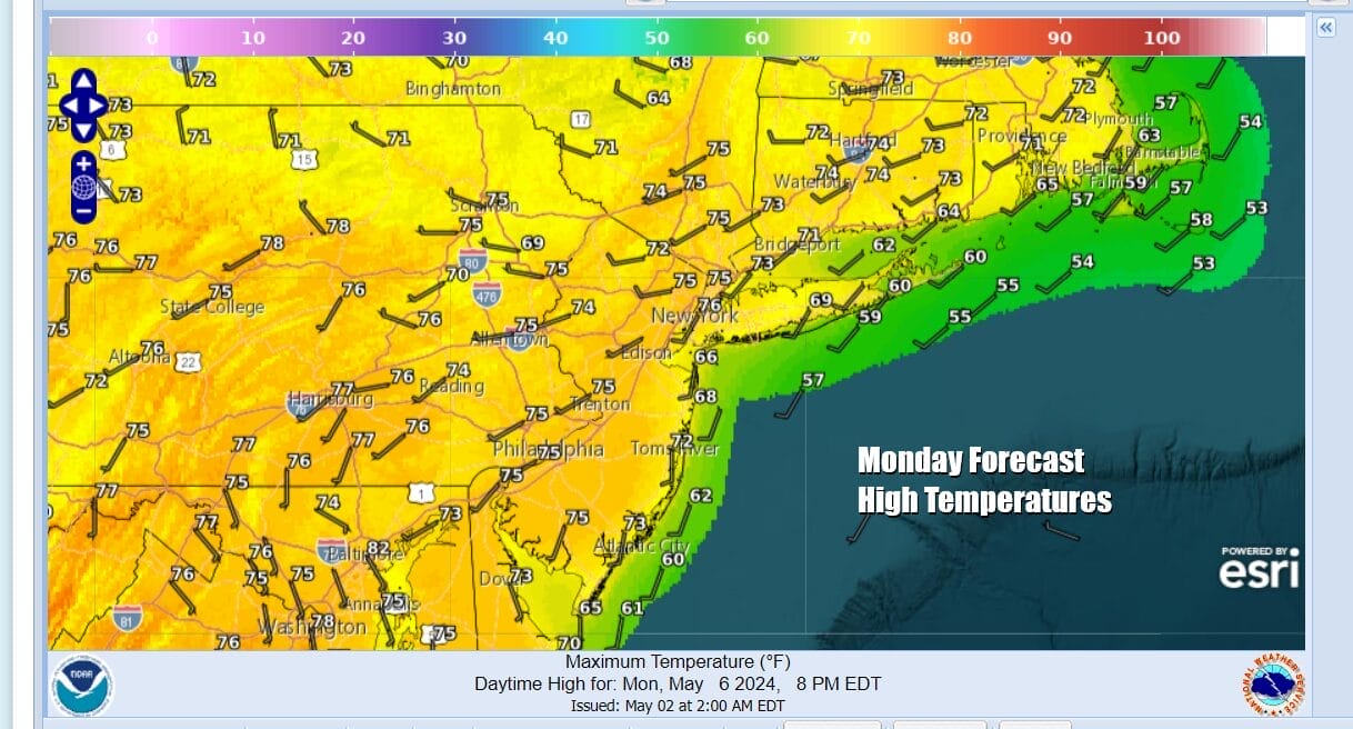
Monday should see more of a west wind and sunshine though clouds will be moving in later in the day. A weak weather system moving northeast from the Lower Ohio and Tennessee Valley brings some Gulf of Mexico moisture though it is limited. Highs Monday will be in the 70s to near 80 degrees for highs, again cooler near south and east facing shore lines.
We will probably see some showery rains on Tuesday with temperatures in the 70s but this is not an all day event and there will be dry periods. Wednesday could be a very warm day ahead of a stronger system that will be headed for the Great Lakes and eventually Upstate NY. this system could be setting us up for shower or a thunderstorm Wednesday night and perhaps more numerous showers and thunderstorms Thursday. There is an outside chance we will be in an area of severe weather risk later Thursday and Thursday night and this will come more into focus over the next several days.
BE SURE TO DOWNLOAD THE FREE METEOROLOGIST JOE CIOFFI WEATHER APP &
ANGRY BEN’S FREE WEATHER APP “THE ANGRY WEATHERMAN!
MANY THANKS TO TROPICAL TIDBITS FOR THE USE OF MAPS
Please note that with regards to any severe weather, tropical storms, or hurricanes, should a storm be threatening, please consult your local National Weather Service office or your local government officials about what action you should be taking to protect life and property.
(Amazon is an affilate of Meteorologist Joe Cioffi & earns commissions on sales.)


