May Begins On the Warmish Side No Rain Until Saturday Night Into Sunday

May Begins On the Warmish Side No Rain Until Saturday Night Into Sunday

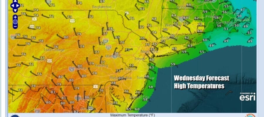
A weather front is passing offshore and we look to be in a dry stretch of weather for the next 4 days which takes through Saturday. It is not the driest air mass in the world as the push behind this front is minimal from that respect. Overnight showers are gone and we have some leftover clouds clouds and even some fog and mist around but we should see that gradually give way to no worse than partly sunny skies. Some areas might take a bit longer to see improvement than others. Temperatures today will be mostly in the 70s except for south and east facing shorelines which look to be cooler thanks to onshore winds. Radars are nice and quiet today and should remain so for the next several days.
SATELLITE WITH LIGHTNING STRIKES

WEATHER RADAR

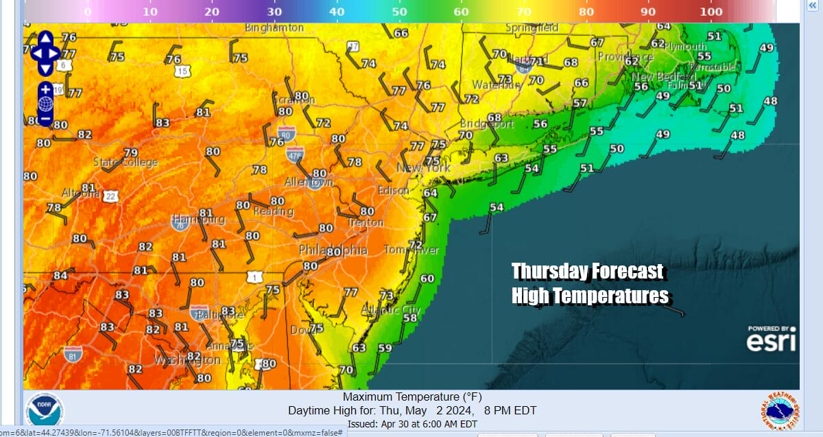
All the action regarding thunderstorms and severe weather remains in the Plains and this will be 7th day in 8 that we see severe weather risk and elevated tornado risk. In the East and especially the Northeast and Northern Mid Atlantic we are under a ridge in the upper atmosphere. Thursday sees a weather system moving across Northern New England with some showers there but no issues for Eastern Pennsylvania to Southern New England.
Thanks to the system moving through New England, it brings a northwest wind for Thursday which will make Thursday the warmest day of the next 4. Sea breezes will be confined to the immediate coast allowing areas to warm up nicely. Skies should be no worse than partly sunny. Most highs will be in the mid 70s to lower 80s.
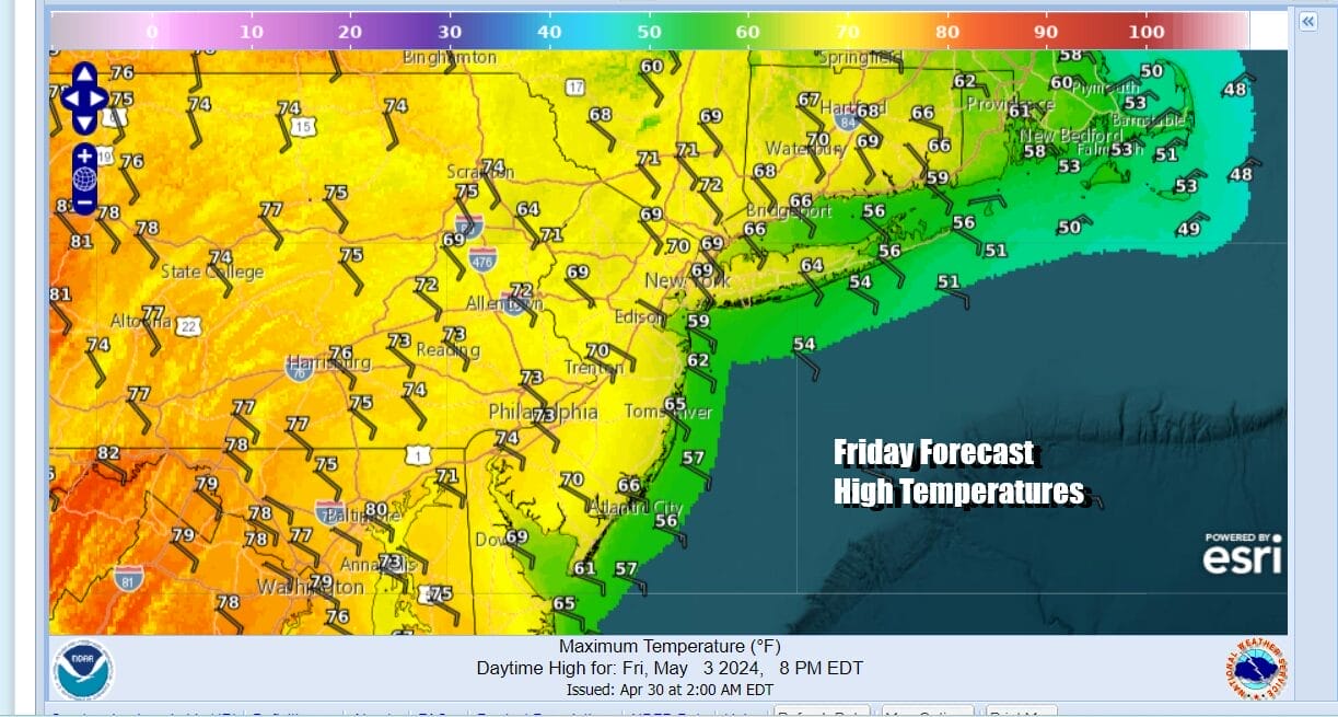
Friday sees high pressure to the north in New England sliding toward the coast and this will turn winds more to the east. This means lower temperatures. It also means that we see overnight periods with clouds and maybe some patchy fog giving way to partly sunny skies Friday highs will be in the 70s except for 60s along south and east facing shorelines.
As far as the weekend is concerned, it now seems that Saturday will be dry though we will have a wind off the ocean and probably a lot more in the way of clouds. Between the ocean wind and the extra cloud cover, temperatures will like sit in the 60s. Any sunshine should be limited as we have the onshore flow, and low pressure and a cold front approaching from the west.

Saturday night and Sunday we will see the front to the west get closer and that will bring showery rains overnight Saturday night and on and off for Sunday. Winds will continue to be from off the ocean so most highs will be in the 60s. This weather system is not going to be a big rain producer, maybe a half to three quarters of an inch seems reasonable. Weather conditions will improve for the first part of next week.
BE SURE TO DOWNLOAD THE FREE METEOROLOGIST JOE CIOFFI WEATHER APP &
ANGRY BEN’S FREE WEATHER APP “THE ANGRY WEATHERMAN!
MANY THANKS TO TROPICAL TIDBITS FOR THE USE OF MAPS
Please note that with regards to any severe weather, tropical storms, or hurricanes, should a storm be threatening, please consult your local National Weather Service office or your local government officials about what action you should be taking to protect life and property.
(Amazon is an affilate of Meteorologist Joe Cioffi & earns commissions on sales.)


