Quick Burst Of Snow Inland Monday Otherwise Mostly Quiet Week Ahead

Weather in 5/Joe & Joe Weather Show Latest Podcast
Quick Burst Of Snow Inland Monday Otherwise Mostly Quiet Week Ahead
We have a nice sunny Sunday underway and it is a cold day with temperatures that will not be much above the low to mid 30s. Yesterday’s upper trough has moved out to the east and the next weather system moving quickly eastward won’t get here until Monday so we like in between in a bit of a sweet spot. The overall pattern for the week ahead looks quiet with the occasional interruption of a weather front moving through.
SATELLITE

The satellite looks fine and the radars a quiet for the time being at least. We will start to see precipitation developing late tonight to the west with the approaching cold front. Clouds will increase later tonight. Most lows will be in the 20s as winds turn more to the southwest.
F5 WEATHER RADARS


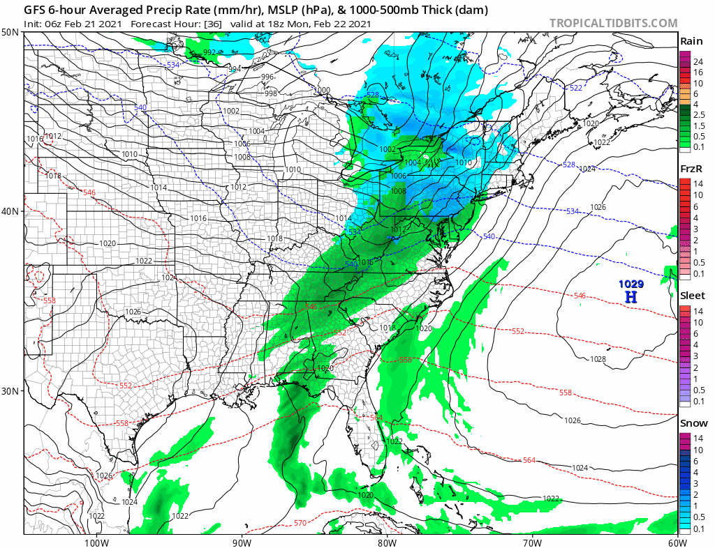
Low pressure will be moving by to our north with a rather quick moving cold front, Usually with these systems it becomes a matter of a quick burst of snow if the precipitation comes in fast enough while it is still cold.
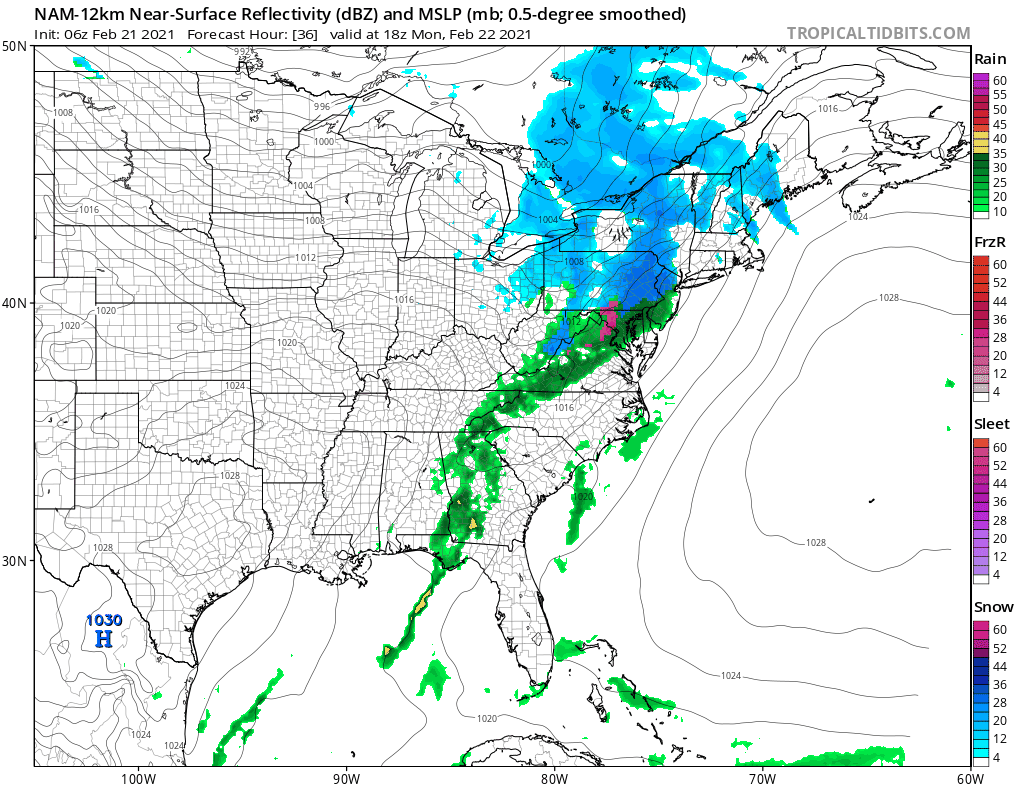
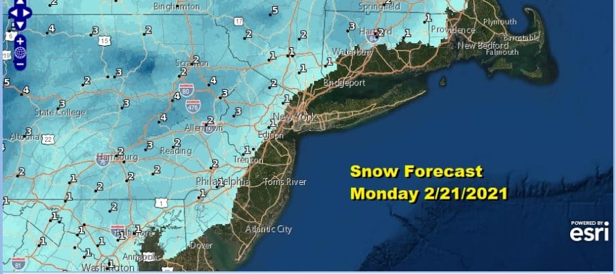
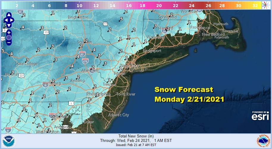
This front is going to behave much like a spring like cold front with showers. Look for a quick burst of snow inland Monday midday until noon and it could snow hard for a short period of time. This puts those areas at risk for a coating to an inch or two and then a change to rain. Along the coast it might just be a very quick burst that goes quickly to rain. Temperatures will rise up into the 40s briefly along the coast and 30s inland. Parts of Northcentral and Northeast Pennsylvania could pick up several inches from this but there really isn’t much upside here due to the fast movement.
Once the front passes we move on through a week that has another cold front coming for Wednesday. This one doesn’t have much with it. Back to Monday’s front, the air behind it is not all that cold so temperatures should moderate nicely. Tuesday look for sunshine and highs into the 40s. Wednesday will be warmer with highs in the 50s ahead of that next front that might produce a quick shower Wednesday evening.
After that front goes by it will be a little colder but nothing unreasonable. We have lost the connection to cold from from Northern Canada and the arctic that was present in the last couple of weeks. Until that connection gets re-established (if it does), our weather should remain relatively benign as we head into month’s end.
BE SURE TO DOWNLOAD THE FREE METEOROLOGIST JOE CIOFFI WEATHER APP &
ANGRY BEN’S FREE WEATHER APP “THE ANGRY WEATHERMAN!

MANY THANKS TO TROPICAL TIDBITS & F5 WEATHER FOR THE USE OF MAPS
Please note that with regards to any severe weather, tropical storms, or hurricanes, should a storm be threatening, please consult your local National Weather Service office or your local government officials about what action you should be taking to protect life and property.


