Polar Cold Front Arrives Tonight Cold Weather Friday Saturday
Clouds are increasing and thickening up today as we await for the arrival of a cold front. There are no weather issues until this afternoon when rain begins to develop from west to east. This is nothing to right home about rain wise. We are looking at most areas getting around a quarter of an inch or so out of this. This front does usher in some rather cold air for Friday and for Saturday so it would be a good idea to get any sensitive plants indoors that are still out doors. We will arm up in the 50s to around 60 today however areas north and west of Route 84 will likely only reach the upper 40s and lower 50s before the front passes and temperatures begin to fall.
SATELLITE

REGIONAL RADAR

Some rain showers are running out ahead of the main rain area this morning on the regional and local radars. We will see a more solid area of rain load up early this afternoon as the front begins its slide to the east.
LOCAL RADAR NEW YORK CITY

LOCAL RADAR PHILADELPHIA


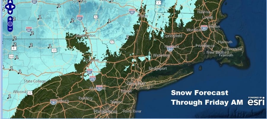
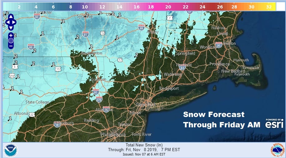
As the front passes we will see cold air come in rather quickly behind it but not fast enough to create a serious issue regarding a change over to sleet or wet snow. This will likely happen in Northeast Pennsylvania and perhaps a few high elevation spots in Northwest New Jersey to the Hudson Valley and Connecticut north of Route 84. It doesn’t amount to much if anything at all.
Friday it is about the cold air and gusty winds with ineffective sunshine. We will be bottoming Friday morning in the upper 20s and lower 30s and highs Friday will be in the upper 30s and lower 40s which is about average for late December. Then it is a trip down to the upper teens to mid 20s by Saturday morning.

Saturday will be another very cold day with highs in the upper 30s and lower 40s with sunshine much of the day though some high clouds could arrive late in the day. Warmer air will be coming back on Sunday for a temperature bounce with clouds and some sun. Highs will be back into the 50s.
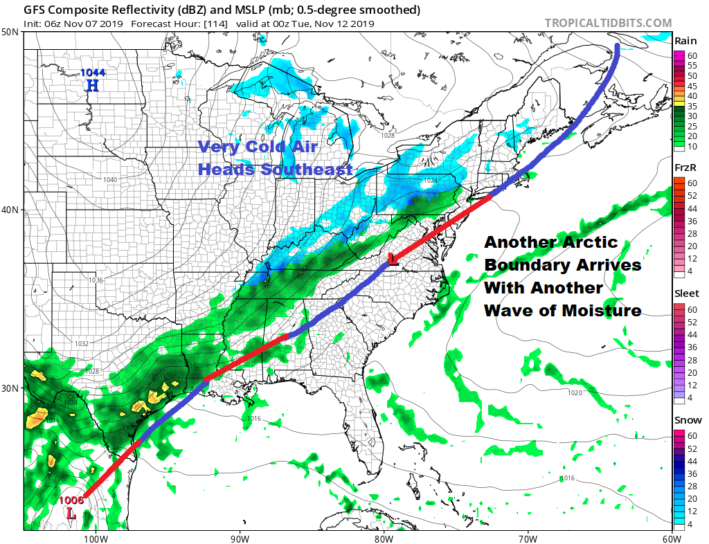
The front slows down and once again it becomes a race between another even colder air mass dropping down from Canada and waves of low pressure on the frontal boundary that should be lying just to our south. Timing issues abound here so it is too soon speculate what will happen here regarding rain or snow though it seems the chances for snow are higher with this system than the one for tonight. Monday we will just have some clouds around with highs in the upper 40s and lower 50s. Then it turns colder into Tuesday with the chance for rain or snow.
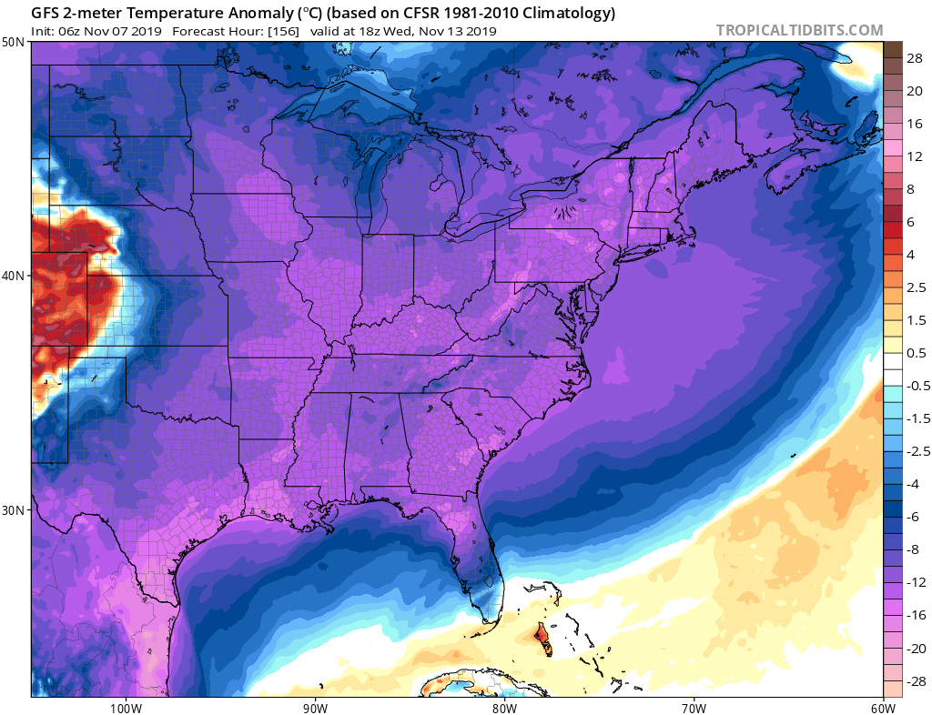
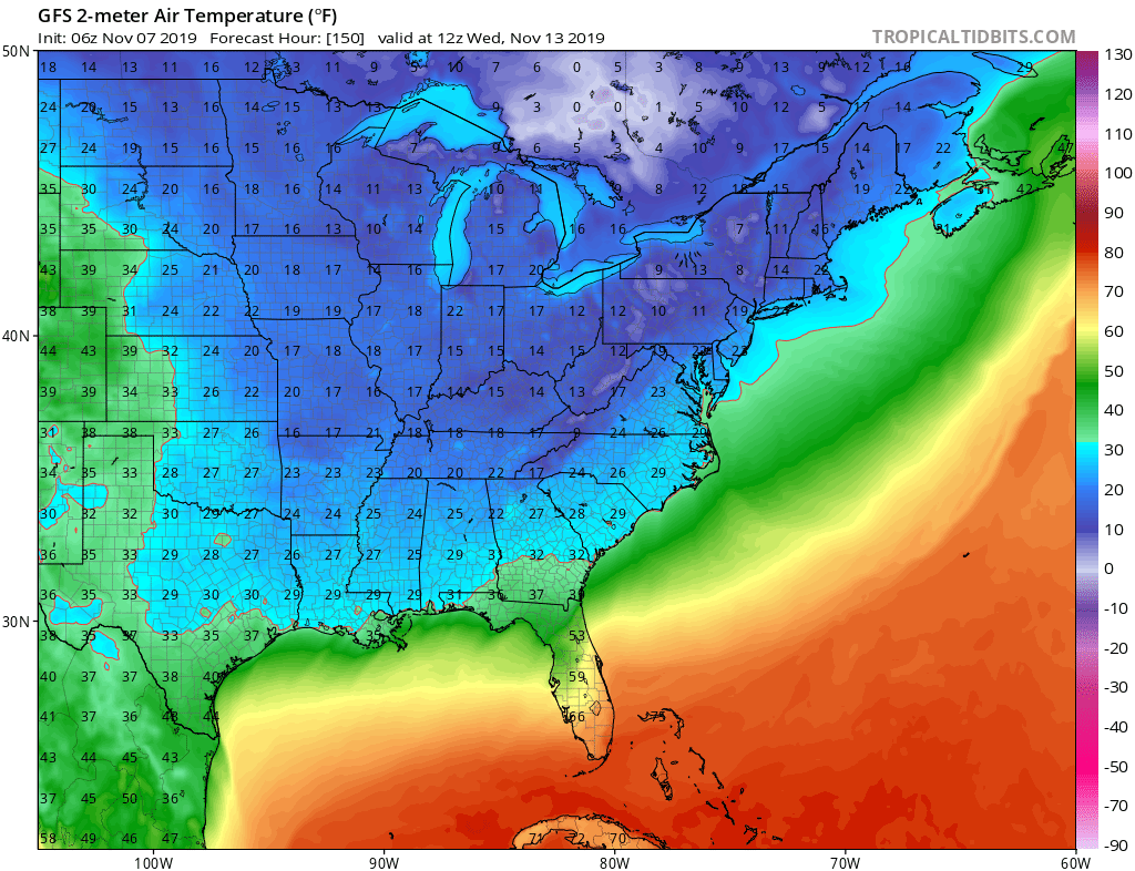
This air mass coming down for next week is a very cold one indeed for this time of year with everyone east of the Rockies experiencing well below average temperatures and 20s making it all the way down to almost the Gulf Coast. We will be very cold here with the developing wave key to bringing that cold air into the Eastern US. We will take a closer look at the prospects for rain or snow early next week as weather models come in later today.
BE SURE TO DOWNLOAD THE FREE METEOROLOGIST JOE CIOFFI WEATHER APP &
ANGRY BEN’S FREE WEATHER APP “THE ANGRY WEATHERMAN!
MANY THANKS TO TROPICAL TIDBITS FOR THE USE OF MAPS
Please note that with regards to any severe weather, tropical storms, or hurricanes, should a storm be threatening, please consult your local National Weather Service office or your local government officials about what action you should be taking to protect life and property.


