Patchy Snow Late Tonight into Saturday Afternoon
As Low Pressure Passes Well South

Patchy Snow Late Tonight into Saturday Afternoon
As Low Pressure Passes Well South

It is a cold morning but at least the wind is no longer a big issues as all wind advisorie have been taken down. A snow and ice storm continues across the Deep South this morning and the snow, sleet, freezing rain and rain will spread through the Carolinas and into Southern Virginia tonight into Saturday morning. In the meantime we will have sunshine giving way to arriving clouds and high temperatures today will reach the low and middle 30s. Radars are quiet for now across the Northeast and Middle Atlantic states.
SATELLITE WITH LIGHTNING STRIKES

WEATHER RADAR

Low pressure is straddling the Gulf Coast, moving eastward and cold air is wedged in as far south as Central Georgia and Alabama. The strong block to the northeast in the North Atlantic is too strong so this surface low will eventually find its way to the Carolinas overnight. An upper air trough to the west is moving east. As these two systems are not going to phase together, the storm will head east and offshore rather than move northward up the coast.

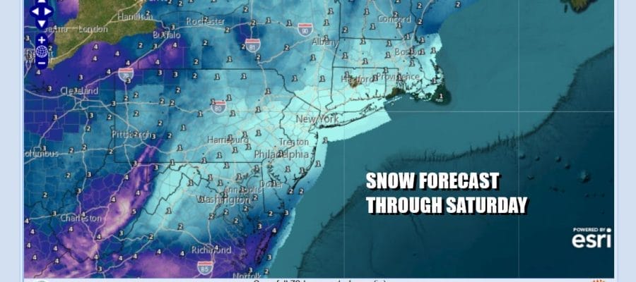
Accumulating snow of up to several inches will reach as far north as Southern Virginia and the southern portions of the Delmarva peninsula. We will likely see patches of light snow develop overnight lasting into midday Saturday from the upper trough to the west. Any accumulations across Eastern Pennsylvania to Southern New England will be on the order of a coating to at most an inch or so in some places.
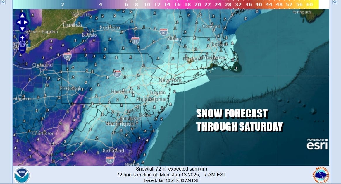
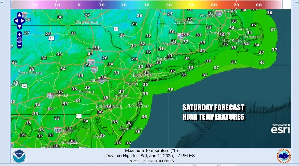
Tonight will be cloudy with temperatures mostly in the upper 20s to lower 30s. Look for those patches of snow sometime between 4am and 1pm Saturday. Then we will see leftover clouds and we may actually break out into some late day sun. High temperatures Saturday will be mostly in the 30s.
Sunday and Monday we will see no worse than partly sunny skies with near average highs in the 30s to around 40 degrees. Another cold front will come through dry Monday night and much colder air returns for Tuesday through at least Thursday next week. The block to the east restrengthens so you can expect the wind to become an issue once again beginning Tuesday and picking up further Wednesday and Thursday. Highs Tuesday will be in the low to mid 30s. Wednesday and Thursday highs will be in the upper 20s and lower 30s. No snow or rain is forecast for all of next week.
BE SURE TO DOWNLOAD THE FREE METEOROLOGIST JOE CIOFFI WEATHER APP &
ANGRY BEN’S FREE WEATHER APP “THE ANGRY WEATHERMAN!
MANY THANKS TO TROPICAL TIDBITS FOR THE USE OF MAPS
Please note that with regards to any severe weather, tropical storms, or hurricanes, should a storm be threatening, please consult your local National Weather Service office or your local government officials about what action you should be taking to protect life and property.


