Another Cold Windy Day Snow Showers Possible Late Friday Night into Saturday

Another Cold Windy Day Snow Showers Possible Late Friday Night into Saturday
It’s another day of cold and wind across the Northeast and into the Middle Atlantic states. The gradient remains relatively tight and we will see northwest winds gusting past 30 mph all day long. We should have a good amount of sunshine today though lately that doesn’t seem to help matters much. High temperatures this afternoon will be in the upper 20s and lower 30s. Lows tonight will be in the teens inland and low to mid 20s along the coast. Radars are mostly quiet today with no snow showers around. Even the late effect areas of Upstate NY will be calming down today from the extensive lake effect snows of recent days.
SATELLITE WITH LIGHTNING STRIKES

WEATHER RADAR

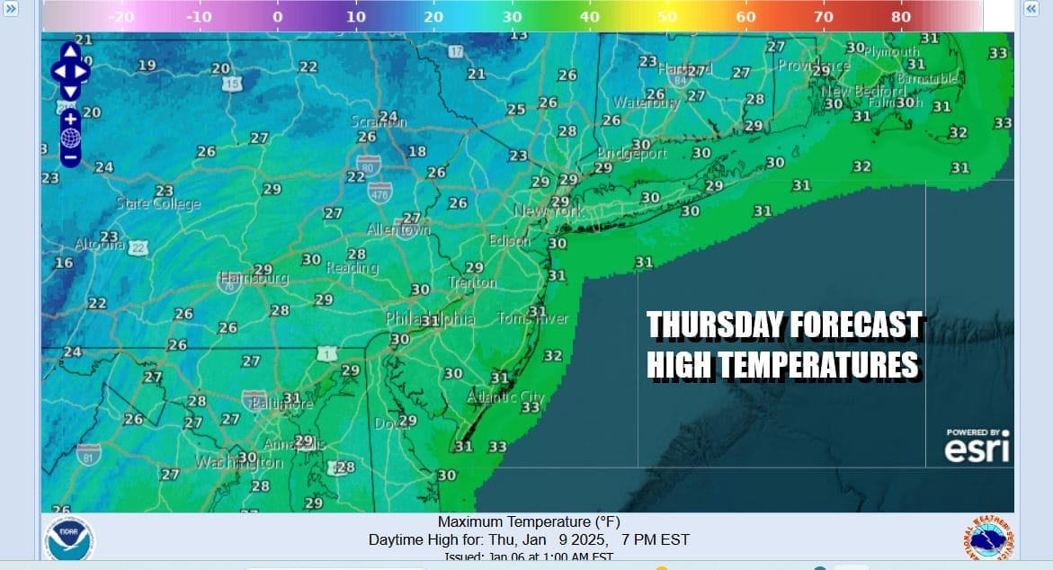
Friday should bring relief from the relentless wind. The gradient relaxes as low pressure in the North Atlantic moves far enough east to get us out of the tight pressure gradient. Friday should start with sunshine but we will see clouds increasing from the south as well as from the west. Friday high temperatures should reach the low and middle 30s in most places.

Low pressure will begin developing today in the Western Gulf of Mexico and it will strengthen some tonight and Thursday. It will be spreading rain, ice and snow across the Deep South from East Texas to Georgia and eventually up through the Carolinas and into Southern Virginia Friday night. At the same time we have a trough coming in from the west. The northern and southern energy will remain mostly separate and that means the southern system will only get so far north to the Southern Mid Atlantic and then slide out to the northeast.

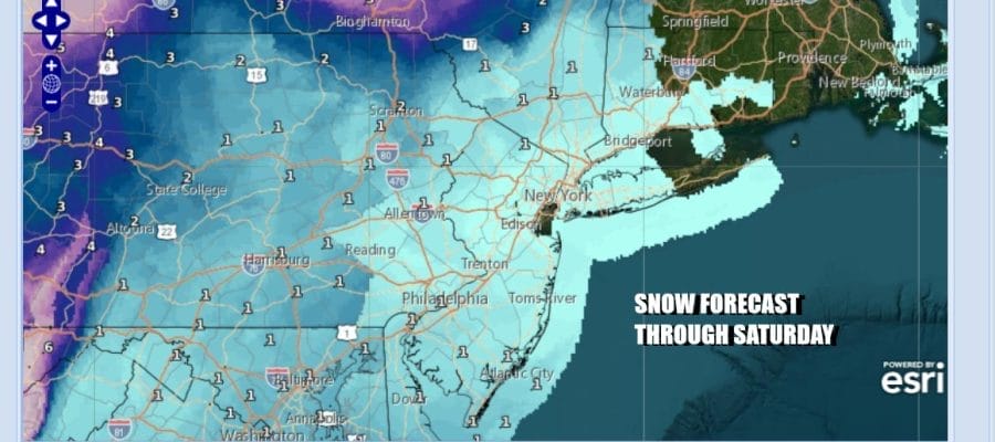
Late Friday night into early Saturday accumulating snows will reach Southern Virginia and Northern North Carolina but north of there snow will be very patchy and more hit and miss. For the most part any snow accumulation across Eastern Pennsylvania to Southern New England will be on the order of a coating to at most an inch or so in some areas inland.
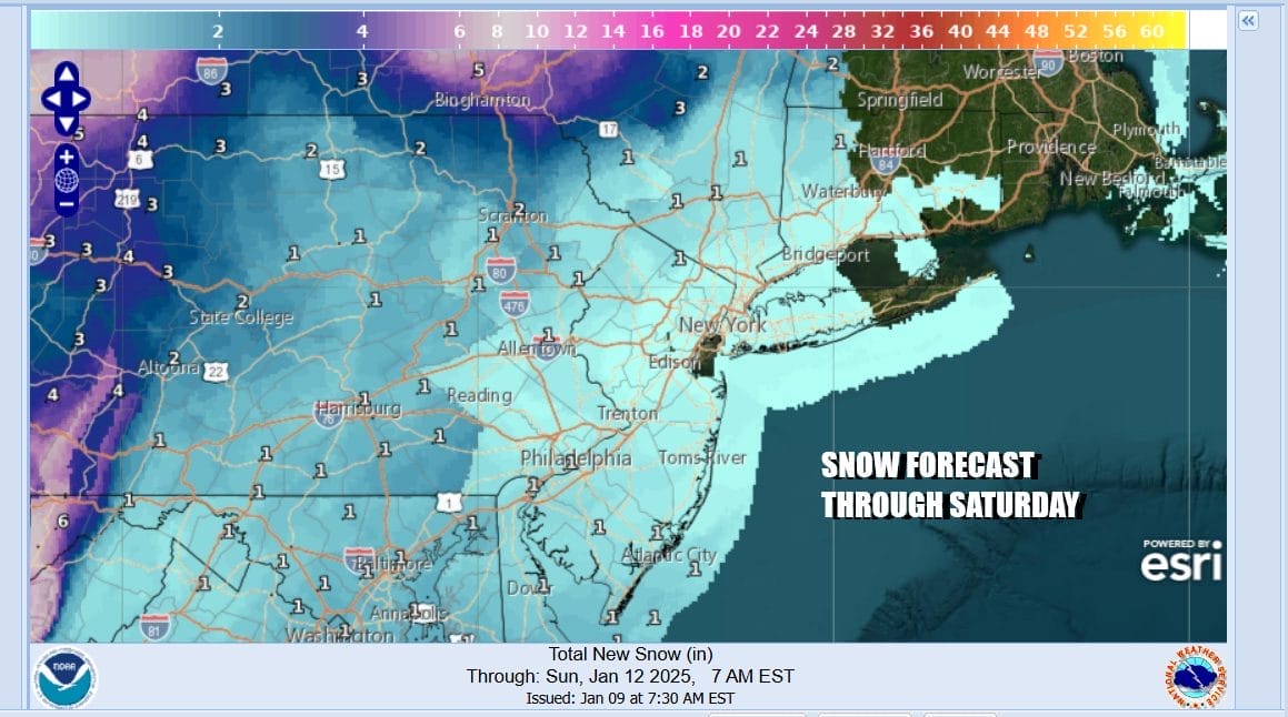
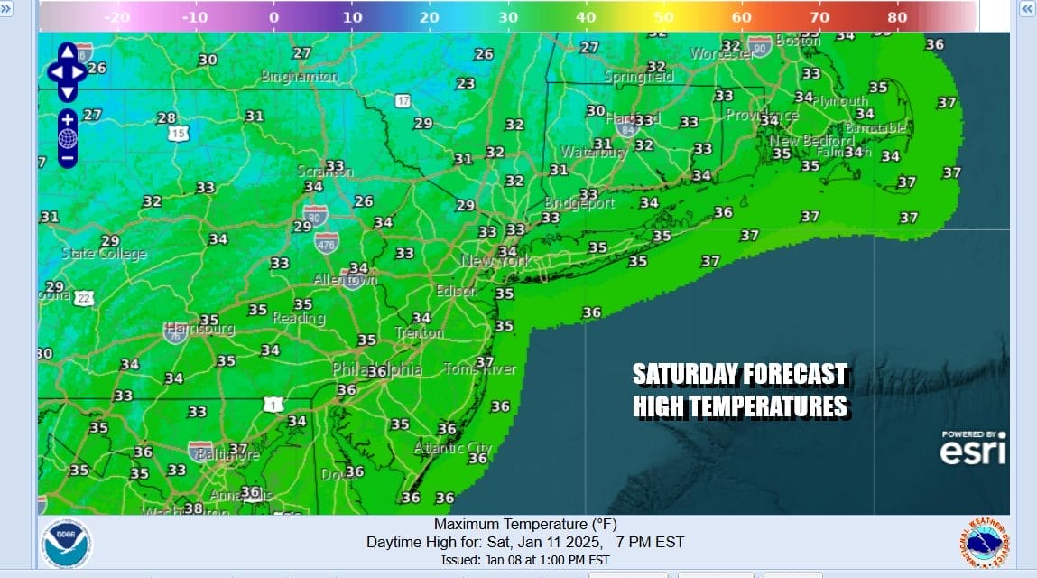
Once the coastal low passes off to the northeast and the upper trough plays through Saturday morning we will likely see leftover clouds around. Temperatures Saturday morning will bottom in the mid to upper 20s and most highs Saturday will be in the low to middle 30s.
We should see improving weather conditions Sunday with some sunshine returning but highs still only in the 30s. Next week looks to be dry all week long as the block reforms. Monday should be an okay day with some sun and highs in the 30s but look for colder temperatures and strengthening winds to come back for Tuesday though next Thursday. No major rain or snow systems are on the horizon anytime soon.
BE SURE TO DOWNLOAD THE FREE METEOROLOGIST JOE CIOFFI WEATHER APP &
ANGRY BEN’S FREE WEATHER APP “THE ANGRY WEATHERMAN!
MANY THANKS TO TROPICAL TIDBITS FOR THE USE OF MAPS
Please note that with regards to any severe weather, tropical storms, or hurricanes, should a storm be threatening, please consult your local National Weather Service office or your local government officials about what action you should be taking to protect life and property.


