Cold Windy Weather Continues
Chance for Snow Saturday As Storm Passes to the South

Cold Windy Weather Continues
Chance for Snow Saturday As Storm Passes to the South
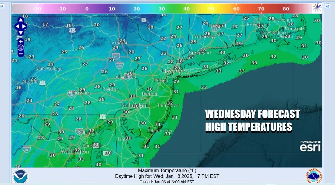
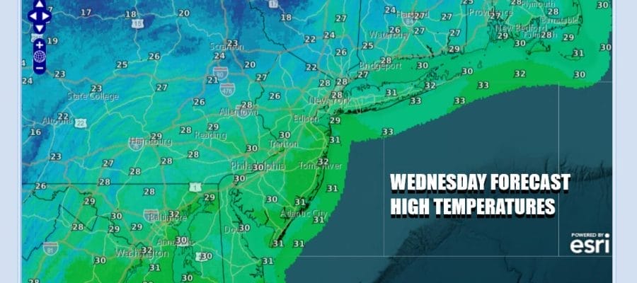
It is another cold and windy day across the Northeast and Mid Atlantic states especially along the coast. Winds will continue to gust past 30 mph at times. We should see no worse than partly sunny skies today but the cold air is locked in and temperatures will top out in the upper 20s and lower 30s this afternoon. Radars are relatively quiet other than some patches of snow well inland and north. Tonight will be another clear cold night with Thursday morning lows in the teens to lower 20s.
WEATHER RADAR
F

Low pressure is starting to form in the Western Gulf of Mexico. This storm system is going to track east right along the immediate Gulf Coast and it is forecast to bring a swath of heavy snow from North Central and Northeast Texas east across the Tennessee Valley and the Deep South and then the storm makes a turn to the northeast, along the coast of the Carolinas Friday night into early Saturday morning.

The strong blocking pattern continues and that means that this storm will only get so far north before it slides to the southeast and offshore. The heaviest snow is likely to fall once again in Virginia, Maryland and Delaware where several inches or more could accumulate. For Eastern Pennsylvania it looks like a coating to an inch or two is possible with lesser amounts as you head north and east of NYC and closer to 2 or so in South Jersey. There is little chance for upside here as the block remains formidable and it won’t allow the storm to climb northward up the coast.
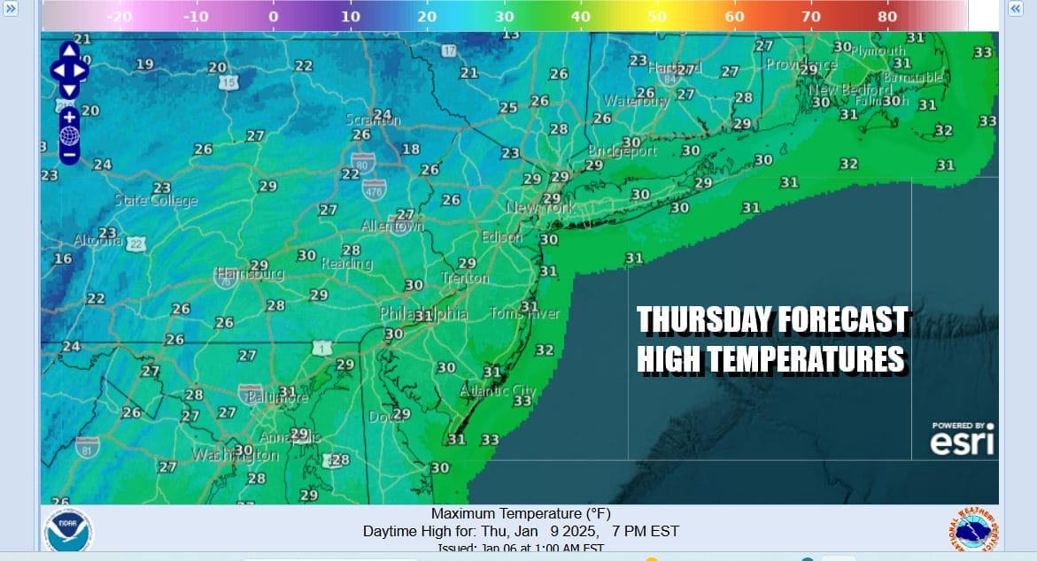
Thursday we will see another cold and windy day with sunshine and highs once again in the upper 20s and lower 30s. Winds will start to ease going into Friday when we see sunshine giving way to arriving clouds. Highs will be in the low to mid 30s. The chance for some snow will be Friday night into Saturday midday and then weather conditions improve later Saturday leaving us cold but dry for Sunday.
BE SURE TO DOWNLOAD THE FREE METEOROLOGIST JOE CIOFFI WEATHER APP &
ANGRY BEN’S FREE WEATHER APP “THE ANGRY WEATHERMAN!
MANY THANKS TO TROPICAL TIDBITS FOR THE USE OF MAPS
Please note that with regards to any severe weather, tropical storms, or hurricanes, should a storm be threatening, please consult your local National Weather Service office or your local government officials about what action you should be taking to protect life and property.


