Deep South Snow Storm Likely Winter Storm Watches & Warnings Posted
Texas to Georgia, Tennessee, Kentucky, Western Carolinas

Deep South Snow Storm Likely Winter Storm Watches & Warnings Posted
Texas to Georgia, Tennessee, Kentucky, Western Carolinas
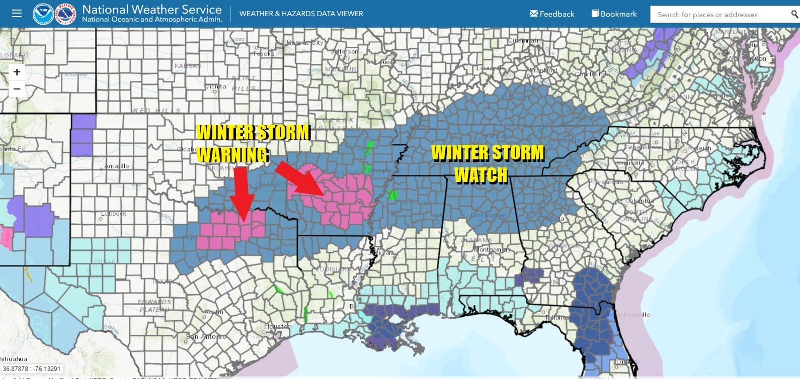
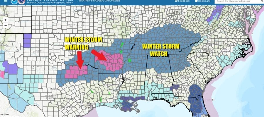
This doesn’t happen often and sometimes it is years between events but we have a high likelihood of a Deep South snow storm of sorts from Texas eastward to the Western Carolinas. Winter Storm Watches and Warnings are already posted for Thursday night into Friday night/early Saturday morning for a large area from North Central and Northeast Texas eastward across the Lower Tennessee Valley, to the Southern Appalachians. This includes major cities like Dallas, Fort Worth, Memphis, Nashville, & Atlanta among others.
SATELLITE WITH LIGHTNING STRIKES

WEATHER RADAR

There is plenty of cold air that is covering this region thanks to high pressure to the northeast. A developing storm in the Western Gulf of Mexico will straddle the immediate Gulf Coast from Texas to Florida Thursday night into Friday night. Snow will accumulate over a wide area with snow and the heaviest will likely fall north of I-20 in Alabama and Georgia and along and northwest of I-85 in South and North Carolina.
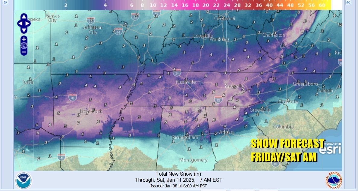
Areas in Northern Georgia, Northern Alabama, Tennessee and into Southern Kentucky could see the heaviest snow and we expect to see an east west band of 4 to 8 inches of snow accumulation from Central and Northeastern Arkansas eastward to the mountains of Northern Alabama, Northern Gerogia and Eastern Tennessee. The Weather Prediction Center of the National Weather Service is showing a high probability for at least 4 inches for this area. The National Weather Service is forecast 4 inches for Atlanta and 4 to 6 inches or more for the mountains of North Georgia. A change to freezing rain is probable across the major metro areas of Birmingham and Atlanta and there will be ice accretion Friday night. This will also be the case for cities in Western North and South Carolina.

Snow develops from west to east Thursday night into Friday morning and ends from west to east later Friday into early Saturday morning depending on your location. This system will then move northeast and likely spread accumulating snow and ice through the Carolinas and into the Mid Atlantic states later Friday night and Saturday. Snow could eventually reach areas as far north as NYC and Southern New England though the risk for heavy snow will be to the south in Virginia, Maryland and Delaware.
BE SURE TO DOWNLOAD THE FREE METEOROLOGIST JOE CIOFFI WEATHER APP &
ANGRY BEN’S FREE WEATHER APP “THE ANGRY WEATHERMAN!
MANY THANKS TO TROPICAL TIDBITS FOR THE USE OF MAPS
Please note that with regards to any severe weather, tropical storms, or hurricanes, should a storm be threatening, please consult your local National Weather Service office or your local government officials about what action you should be taking to protect life and property.