
Improving Weather Conditions Next 3 Days Before More Cold Air Arrives Tuesday

Improving Weather Conditions Next 3 Days Before More Cold Air Arrives Tuesday
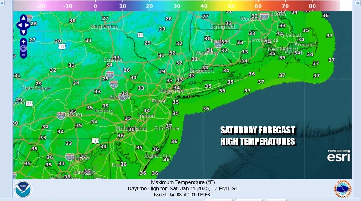
We had some light snow overnight and into daybreak thanks to an upper trough moving eastward into New England while the Deep South & Southeast snow and ice storm heads east northeast out to sea. A coating to an inch was left behind and now we can see some slow improvement today with leftover clouds giving way to developing sunshine from west to east this afternoon. Temperatures will top out in the mid to upper 30s. No additional precipitation is forecast for the rest of the weekend.
SATELLITE WITH LIGHTNING STRIKES

WEATHER RADAR

Skies will clear out tonight with most lows in the low to mid 20s. Sunday looks like a nice day with sunshine. We will not be having to deal with strong gusty winds for a few days which is good after last week’s unrelenting wind. Highs will reach the upper 30s and lower 40s across Eastern Pennsylvania to Southern New England.

Winds Monday will turn more westerly ahead of a cold front that will be passing through late Monday and Monday night. There isn’t much moisture around so the front will come through dry and skies will be no worse than partly sunny Monday. Highs again will be in the upper 30s and lower 40s which is just about average for this time of year.

Colder air will be coming in Monday night and the wind will become an issue again Tuesday and Wednesday. Both days will be cold and dry with some sunshine. However high temperatures both Tuesday and Wednesday will be just in the upper 20s and lower 30s. NIghttime lows will be in the teens to near 20. Winds will be gusting to 30 mph or more on both days and that means it will feel 10 or more degrees colder than the thermometer reads. No storms are in the forecast next week as the pattern goes quiet however beyond the work week, things could get more active later next weekend or the week that follows.
BE SURE TO DOWNLOAD THE FREE METEOROLOGIST JOE CIOFFI WEATHER APP &
ANGRY BEN’S FREE WEATHER APP “THE ANGRY WEATHERMAN!
MANY THANKS TO TROPICAL TIDBITS FOR THE USE OF MAPS
Please note that with regards to any severe weather, tropical storms, or hurricanes, should a storm be threatening, please consult your local National Weather Service office or your local government officials about what action you should be taking to protect life and property.


