Our Chilly But Dry Weekend Continues Dry Weather Through Thursday

Weather in 5/Joe & Joe Weather Show Latest Podcast
Our Chilly But Dry Weekend Continues Dry Weather Through Thursday
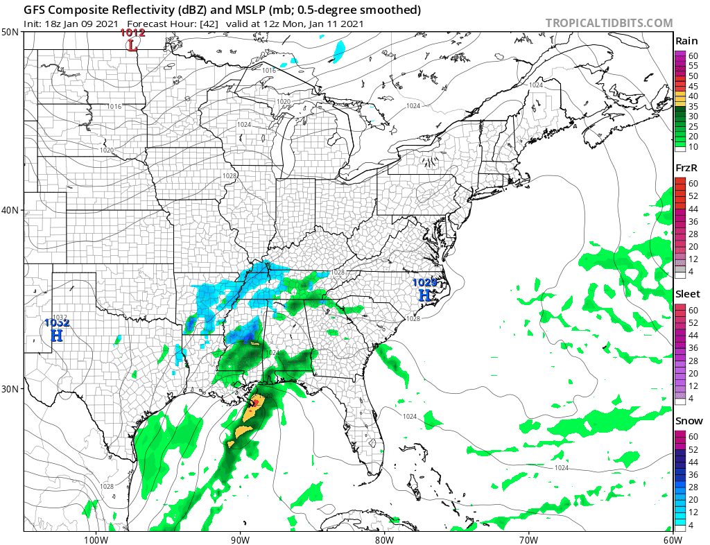
After a week with a storm sitting to the east and not moving, it finally moved away only to be replaced by another storm. This one moved across the south yesterday and left snows from Tennessee to Southern Virginia and Western North Carolina. This keeps us pretty much in the same place weather wise with no changes through Monday.
SATELLITE

On the satellite picture we have clouds around this evening. They are hard to pick up on the infrared shot. A weak upper air disturbance will be moving through. The disturbance should move along and skies will go mostly clear overnight. Regional radar is quiet both in New England and in the Mid Atlantci. Overnight lows will be mostly in the 20s.


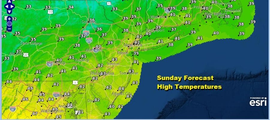
It has been pretty much a wash rinse repeat pattern and we will continue to cruise along with sunshine for Sunday and at least some sunshine for Monday. HIghs will be in the upper 30s to some lower 40s. Nighttime lows Sunday night will be in the 20s to near 30. We have been experiencing near average temperatures all week and that continues Sunday and Monday.
The week ahead is pretty much the same story. Another weak storm will pass to our south on Tuesday and we may have to wait until Friday before the next cold front arrives. That leaves us in dry conditions. Tuesday will be the 8th day in a row of no rain or snow and we will probably make it 10 through Thursday. Highs Tuesday will be in the upper 30s and lower 40s. Wednesday and Thursday will be a little warmer with highs in the low to mid 40s. Friday brings the next cold front that might have enough to produce a few rain showers but here too we are seeing little to get excited about.
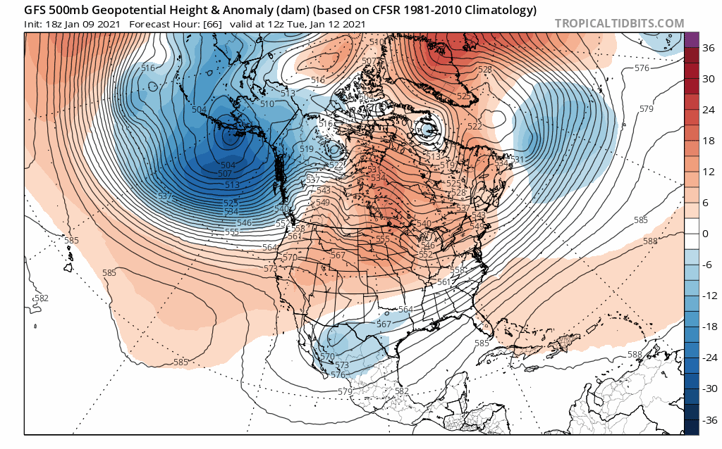
The upper pattern continues to react to the building block over Greenland and the strengthening flow of colder air but these upper troughs that are swinging through are either too broad or they are lining up in places that keep things cold or at least chilly and dry. I do want to keep an open mind here given the strong blocking high to the north northeast. Some runs have show storm possibilities while others have shown very little. We are in prove it to me mode for now.
BE SURE TO DOWNLOAD THE FREE METEOROLOGIST JOE CIOFFI WEATHER APP &
ANGRY BEN’S FREE WEATHER APP “THE ANGRY WEATHERMAN!
MANY THANKS TO TROPICAL TIDBITS FOR THE USE OF MAPS
Please note that with regards to any severe weather, tropical storms, or hurricanes, should a storm be threatening, please consult your local National Weather Service office or your local government officials about what action you should be taking to protect life and property.


