One Last Dry Day Shower Risks Lie Ahead Through The Weekend

One Last Dry Day Shower Risks Lie Ahead Through The Weekend

We have a nice Monday ahead and the satellite loop shows a rather unusual set up here in the Eastern US. It isn’t often in the summer months that we are talking about a northerly flow of air aloft but we have it right now. Clouds on the loop are moving generally from north to south rather from there usual east to west. Nothing is moving at the moment so if you are in the right spot (and we are) you get to see another day of sunshine and dry conditions. Temperatures today will move higher and we should see highs in the mid 70s to around 80 degrees. Eventually those clouds to the west which lie ahead of a warm front will push eastward but that won’t happen until tonight. In the meantime we have no weather issues to worry about and the radars are nice and quiet
SATELLITE

WEATHER RADAR

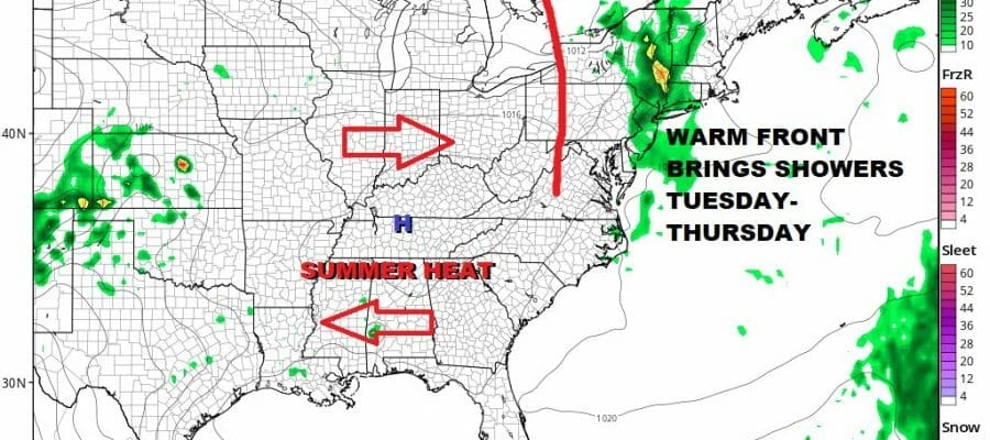
The warm front to the west will inch eastward and likely stall to our west late tonight an basically sit stalled out to our west Tuesday into Thursday. That puts us in line with that northerly flow and that will start to bring in some shower chances during the day Tuesday. The band of showers is not very wide, perhaps only about 100 miles across so we will have to see how it lines up. I don’t think it rains straight through Tuesday and Wednesday. There will be breaks in the mix.
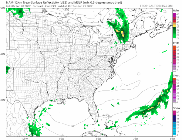
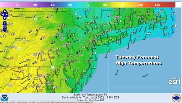
Temperatures overnight will be mostly in the mid 50s to lower 60s. Showers will move southward from upstate NY during the day Tuesday. We will paint a broad brush chance for showers for everywhere from Eastern Pennsylvania to Southern New England. Tuesday highs will be mostly in the 70s east of the warm front and warmer 80s to the west and that would mainly be west of I 81.
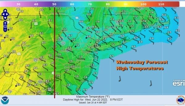
Wednesday is a bit tricky but we will leave in the chance for showers again. The stalled warm front along I-81 in Pennsylvania remains stalled. The winds will be from off the ocean ahead of it and that will keep temperatures in check, probably no higher than the low to mid 70s with even some 60s along the immediate coast. West of the warm front highs will again reach the 80s.
Finally we will see things start to move again as the block to the east breaks down and that will allow the warm front to start to pass through while a weak cold front nears the coast with showers and some thunderstorms Wednesday night into Thursday morning. The front is going to linger a bit nearby Thursday leaving the risk for showers again. There is no real push behind this front and no real wind shift. So it is more of the same. Highs will be in the 70s east of I-81 and low 80s to the west. Friday might be the one day we catch a bit of a break with changeable skies but the risk of a shower is still there. Highs finally should be back into the 80s. The weekend is questionable at the moment with a warm humid flow of air coupled with a dying front and the old trough hanging around off the Carolinas. For now we will go with the idea of changeable skies over the weekend with the chance for some showers or downpours but for now no all day rains are forecast. Highs over the weekend will be in the upper 70s to lower 80s. This part of the forecast is likely to change somewhat as we figure out what is going to happen with all the players hanging around the East Coast late this week.
BE SURE TO DOWNLOAD THE FREE METEOROLOGIST JOE CIOFFI WEATHER APP &
ANGRY BEN’S FREE WEATHER APP “THE ANGRY WEATHERMAN!
MANY THANKS TO TROPICAL TIDBITS & F5 WEATHER FOR THE USE OF MAPS
Please note that with regards to any severe weather, tropical storms, or hurricanes, should a storm be threatening, please consult your local National Weather Service office or your local government officials about what action you should be taking to protect life and property.


