One Last Day of Record Highs Before Onshore Flow Clouds Showers This Weekend

One Last Day of Record Highs Before Onshore Flow Clouds Showers This Weekend
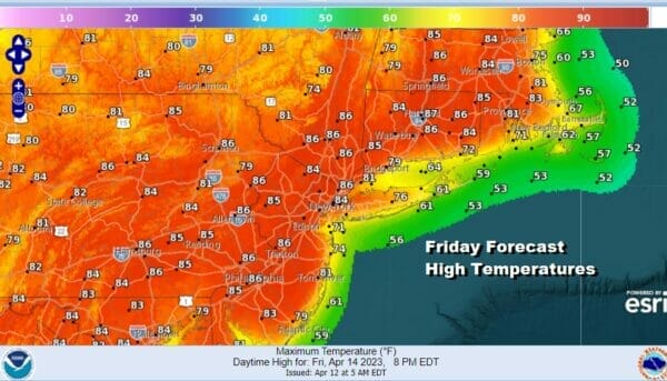
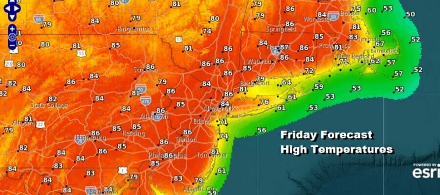
Yesterday we saw the first 90 degree highs for the season and a number of record highs were set. Today we will have another run at record highs this afternoon. We are going to squeeze out one more day of sunshine as we lie in between the northwest flow well to the north in Northern Maine and a weakening upper air system in the Southeast US that is moving northward. With sunshine. and a west to southwest wind, we will see highs againr reach the upper 80s to lower 90s away from the ocean and south facing shorelines. There may be more of a sea breeze this afternoon and it may come in a bit sooner than the past few days.
SATELLITE

WEATHER RADAR

Temperatures tonight will go no where and we will have clouds increasing overnight with most lows in the 50s to around 60. Saturday we are going to see to important changes that will hold temperatures down. First off we will have lots of clouds and not much if any sun. The wind will turn more to the south and that will keep temperatures lower.
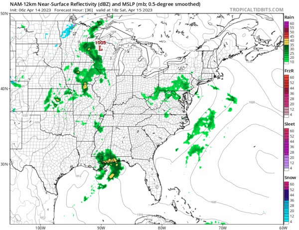
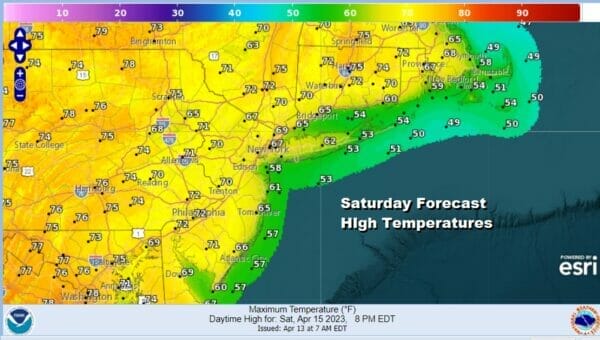
Some of that southern moisture will trigger off some showers Saturday afternoon and evening though I wouldn’t expect them to be anything problematic and there may be some areas that escape showers altogether. As for temperatures it will be a day where highs will not make it much above the 60s coast and south facing shorelines and 70 to 75 ish inland.
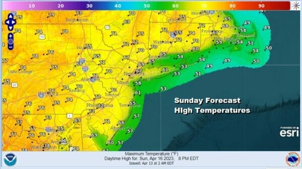
Sunday could turn out to be the better of the two weekend days but we will have clouds around. There may not be much if any showers Sunday and the sun could potentially poke its nose through. The south wind will keep temperatures again in a range of 60s along the coast and low to mid 70s inland. While the weekend temperatures are obviously cooler than today, it is still well above normal by about 10 to 12 degrees.
Late Sunday night into Monday morning a cold front moves through with a few showers and then we will have leftover clouds Monday afternoon with most highs in the 60s. Cooler air will bring back normal temperatures Tuesday and Wednesday with highs in the 50s to near 60 Tuesday and into the 60s Wednesday. Both days should feature some sunshine.
BE SURE TO DOWNLOAD THE FREE METEOROLOGIST JOE CIOFFI WEATHER APP &
ANGRY BEN’S FREE WEATHER APP “THE ANGRY WEATHERMAN!
MANY THANKS TO TROPICAL TIDBITS & F5 WEATHER FOR THE USE OF MAPS
Please note that with regards to any severe weather, tropical storms, or hurricanes, should a storm be threatening, please consult your local National Weather Service office or your local government officials about what action you should be taking to protect life and property.


