On & Off Rain Developing Friday Lasting Through Saturday
Windy Colder Sunday

On & Off Rain Developing Friday Lasting Through Saturday
Windy Colder Sunday
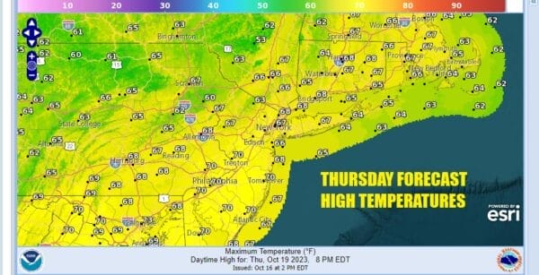
All week long we have been struggling with an upper trough, self destructive sunshine, and scattered showers. Today we get a one day break from all this and that makes today, Thursday, the best weather day of the week. Southwest winds will bring in warmer air and with sunshine for much of the day, highs will reach the mid 60s to lower 70s in most places in Eastern Pennsylvania to Southern New England. Radars are nice and quiet ahead of the next cold front that will be approaching Friday. Clouds could arrive late this afternoon and they will be increasing overnight with most lows in the upper 40s to mid 50s.
SATELLITE WITH LIGHTNING STRIKES
WEATHER RADAR
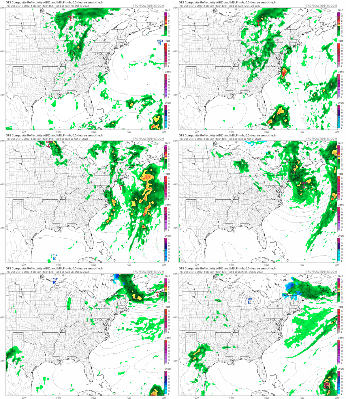
Friday we will be dealing with two systems. The cold front moving through the Great Lakes and Ohio Valley today and a weak low that develops along the North Carolina coast. Showers from the Carolina system will be moving northward and overspreading the area late tonight into Friday afternoon. Then the front from the west will come in and bring in more showery rains Friday night into Saturday afternoon.
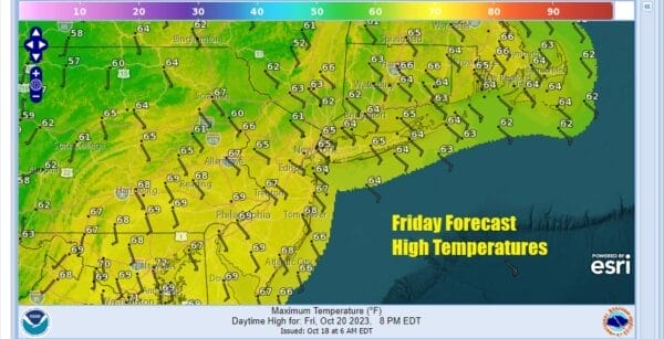
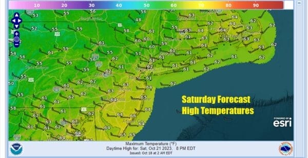
Everything does seem to be moving a little faster which is good because that means we should start to see improving weather conditions during Saturday afternoon from west to east. Friday temperatures will be lower than today with clouds and the rain. Highs will be generally in the 60s. Saturday highs will also be mostly in the 60s.
As far as rainfall amounts are concerned, this will not be a heavy rain producer for our area. Heavier rains will likely fall as you head northeast into Central and Northern New England. We don’t expect to see any flooding issues nor do we expect to see any thunderstorms though some places could see the occasional heavier downpour. There will also be some breaks in between the showery rains Friday into Saturday.
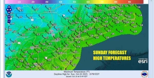
The storm that develops on the front east of New Jersey and south of Long Island will strengthen Saturday night and Sunday in New England. The gradient between the storm and new high pressure in the Great Lakes will tighten up and Sunday will be a windy day with partly sunny skies. Winds will gust to 30 to 40 mph at times. Temperatures Sunday will i believe be lower than modeled and highs will likely be in the low to middle 50s.
Next week we will see a cool first half of the week and a warmer second half as high pressure moves off the mid Atlantic coast around Wednesday. Temperatures Monday and Tuesday will be in the 50s and then we should head higher into the 60s starting Wednesday and possibly into the 70s for Thursday and Friday. No cold fronts will be moving through next week so no rain is forecast through Friday.
BE SURE TO DOWNLOAD THE FREE METEOROLOGIST JOE CIOFFI WEATHER APP &
ANGRY BEN’S FREE WEATHER APP “THE ANGRY WEATHERMAN!
MANY THANKS TO TROPICAL TIDBITS FOR THE USE OF MAPS
Please note that with regards to any severe weather, tropical storms, or hurricanes, should a storm be threatening, please consult your local National Weather Service office or your local government officials about what action you should be taking to protect life and property.
(Amazon is an affilate of Meteorologist Joe Cioffi & earns commissions on sales.)


