

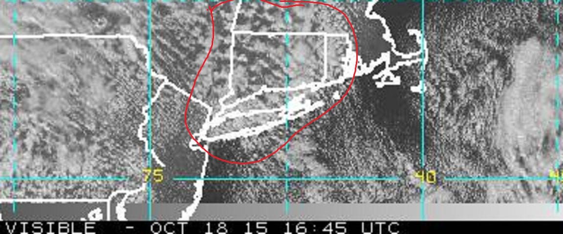
Radar is showing ocean moisture getting advected into the very cold air that is over us especially aloft. Add to that a little instability and you have ocean effect snow showers going on. They show up on the satellite with the streams of clouds over Long Island and Connecticut as they move southeastward.
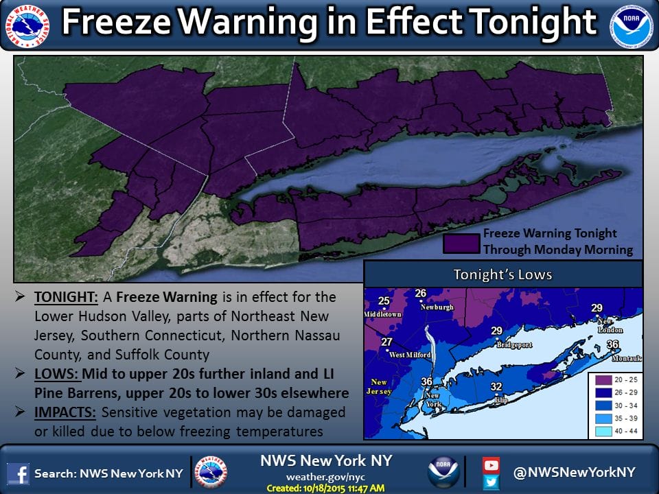
These snow showers probably mixed with a little rain will continue this afternoon and into this evening and then once the atmosphere stabilizes skies will become mostly clear tonight, setting us up for a widespread freeze Monday morning. Freeze warnings are in effect for the entire area except near warmer urban areas of New York City and Eastern New Jersey. It is a little unusual to get this in mid October but we do have an unusually cold air mass overhead. The core of the cold air aloft pulls out tonight and then the warm up begins back to normal. The warm up will happen fairly quickly.
Tuesday morning might see pockets of frost if it stays clear Monday night long enough. The return of warm air will come with some clouds but that won’t stop temperatures from getting back to 60 Tuesday afternoon. Another front will approach and move through Thursday with some cooler air behind it but it is not going to be of the magnitude of this cold air mass and the cool down should be brief and only take temperatures a little below normal. Not much in the way of rain is forecast this week.
If you should happen to see flurries and you have your camera handy, please take a pic and post it to my facebook weather page. For more specific forecasts download my weather app and subscribe to my forecasts for just 99 cents a month. It is available for both andriod and I phones.