Noreaster Wind Rain Snow Forecast Maps
Noreaster Wind Rain Snow Forecast Maps
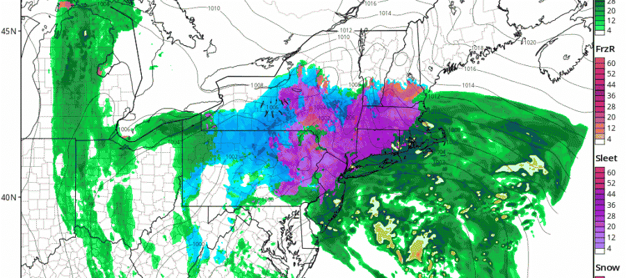
Heavy rains continue along the coast and we have an expanding area of sleet across Northwest New Jersey and the Hudson Valley into Northern Connecticut. The National Weather Service has raised estimates of sleet/snow accumulation though it appears to be mostly sleet. Some pockets of 4 inches are possible in Northwest New Jersey and several inches in pockets across the Hudson Valley and Northwest Connecticut.
Noreaster Wind HRRR Model 10pm-4am Tuesday
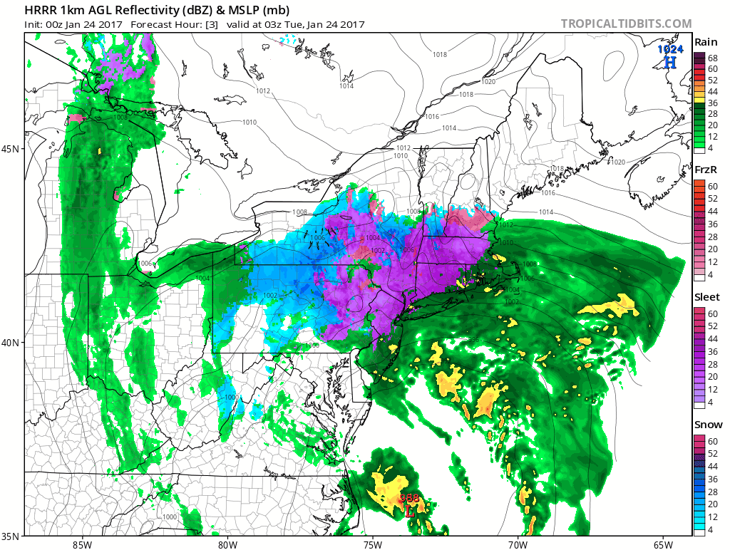
You can see the latest HRRR model view above as it shows precipitation continuing for the next 6 hours before the precipitation shield shifts northward during the early morning hours. Rainfall amounts will finish in the 1.50 to 3 inch range around the area.


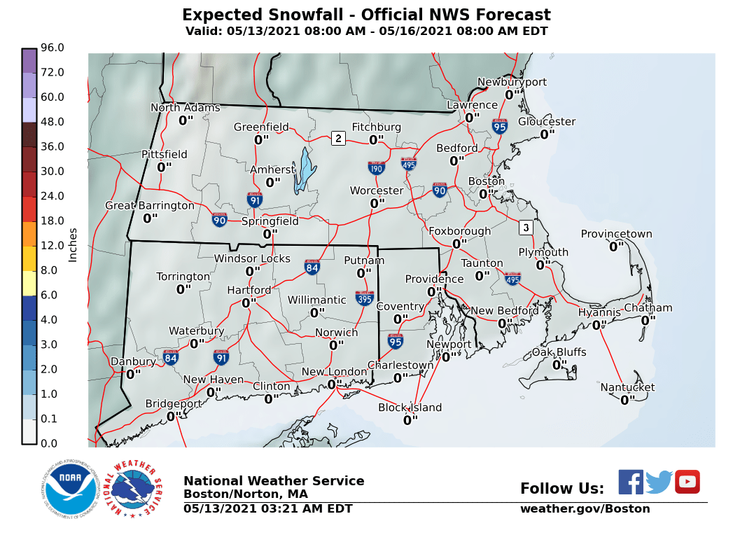
The maps below are the National Weather Service forecast snow maps with the most likely snowfall prediction.