Nor’easter Conditions Develop Late Tonight,
Severe Weather Risks, Flash Flood Watch, Gale Warnings
Weather in 5/Joe & Joe Weather Show Latest Podcast
Nor’easter Conditions Develop Late Tonight,
Severe Weather Risks, Flash Flood Watch, Gale Warnings
Nor’easter Conditions Develop Late Tonight,
Severe Weather Risks, Flash Flood Watch, Gale Warnings
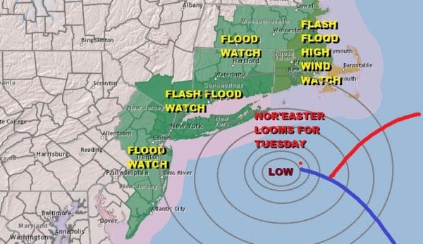
We are prepping up for a nor’easter on Tuesday and we have Flash Flood Watches and Flood Watches up frmo Coastal New Jersey to Southeastern New England. A High Wind Watch is in effect for Southeastern New England and Gale Warnings are posted for the coastal waters offshore. We can tell you that nothing much is going to happen today as we have dense fog to start the day in some areas that will burn off to some sunshine and daytime heating takes highs to the mid 70’s to around 80.
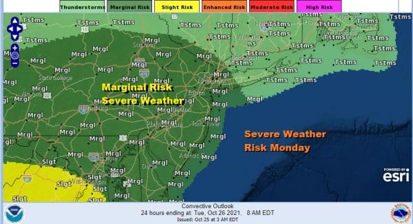
Daytime heating is going to set up some severe weather risk and the Storm Prediction Center has a marginal risk of severe weather reaching to about NYC and the New Jersey NY State Line covering Pennsylvania, New Jersey and points south. Slight risk starts to show up in Northeastern Virginia. I don’t expect much other than some scattered cells developing very late this afternoon but as low pressure transfers energy to the the coastal low moving northward up the coast, we could see some severe thunderstorms develop inside developing clusters of thunderstorms overnight into Tuesday morning.
SATELLITE
WEATHER RADAR
Let’s take you through today. Overnight rains is in New England and the regional radar is not showing much of anything to the south and west of that rain. We should be mostly dry through the afternoon and then the storm starts to get going overnight into Tuesday. The satellite picture above shows clouds from the low to the west. That low is heading into Ohio. Off the Southeast US coast low pressure is developing there and that will become the main storm as the primary low dies out. The strengthening process tonight will create clusters of heavy thunderstorms and then as the low organizes we will watch a band of heavy rain set up for Tuesday.
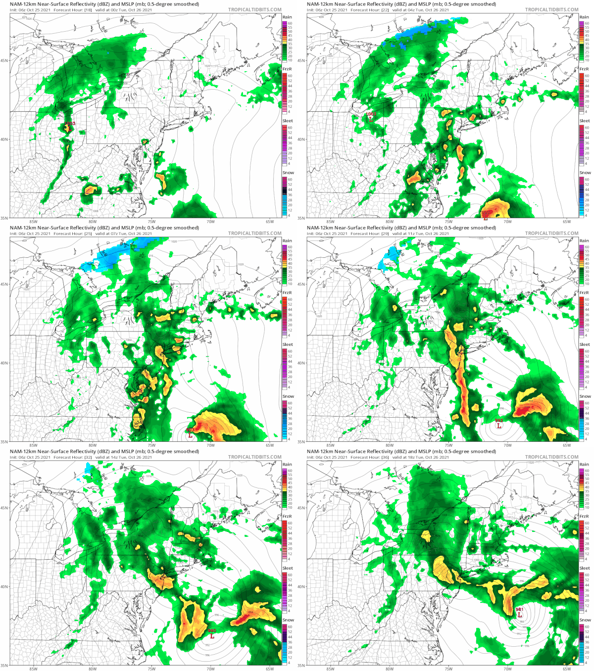
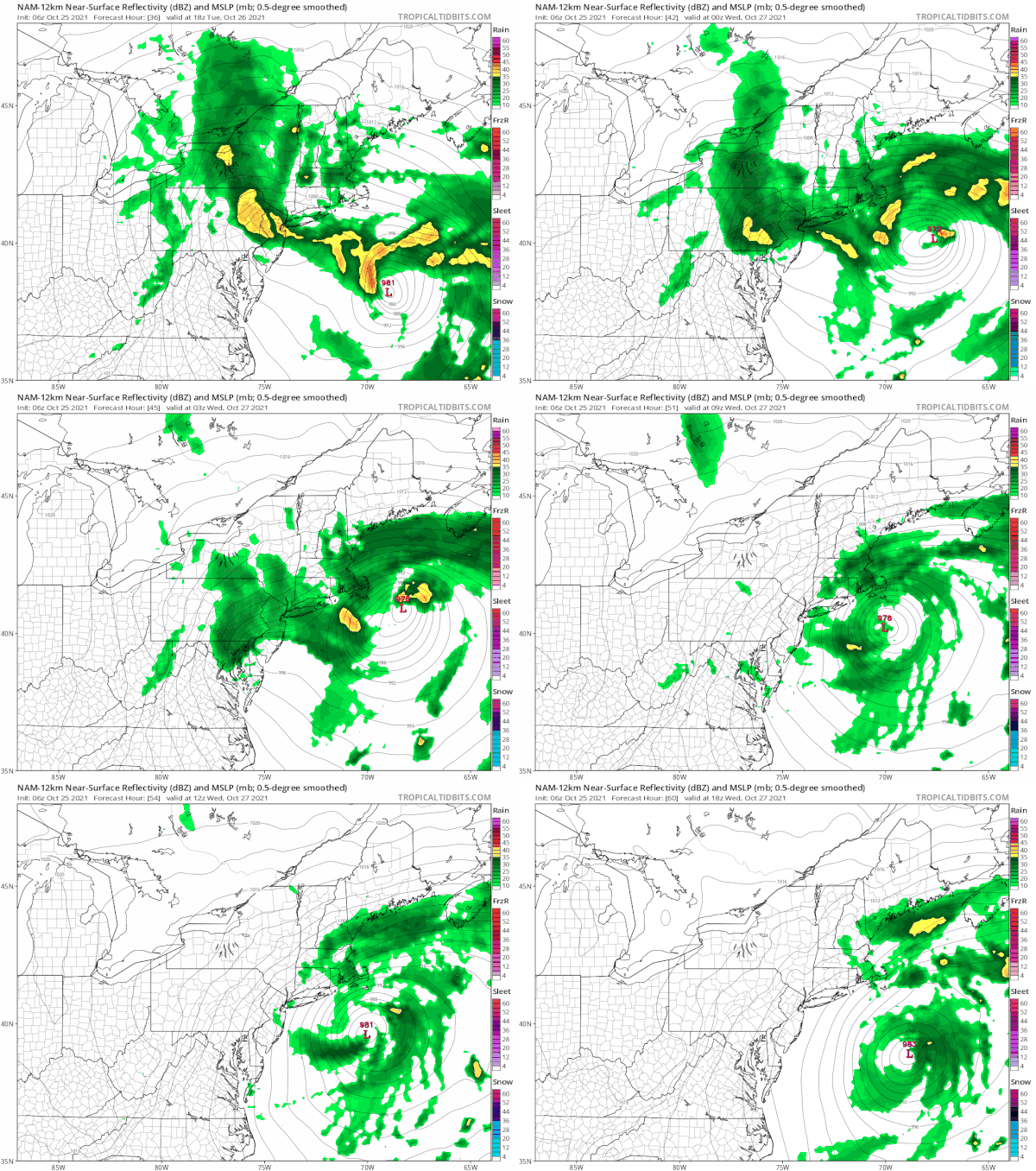
The NAM loop is hour by hour from 8pm tonight to 2pm Tuesday. Notice that the rain is oriented north south and then as the low strengthens offshore, the rain band turns more northeast southwest. Somebody is going to get clobbered with several inches or more of rain. Use the NWS rainfall forecast map as a base case as some areas are going to run higher than advertised. Rains cut off to the west in Eastern Pennsylvania. Highest amounts will be from New Jersey to Southeastern New England including NYC, Long Island and the Hudson Valley.
Winds are not going to be a big issue inland. I still believe along the coast we will see gale force winds from coastal New Jersey and Long Island especially the East End into Southeastern New England. Gusts of 40 to 50 mph are possible. I also think the strongest winds won’t happen until later Tuesday and Tuesday night when the low offshore is doing a counterclockwise loop bringing the tighter gradient closer to the coast.
Weather conditions will improve somewhat Wednesday into Thursday though the onshore flow will keep us in clouds probably through both days. Then another storm coming into the west today (another major storm there) will head east and bring another round of heavy rain Friday into Friday night and improvement will be elusive on Saturday though it might get a little better for Sunday.
BE SURE TO DOWNLOAD THE FREE METEOROLOGIST JOE CIOFFI WEATHER APP &
ANGRY BEN’S FREE WEATHER APP “THE ANGRY WEATHERMAN!
MANY THANKS TO TROPICAL TIDBITS & F5 WEATHER FOR THE USE OF MAPS
Please note that with regards to any severe weather, tropical storms, or hurricanes, should a storm be threatening, please consult your local National Weather Service office or your local government officials about what action you should be taking to protect life and property.


