Nice Weather Continues Warmer Late Week No Storm Systems Through Sunday

Nice Weather Continues Warmer Late Week No Storm Systems Through Sunday
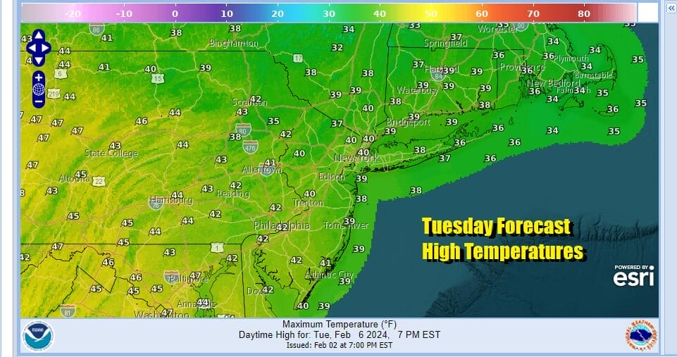
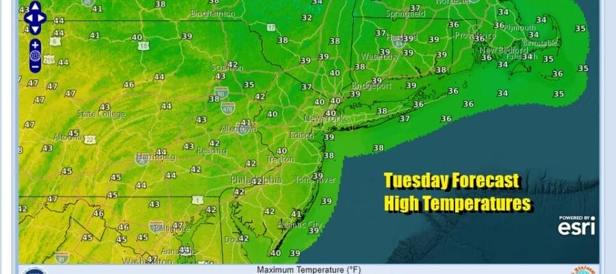
Today is the 4th day in a row of very nice dry weather. Two storms, one to our south off the US Southeast coast, the second southeast of Nova Scotia continue to spin away and hold high pressure from New England to Northern Florida in place. This leaves us locked in cloud free conditions for much of the time. A northerly wind keeps temperatures a bit chilly but reasonable. Lots of sunshine from start to finish today will take high temperatures to a range of 40 to 45 this afternoon. Radars are nice and quiet and we see them remaining so at least through Thursday.
SATELLITE WITH LIGHTNING STRIKES

WEATHER RADAR

Nights have been cold and clear but again, reasonable. Lows at night have been in the 20s to lower 30s and continues to be the case tonight into Wednesday morning. Wednesday dayside will be another day of lots of sunshine with reasonable temperatures. Highs Wednesday will be in the low to middle 40s.

We have been in the sweet spot of an “omega block” which is two strong storms with strong high pressure sandwiched in between. This block begins to break down over the next couple of days which allows weather systems to move along in the flow however there isn’t very much in the way of moisture around. The Atlantic Ocean and the Gulf of Mexico will remain basically shut off as the next low and cold front moves east across the Great Lakes and Ohio Valley late in the week.

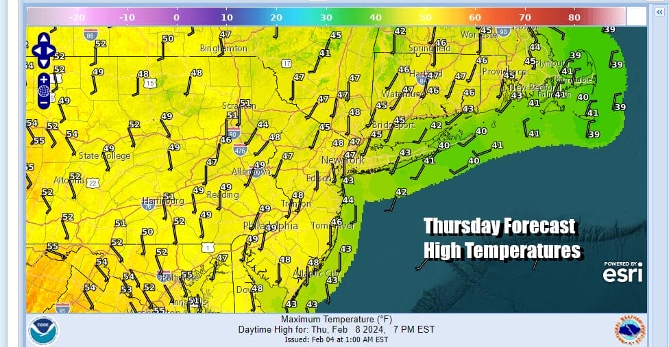
Once this front passes we expect to see a stair step decline in temperatures later in the weekend and into next week but we will warm up ahead of it. We also will see the flow open up to storm systems coming eastward next week and there will be track and cold air questions when we get there. Until then though we have Thursday which will be a warmer day with sunshine taking highs to the upper 40s and lower 50s.
Friday will be a day where we will have some sunshine and clouds around with highs into the 50s just about everywhere. This weather front is going to have very little with it rain wise and that leaves us with a warm start to the weekend. Saturday highs will reach into the 60s before we start to cool off Sunday and then trend colder next week.
BE SURE TO DOWNLOAD THE FREE METEOROLOGIST JOE CIOFFI WEATHER APP &
ANGRY BEN’S FREE WEATHER APP “THE ANGRY WEATHERMAN!
MANY THANKS TO TROPICAL TIDBITS FOR THE USE OF MAPS
Please note that with regards to any severe weather, tropical storms, or hurricanes, should a storm be threatening, please consult your local National Weather Service office or your local government officials about what action you should be taking to protect life and property.
(Amazon is an affilate of Meteorologist Joe Cioffi & earns commissions on sales.)


