Dry Weather Sunshine Continues Through At Least Thursday, No Storms in Sight

Dry Weather Sunshine Continues Through At Least Thursday, No Storms in Sight

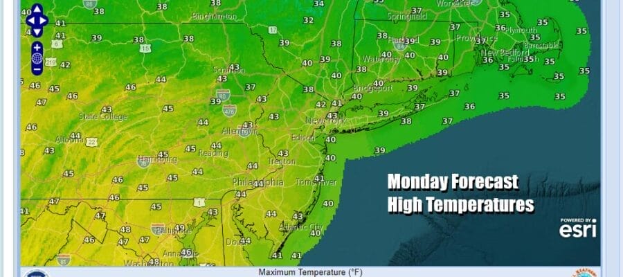
We continue to sit in a atmospheric sweet spots. To the northeast we have a stalled out storm southeast of Nova Scotia which has brought heavy snow to Nova Scotia and nearby areas there. The satellite loop shows that storm throwing clouds back westward to near coastal Eastern New England and offshore. To the south we have this stretched out low pressure area from the Gulf of Mexico to the Florida East Coast. Clouds are over the Southeast US but that system is getting shoved out to the east under the block. This leaves us in sunny skies from most of New England to North Carolina and no weather issues to speak of. High pressure sandwiched in between the two lows will keep things dry. Temperatures are chilly but running slightly above average today with highs in the low to mid 40s.
SATELLITE WITH LIGHTNING STRIKES

WEATHER RADAR

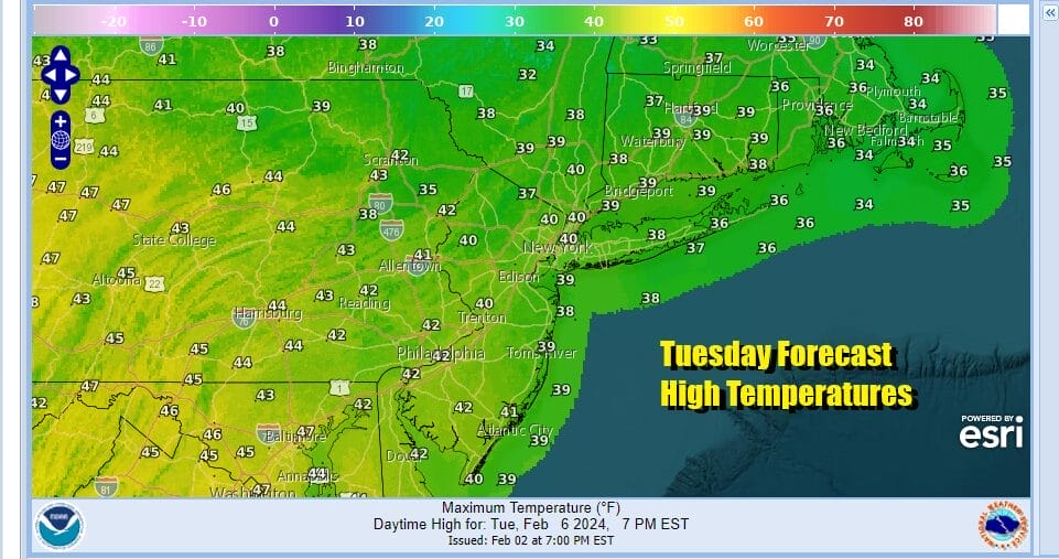
We have no issues at all on the regional radar loop so we will continue to roll along tonight under clear skies. Lows will be in the 20s except for lower 30s warmer urban areas. Tuesday looks like a nice sunny day with highs in the low 40s. Wednesday as the center of the high moves overhead we will sunshine with highs in the low to mid 40s.

This blocking pattern eventually breaks down this week and that will allow weather systems to start moving again. However even though we had a major storm come into California overnight, that system heads to the Dakotas and points north and east and a cold front will be pushing eastward. There is very little moisture for this systemt to tap as the Gulf of Mexico and the Atlantic will be shut off as far as moisture is concerned.

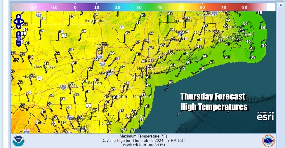
As the surface highs moves offshore winds turn more southwest beginning Thursday. It will also be another day of sunshine so look for temperatures to reach the mid to upper 40s. A few warmer spots might be able to break the 50 degree mark, mostly from South Jersey and Southern Pennsylvania southward.
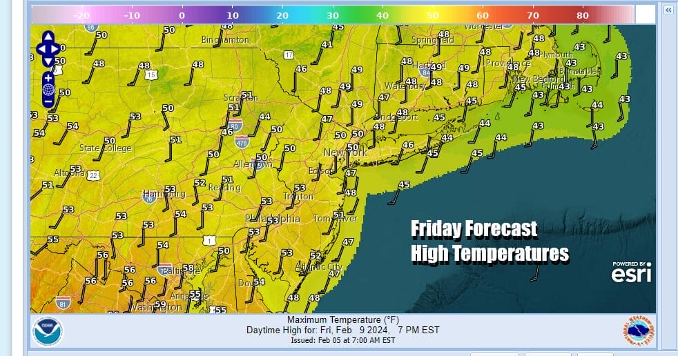
Friday sees a cold front approaching but most of the models show not much with this front and what there is should go to our north. Clouds might come into the mix Friday but there will be sunshine. Friday is actually looking like a nice mild day with high temperatures reaching into the 50s in many locations.
The weekend is setting up to be dry and uneventful. Temperatures will trend lower over the weekend and next week in the long range as the pattern turns somewhat colder overall. However if you are expecting some sort of big blast of cold arctic air, that isn’t happening. We may be heading into a stretch of weather where temperatures will average close to or a little below normal. Many forecast shoppers out there have seen posts of winter returning with a vengence, I DO NOT see that happening. What I do see is what could be a chilly, dry pattern with little in the way of rain or snow, and temperatures that may be near or slightly below average. Weather systems next week look suppressed well to the south which means we will possibly go two weeks with little if any precipitation! No major storms are on the horizon.
BE SURE TO DOWNLOAD THE FREE METEOROLOGIST JOE CIOFFI WEATHER APP &
ANGRY BEN’S FREE WEATHER APP “THE ANGRY WEATHERMAN!
MANY THANKS TO TROPICAL TIDBITS FOR THE USE OF MAPS
Please note that with regards to any severe weather, tropical storms, or hurricanes, should a storm be threatening, please consult your local National Weather Service office or your local government officials about what action you should be taking to protect life and property.
(Amazon is an affilate of Meteorologist Joe Cioffi & earns commissions on sales.)


