
Nice Weather Ahead Friday Into Tuesday of Next Week

Nice Weather Ahead Friday Into Tuesday of Next Week
We discussed earlier today that we could finally see a string of nice weather around here from the standpoint of sunshine beginning on Friday and lasting through at least Monday and possibly into Tuesday and that still remains the case after looking through all the weather models. We have a blocky signature in the upper atmosphere at the moment which will break down over the weekend. At least it sets up a dry though chilly flow of air beginning Friday and keeping us protected through at least Monday and possibly into Tuesday.
JET STREAM FORECAST SUNDAY APRIL 22, 2018
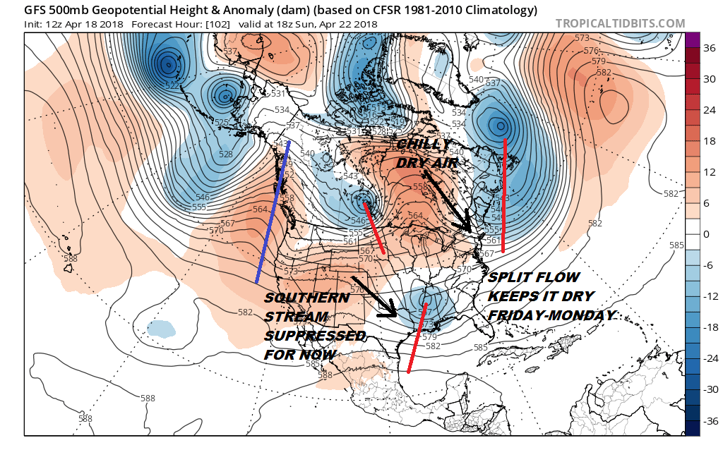
The flow across the US is split into two parts. The northern part of the split is dominated by an upper low east of New Foundland which holding and it creates a dry chilly flow from Eastern Canada into the Northeast & Middle Atlantic states. Other than occasional patchy clouds the weather looks good starting Friday and through the weekend. That low east of New Foundland starts to pull away as the block breaks down and we begin to set the wheels in motion for the next weather maker here. It will take a few additional days for that to play out so Monday looks good and Tuesday looks okay as well. Unfortunately below average temperatures will continue.
BELOW AVERAGE TEMPERATURES NEXT WEEK

Once the weak block breaks down, we begin to watch a system in the southern part of the jet stream and northern energy that will try to lift that energy northward as we head into the middle of next week.
JET STREAM TUESDAY APRIL 24, 2018

Weather models were suggesting for a few days that the northern energy would basically kick out the southern energy to the northeast and making it a non event for us however the timing seems to be evolving differently in the last day or so. Also the strength and timing of the northern energy argues for the southern energy to be picked up and lifted northward bringing rain here as early as Tuesday night or perhaps on Wednesday of next week. We are going to wait and see if models are correct on the timing of all the energy running around and how models handle this going forward. One that we can say is that if you are looking for a return to the late spring temperatures we had last Friday and Saturday, you can forget about that for now. Other than the odd day that might pop up here and there, the overall trend of below average temperatures looks to continue at least into the end of the month of April and for the start of the month of May.
SHOP THE JOESTRADAMUS STORE
MANY THANKS TO TROPICAL TIDBITS FOR THE WONDERFUL USE OF THE MAPS

GET JOE A CIGAR IF YOU LIKE!
FiOS1 News Weather Forecast For Long Island
FiOS1 News Weather Forecast For New Jersey
FiOS1 News Weather Forecast For Hudson Valley
NATIONAL WEATHER SERVICE SNOW FORECASTS
LATEST JOESTRADAMUS ON THE LONG RANGE