
Another Day Limited Sun Chilly Better Weather Weekend
Another Day Limited Sun Chilly Better Weather Weekend
The complete lack of bright and sunny days is really getting to me at this point and I’m it is getting to most of you. The storm from Monday remains rather noticeable on the satellite shot this morning and that has us in some cloud cover. To the west northwest is a small fast moving storm system that is bringing snow today to parts of Iowa and Wisconsin (as if they needed more) and that system will head our way for later tonight and Thursday. Today it seems that it should at least try to go partly sunny and hopefully it does. Temperatures will probably hold mostly in the 50s.
US SATELLITE

REGIONAL RADAR

LOCAL RADAR NEW YORK CITY

LOCAL RADAR PHILADELPHIA


Tonight we look ahead to that Midwest system approaching so clouds will increase. The low now looks to move into Central Pennsylvania and redevelop off the New Jersey coast Thursday morning. This may actually put a good chunk of the area in an onshore flow for awhile later tonight. Some rain will develop during the early morning hours and last to about daybreak. I don’t believe it amounts to much.
NAM FORECAST 9AM THURSDAY APRIL 19, 2018
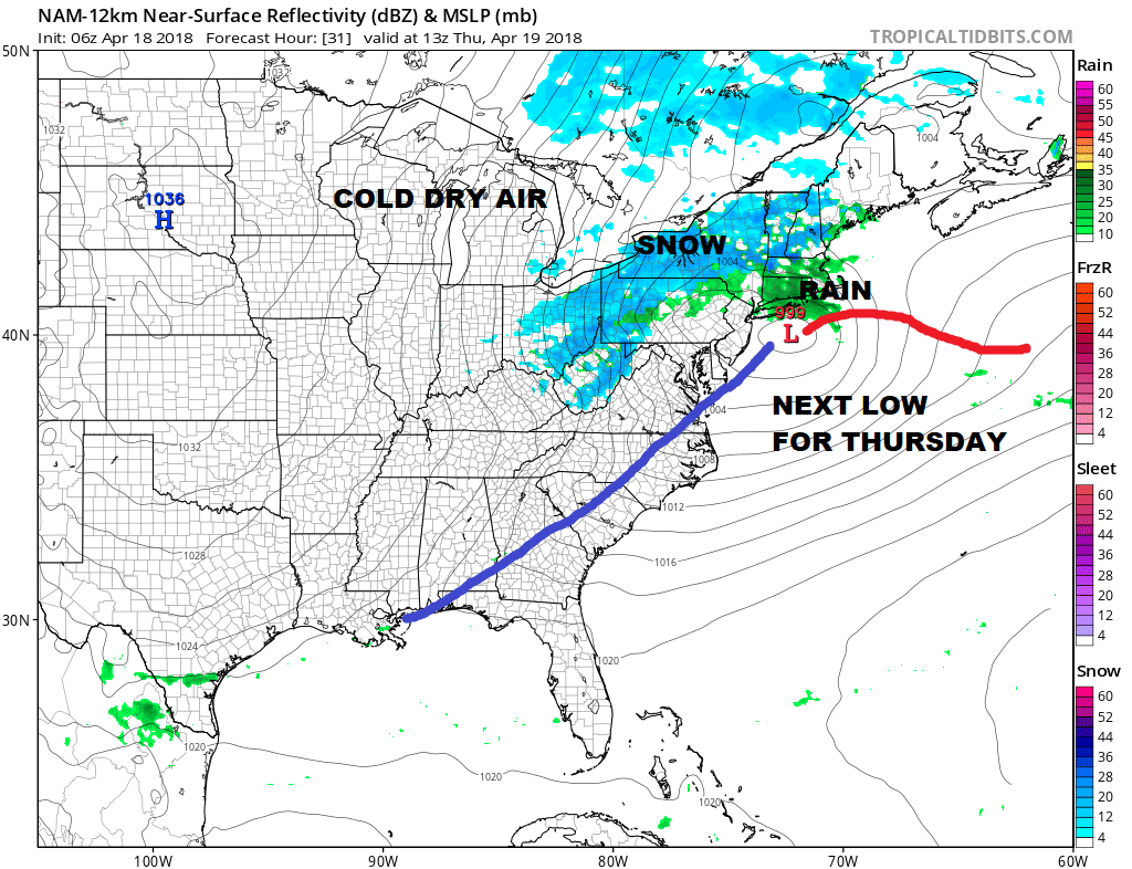
Thursday to me looks like a day of variable cloud cover with some attempts at some sunshine. Most highs will be in the 50s to near 60. Then as the low goes out to the northeast a chilly high builds in. The good news is that it begins what should be a dry period of weather that should last through at least next Tuesday. The only issue may come later Saturday as a weak disturbance goes by that could produce a brief shower Saturday evening. Other than that we should see some sun with highs in the 50s each day and next Monday and Tuesday we should be pushing that into the 60s.
JET STREAM FORECAST FOR EARLY NEXT WEEK SUNDAY APRIL 22, 2018
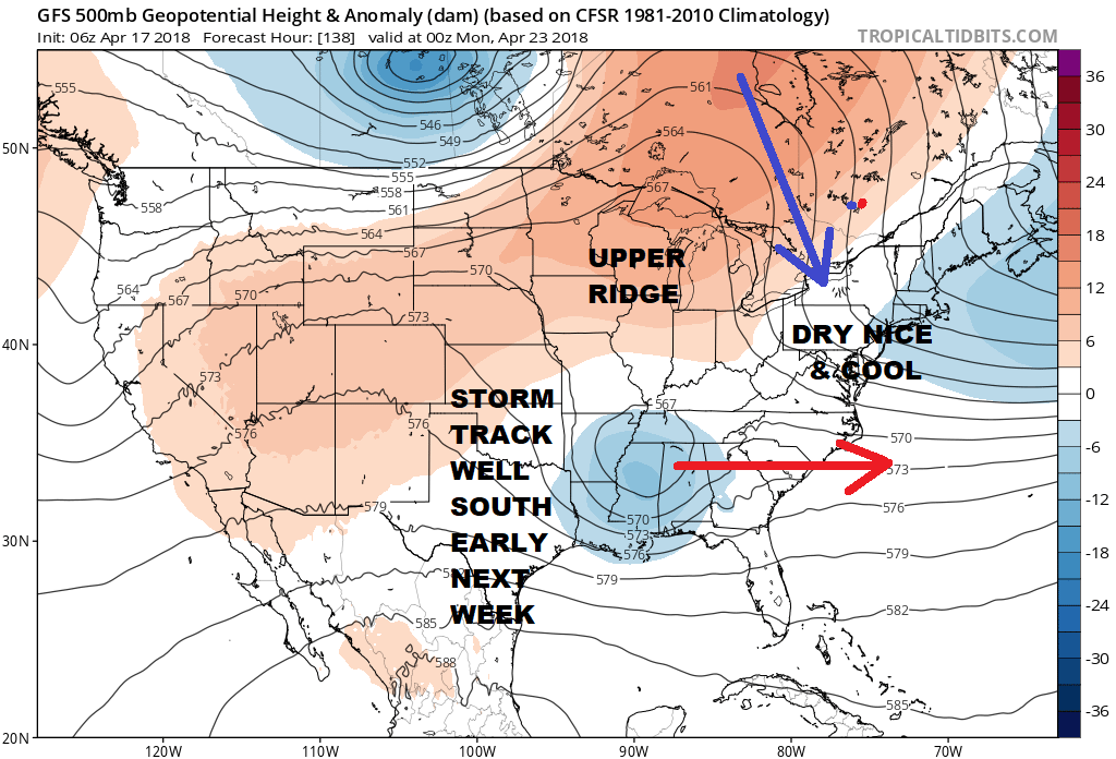
The upper air jet stream shows a “split” flow with northerly winds aloft early next week to keep things quiet. The system in the southern part of the jet stream may try and lift northward once it reaches the East Coast creating another soupy scenario next Wednesday but we will worry about that in a few days. If we can manage to string together 3 or 4 days of at least some sunshine in between now and then I’m sure most of you will be happy Temperatures are another matter as we continue to run near or below average until maybe Monday and Tuesday next week when average temperatures could be accomplished.
 GET JOE A CIGAR IF YOU LIKE

FiOS1 News Weather Forecast For Long Island
FiOS1 News Weather Forecast For New Jersey
FiOS1 News Weather Forecast For Hudson Valley


