Nice Weather Ahead for Easter Weekend
Next Week Dry And Warmer Than Average
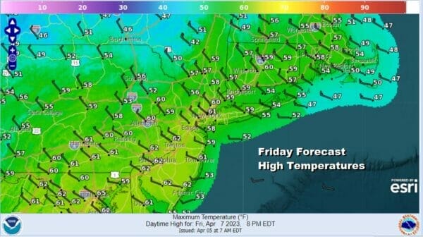
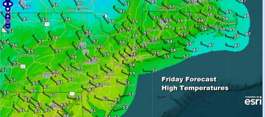
Last night’s cold front moved through without much fanfare. The severe weather was well to south across Virginia, Eastern Maryland and Delaware. The front is now slowing down and stalling from the Carolinas southwest to Texas. Clouds have pulled out for the most part north of New York City but clouds are still going to be a bit on the stubborn side across Southern New Jersey, Southern Pennsylania and points southward. It will be a cloudy to partly sunny type of day. Radar echos where the rain is reaching the ground are well south into Virginia and we do not expect those to be an issue today.
SATELLITE

WEATHER RADAR

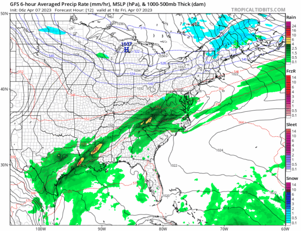
High pressure around the Great Lakes will be the primary driver of weather over the Easter Weekend which means we will see temperatures on the cool side of average for both Saturday and Sunday. The high and a northwest flow developing over the Northeast US should keep the stalled front to the south along with the wave that develops on that front off the Carolinas Saturday into Sunday.
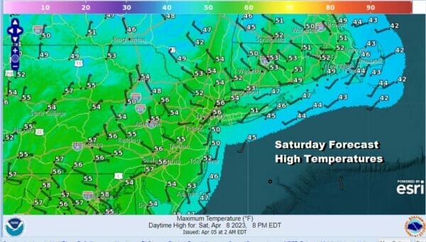
We have a chilly night ahead of us with clear skies to the north and some clouds to the south. Lows by morning will be in the 20s north and west of the big cities of NYC and Philadephia and mostly low and middle 30s everywhere else. Saturday look for high clouds to move northward which will veil the sunshine and keep temperatures from rising much. HIghs will just be back in a range of 50 to 55 in most places.
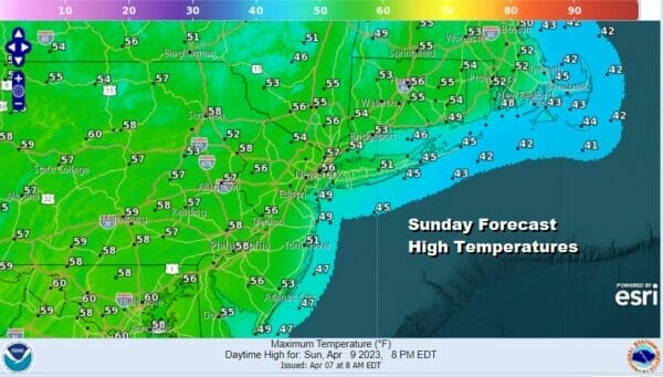
The developing low off the Carolinas will move away to the east Saturday night and Sunday and this will allow the high to the north to move right over the The Northeast and Mid Atlantic states Easter Sunday. It looks to be a mostly sunny Easter with highs in the mid to upper 50s which is a little lower than where we should be for this time of year.
Next week looks to be dry all week long. Other than a front that comes through dry Tuesday night, there are no important weather changes of note. We also have a pattern set up in the Eastern US where the high is strong and to our south and that should keep away any backdoor cold fronts. This should lead to a week of above average temperatures. We should be back into the low and mid 60s Monday with sunshine. Tuesday we will be in the 70s with sunshine. Wednesday with a northwest wind and no cold air to speak of, highs will probably be in the upper 70s to lower 80s. The warm weather continues Thursday and Friday and the next chance for any showers won’t occur until perhaps next weekend.
BE SURE TO DOWNLOAD THE FREE METEOROLOGIST JOE CIOFFI WEATHER APP &
ANGRY BEN’S FREE WEATHER APP “THE ANGRY WEATHERMAN!
MANY THANKS TO TROPICAL TIDBITS & F5 WEATHER FOR THE USE OF MAPS
Please note that with regards to any severe weather, tropical storms, or hurricanes, should a storm be threatening, please consult your local National Weather Service office or your local government officials about what action you should be taking to protect life and property.


