
Get Ready for 80s NYC South & West Late Showers Thunderstorms
Easter Weekend Dry

This is going to be a very warm day for most of the area and except for those places exposed to the ocean like Long Island and the New Jersey shore, we could see many areas reach into the 80s for the first time this spring. The stalled front to the south is making its way northward and that should allow for sunshine to develop as we move through the day. Along shore areas highs will reach the 60s and 70s depending on how much of a sea breeze takes hold.
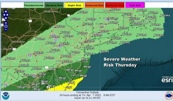
Late this afternoon and evening we will see some showers and perhaps a thunderstorm or two. We have been arguing that the set up for severe weather tonight is different from what we saw last Saturday. The Storm Prediction Center has pushed the area of marginal risk further south into Southern New Jersey and the slight risk even further south leaving general thunderstorm risk everywhere else. While there could be an isolated stronger thunderstorm cell or two, for the most part this should be manageable.
SATELLITE

WEATHER RADAR

Showers and thunderstorms this evening will come to an end tonight and then we have leftover clouds to follow. Lows will be in the 40s to around 50 in warmer urban locations. This cold front will sag southward and stall out across the Southeast US. That should be far enough south to keep rain away from the Northeast and Northern Mid Atlantic right through the Easter holiday weekend.

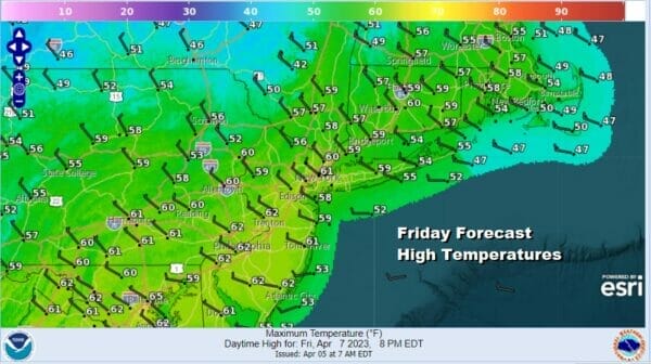
Friday will be dry with sunshine and some clouds with a cooling breeze. Most highs will be in the upper 50s to around 60 degrees. High pressure will start building from the Great Lakes and this is going to suppress a developing low off the Carolinas tonight and Saturday, keeping it well to the south and east.
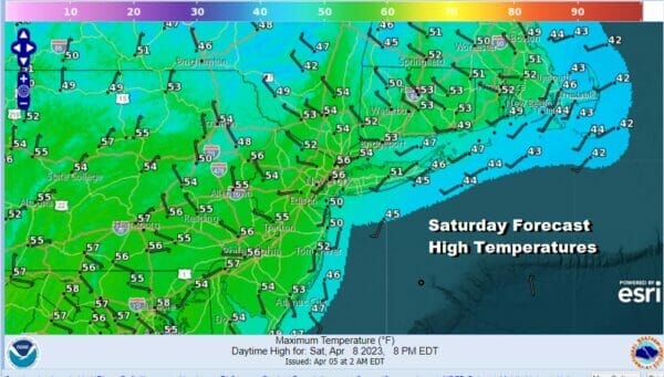
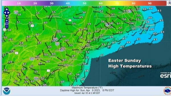
The issue for Saturday is that we will see sunshine but we will also see high clouds veiling that sun and that will help to keep temperatures down. Highs Saturday will be in the low to middle 50s. Easter Sunday looks like a great day with lots of sunshine and highs will reach the upper 50s to around or just over 60 degrees in most areas.
Next week looks to be dry all week long which is a little unusual for April but it does happen. Temperatures on the whole will be above average. We should see 60s Monday and at least 70s Tuesday and Wednesday. Other than risks from a back door front at some point later next week, it could turn out to be the best week of the young spring season so far.
BE SURE TO DOWNLOAD THE FREE METEOROLOGIST JOE CIOFFI WEATHER APP &
ANGRY BEN’S FREE WEATHER APP “THE ANGRY WEATHERMAN!
MANY THANKS TO TROPICAL TIDBITS & F5 WEATHER FOR THE USE OF MAPS
Please note that with regards to any severe weather, tropical storms, or hurricanes, should a storm be threatening, please consult your local National Weather Service office or your local government officials about what action you should be taking to protect life and property.


