Nice Saturday Low Humidity Sunshine
Chance Shower Thunderstorm Sunday Evening

Weather in 5/Joe & Joe Weather Show Latest Podcast
Nice Saturday Low Humidity Sunshine Chance Shower Thunderstorm Sunday Evening
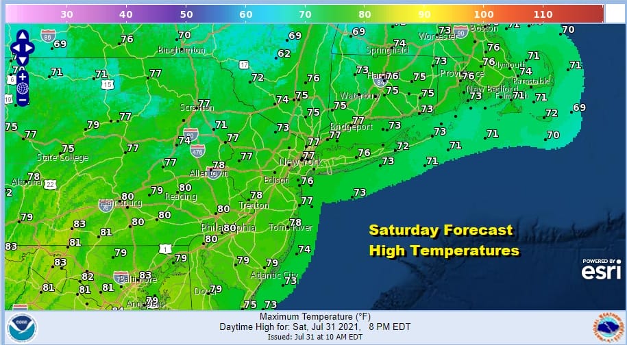
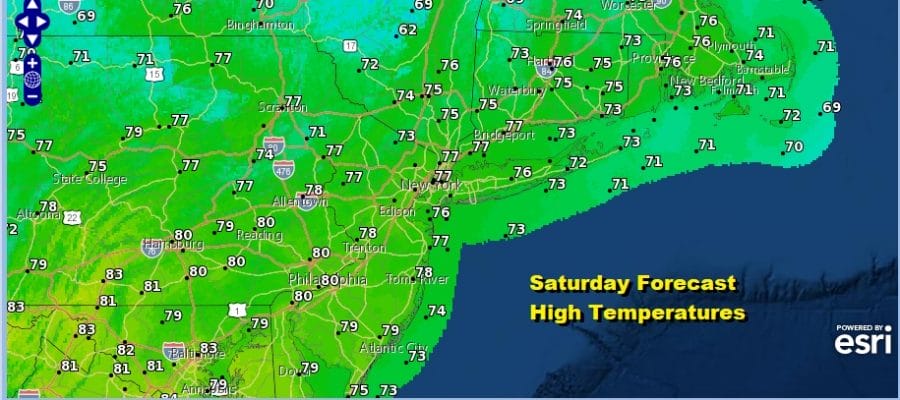
We have a beautiful Saturday underway with plenty of sunshine over most of the area and while there are some clouds across the Northern Mid Atlantic, they should not pose a serious issue today other than fading some of the sun at times in areas across Southern Pennsylvania and Southern New Jersey south. North of there into Southern New England skies are mainly sunny. Humidity is low everywhere and will remain so. Highs this afternoon will be in the 70s to near 80.
SATELLITE

Radars are picking up on some light showers aloft scattered in Southern New Jersey down into Delaware but these showers should disappear before too long. Then it is on to another nice clear night. It won’t be quite as cool as last night but it will be still rather pleasant with lows in the low to mid 60s in warmer urban arears and in the 50s in colder rural and outlying areas.
WEATHER RADAR


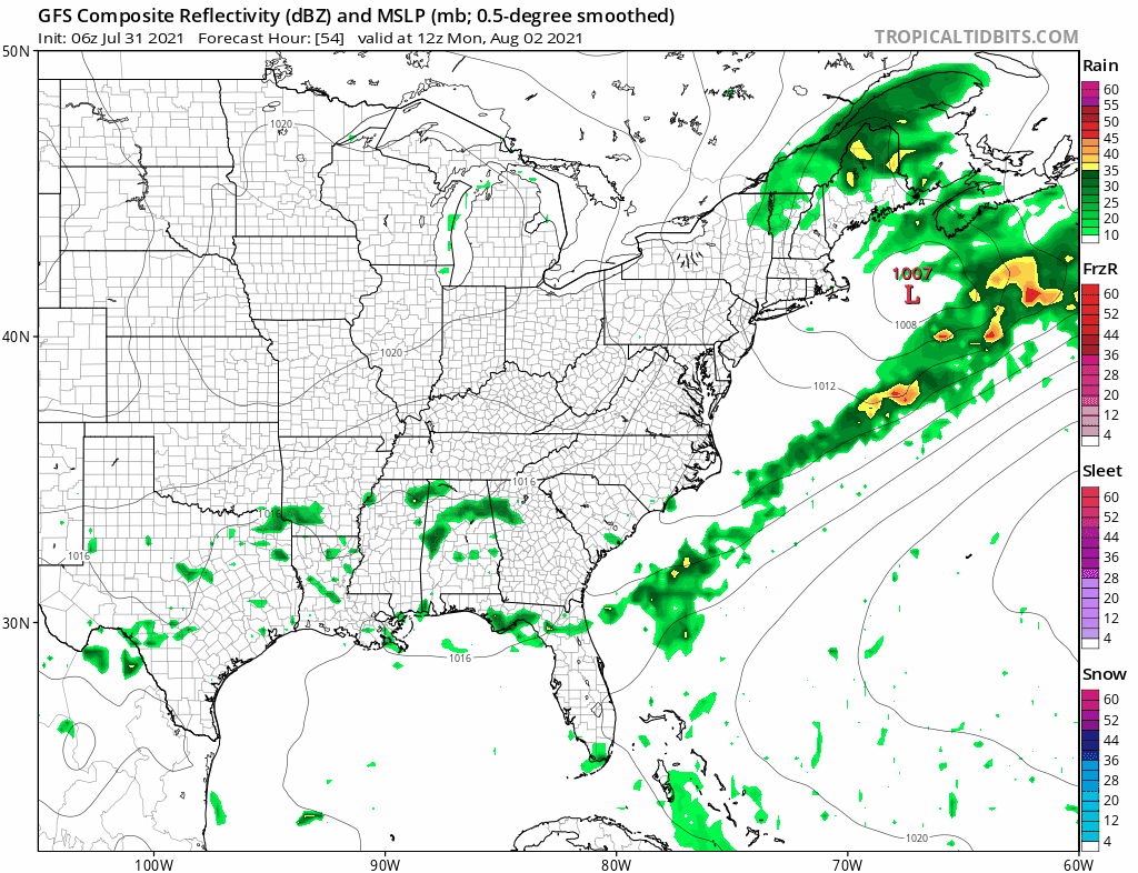
Sunday brings a cold front through the area late in the day so look for sunshine and arriving clouds with highs again in the 70s to near 80. Late afternoon and evening could bring a few showers or possibly a thunderstorm. No severe weather is forecast from this front. Dew points will come up into the lower 60s but not enough to set off severe weather.

The front is the leading edge of another dry air mass from Canada and that means Monday will be a sunny day with low humidity again. Highs will be in the 70s to near 80. The front stalls far enough offshore to prevent any issues into Tuesday but it stalls out close to the Carolina coast. A wave will develop on that front and eventually it will move northward. We should be far enough west and north of that boundary Tuesday to enjoy some sun but there will be some clouds around. Highs will be in the upper 70s near the coast and lower 80s inland.
The first wave passes to the east late Tuesday and Tuesday night and it does not push the front out further east. You can thank a strengthening upper high in the ocean for that and it keeps the front pinned close to the coast. A second wave will develop later this week and this will bring some rain up the coast later Thursday or Friday. While it should be dry on Wednesday we will likely have some clouds to deal with but there should be some sun. Highs will reach 80 to 85. Thursday’s highs will be in the upper 70s to near 80 with more clouds and then the chance for rain later Thursday into Friday. Highs Friday will be in the 70s to near 80. Humidity levels this week Monday and Tuesday and while they will start to come up for the second half of the week they will not get out of hand.
BE SURE TO DOWNLOAD THE FREE METEOROLOGIST JOE CIOFFI WEATHER APP &
ANGRY BEN’S FREE WEATHER APP “THE ANGRY WEATHERMAN!

MANY THANKS TO TROPICAL TIDBITS & F5 WEATHER FOR THE USE OF MAPS
Please note that with regards to any severe weather, tropical storms, or hurricanes, should a storm be threatening, please consult your local National Weather Service office or your local government officials about what action you should be taking to protect life and property.


