Nice Early Autumn Weather Into Friday
Watching Southeast US Coast for Subtropical Storm Developement

Nice Early Autumn Weather Into Friday
Watching Southeast US Coast for Subtropical Storm Developement
Yesterday’s system that produced up to a few inches of rain for some folks in Eastern Pennsylvania to Southern New England has now moved away to the east and we have some spectacular weather for the next 3 or 4 days. Skies have cleared out from overnight and we will enjoy lots of sunshine today. High pressure builds from the Great Lakes to the Northeast. Highs will be in the low to middle 70s with a nice northwest breeze. There are no issues on the radar and we will be dry for the rest of the work week.
SATELLITE WITH LIGHTNING STRIKES
WEATHER RADAR
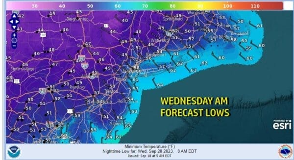
The high pressure area will build into New England and only very slowly move eastward. This will keep things very dry and cool with clear skies tonight. It has been quite a while since it has been this coo. We probably need to go back to early June. Lows will be in the mid to upper 40s inland and low to mid 50s coast and warmer urban locations.
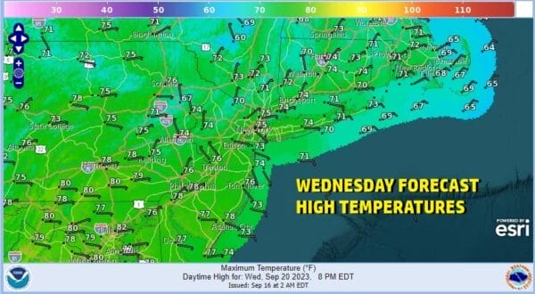
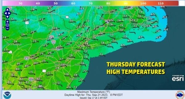
Wednesday and Thursday high pressure is overhead. Our nice weather continues with sunshine both days. No rain is forecast anywhere. Highs Wednesday and Thursday will be in the 70s. Nights will continue to be on the cool side with lows in the 40s inland and 50s to near 60 along the coast.
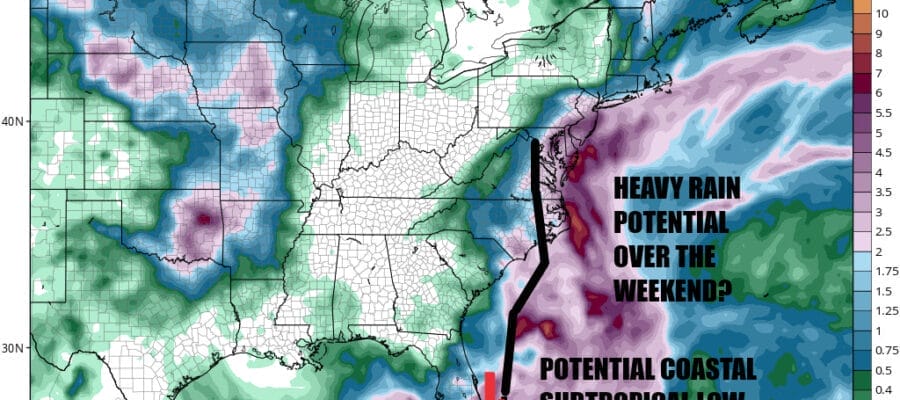
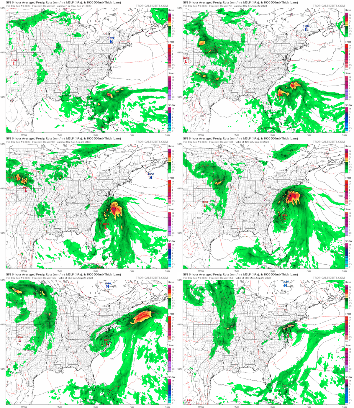
Thursday night into Friday the large high will be heading off the coast of Maine. We will have an easterly flow up and down the East Coast with lower pressures developing off the Southeast US coast and east of Florida. A low will develop off the Florida coast and it will meander a bit. Then the low will begin a slow move northward toward the coastal Carolinas.
Initially this system will have a cold core nature to it but the warm ocean off the Southeast Coast and east of Florida could allow this system to acquire subtropical characteristics or even tropical characteristics. The low is forecast to move northward. Friday will not be an issue as we will still have enough of the high to bring us sunshine to start the day but clouds will be arriving. There will also be a bit of an east wind that will pick up a bit especially south of NYC. Highs Friday will be in the upper 60s coast to mid 70s inland. We will likely see an area of rain move up the coast through the Mid Atlantic states Friday night and possibly reaching the Hudson Valley, Southern New England, NYC, much of New Jersey and Long Island by Saturday morning.
There are still a lot of questions here regarding the low track. While the low center is forecast to move into Coastal North Carolina, it may not survive the trip up the east side of the Appalachians. On the other hand we have the rain area which seems to break away from the main low and head northeastward. This seems to be the main risk from this complex system. The heaviest rain would tend to favor the coast verses inland areas and weather models are bullish for some areas seeing several inches. We will continue to monitor this system and in the meantime we have some very nice end of summer weather over the Eastern US so enjoy that as much as you can.
BE SURE TO DOWNLOAD THE FREE METEOROLOGIST JOE CIOFFI WEATHER APP &
ANGRY BEN’S FREE WEATHER APP “THE ANGRY WEATHERMAN!
MANY THANKS TO TROPICAL TIDBITS FOR THE USE OF MAPS
Please note that with regards to any severe weather, tropical storms, or hurricanes, should a storm be threatening, please consult your local National Weather Service office or your local government officials about what action you should be taking to protect life and property.
(Amazon is an affilate of Meteorologist Joe Cioffi & earns commissions on sales.)

