Nice Into Friday But Watching Southeast US Coast
for Subtropical Storm Development,
Heavy Rain Risk Weekend Coastal Mid Atlantic to Southern New England

Nice Into Friday But Watching Southeast US Coast
for Subtropical Storm Development,
Heavy Rain Risk Weekend Coastal Mid Atlantic to Southern New England

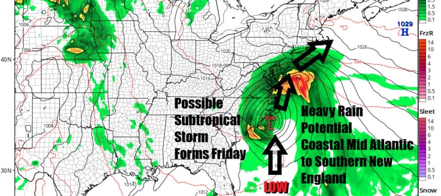
We continue to enjoy nice mid September weather and it will last into Friday. However we do see increasing risk for a potential subtropical storm to develop off the Southeast US coast. This low will develop Thursday night and Friday and head northward. The risk will be for a period of heavy rain Friday into Saturday morning from the Coastal Carolinas and Virginia and then moving northward to New Jersey to Southern New England later Friday night into Saturday morning. Also we could see some wind issues developing along the coast as this system heads northward and then northeastward.
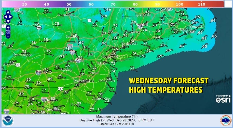
We have have more on this system shortly but first we want to discuss today. After a cool start this morning we see no issues. In fact much of the East Coast is enjoying very nice mid September weather with temperatures about where they should be for this time of year and no rain. We will see lots of sunshine today and high temperatures will reach the low to middle 70s. This will be followed by another night of clear skies. Most lows in Eastern Pennsylvania to Southern New England will be in the 50s with 40s in cool spots and near 60 warmer urban areas and the coast.
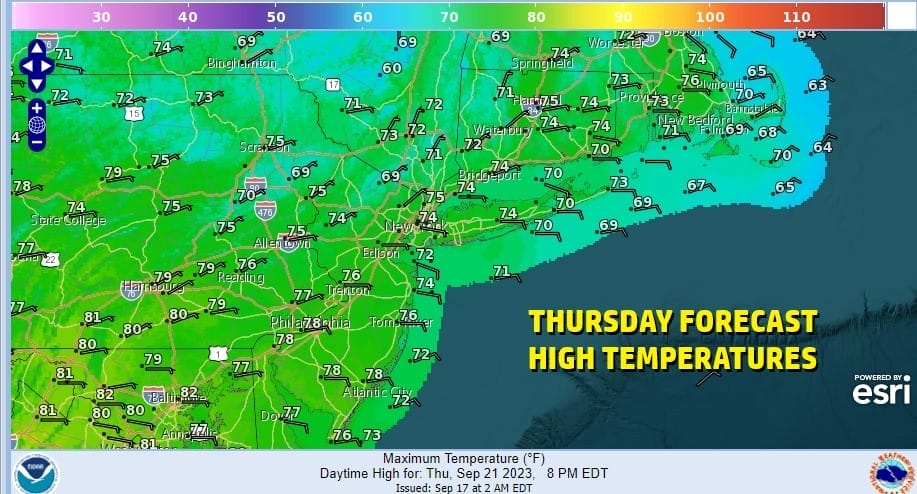
High pressure will remain in control for Thursday as it sits in upstate New York and over New England. Northeast to east winds will keep things on the cool side and we should have plenty of sunshine. The dry air should last into early Friday when we will likely see increasing clouds as the day wears on. Highs Friday will be in the upper 60s to lower 70s.
SATELLITE WITH LIGHTNING STRIKES

WEATHER RADAR

Our attention will then turn to the south. Large high pressure over New England is creating lower than normal pressures off the US Southeast Coast southward to Florida and the Bahamas. We also have a stalled frontal boundary lying across Florida and out into the Atlantic. Disorganized showers and thunderstorms are developing offshore the East Coast of Florida today and this is the beginning of low pressure developing.

Initially this starts off as a cold core system but the ocean is very warm off the Southeast Coast. We also have a strengthening upper trough in the Southeast US which will cause the low center to strengthen as it heads northward toward the Carolinas Friday into Friday night as the GFS model shows. Actually all of the major global weather models are on board with this idea. Weather conditions will deteriorate rather quickly with rain developing from south to north from Delaware to Southern New England during Friday and night and it will heavy into Saturday morning based on latest forecast tracks.

If today’s model runs verify we could see widespread 2 to 3 inch or more rainfalls over a very short 6 to 8 hour window Friday night into Saturday morning. Once the first surge is done we wait to see what the low center does and we could still see some more rain on and off Saturday night into Sunday. Certainly this opens the door to the potential for local flash flooding.
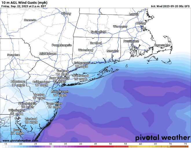
Winds could also become an issue along the coast as the pressure gradient between the high to the northeast off the coast of Nova Scotia and the low pressure centered to the south in Coastal Virginia. Gales will spread northward Friday night into Saturday from Coastal Virginia to Southern New England with gusts probably exceeding 40 mph at times. There is still much to figure out with this weekend forecast regarding the low development and the track. Whether it becomes subtropical or not is a technicallity that the National Hurricane Center will concern itself with. It doesn’t change the the weather outcome if it remains a cold core non tropical system. We will monitor new model runs over the next few days and make forecast adjustments accordingly.
BE SURE TO DOWNLOAD THE FREE METEOROLOGIST JOE CIOFFI WEATHER APP &
ANGRY BEN’S FREE WEATHER APP “THE ANGRY WEATHERMAN!
MANY THANKS TO TROPICAL TIDBITS FOR THE USE OF MAPS
Please note that with regards to any severe weather, tropical storms, or hurricanes, should a storm be threatening, please consult your local National Weather Service office or your local government officials about what action you should be taking to protect life and property.
(Amazon is an affilate of Meteorologist Joe Cioffi & earns commissions on sales.)
wA


