Nice Dry Weather Returns But Coastal Flooding Issues Into Monday

Nice Dry Weather Returns But Coastal Flooding Issues Into Monday
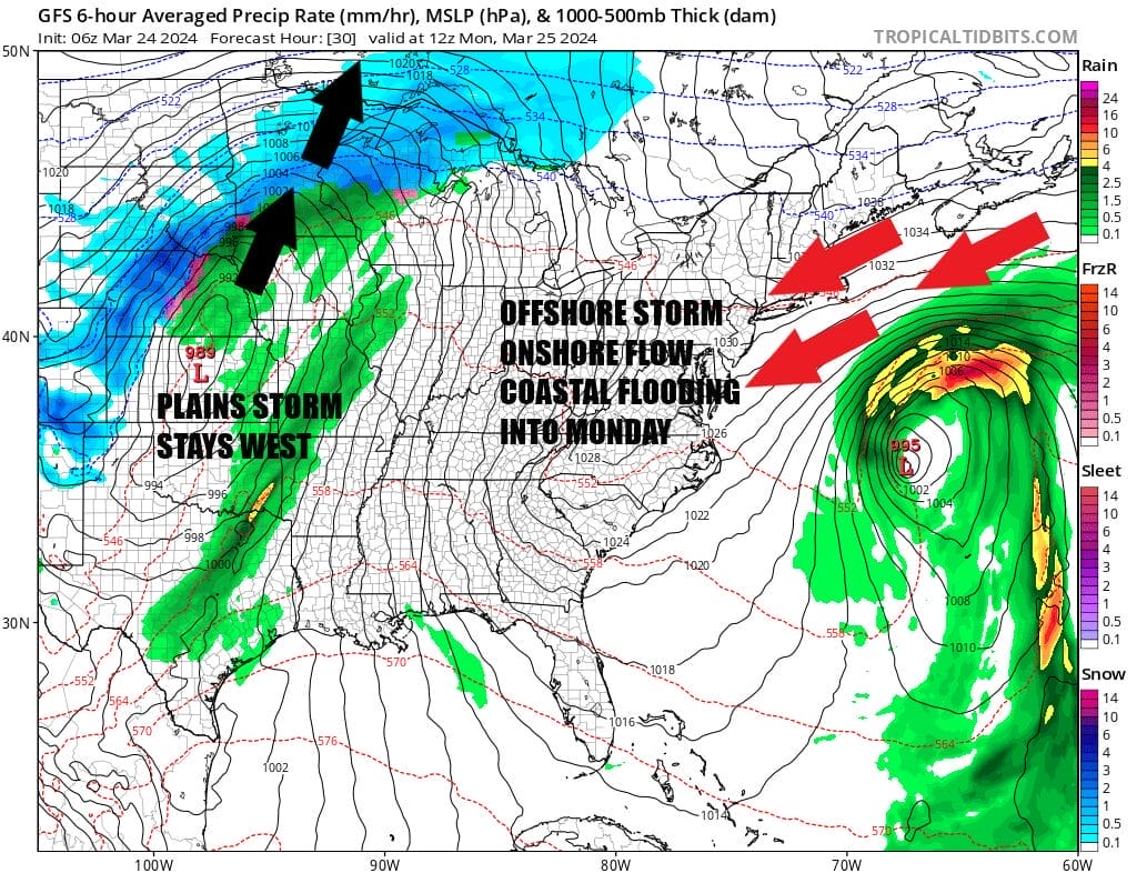
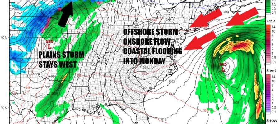
Yesterday’s rain and wind storm left 2 to 4 inches of rain over much of Eastern Pennsylvania to Southern New England. Heavy snow of 1 foot to a foot and half fell across Northern NY into Northern New England. This storm is now gone away to the northeast but on the satellite loop we see clouds offshore and a bulge in those clouds off the Middle Atlantic coast. We also have a storm in the Plains that is tracking well to our west so this leaves us in between with strong high pressure building south from Eastern Canada down the Eastern Seaboard.

This set up holds into early Tuesday so the result will be a strong onshore flow between the low and the high and we will see coastal flooding issues at high tide today and more so Monday when we hit the peak of the high tide cycle. Also being in between the two storms with the high in the middle leaves us at least a place we we are going to see a good deal of sunshine today, a fresh and gusty north to northeast wind, and most highs this afternoon reaching the low and middle 40s. Perhaps Southern New Jersey and points will see temperatures a little higher.
SATELLITE WITH LIGHTNING STRIKES

WEATHER RADAR

At least we can look to the week ahead and say that there are no major storms ahead thankfully. Many areas are pushing up between 6 and 9 inches of rain for the month and if we get another rain storm between now and months end, we could see monthly records topple across the Northeast and Mid Atlantic. Skies will be clear tonight with most lows in the mid 20s to lower 30s.
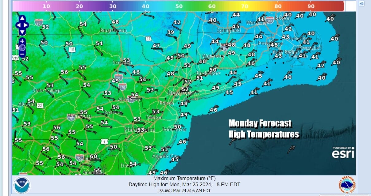
Monday should be a day of some sunshine. The storm offshore should be far enough east to keep clouds out of the way. The northeast flow continues and we will see coastal flooding at high tide during the day Monday. Temperatures Monday afternoon will reach the upper 40s and lower 50s in most areas. Tuesday we will see the ocean storm weaken and the onshore flow relax. It should be no worse than sunshine and patchy clouds with Tuesday highs in the 50s except for perhaps near the coast where we will see temps in the 40s.

The ocean storm deflects a strong storm in the Plains to head up into Central Canada. The trailing cold front will finally be able to approach Wednesday but that front will lose much of the moisture with it as it arrives so we are thinking that for the most part Wednesday should be dry with clouds & some sun with highs in the 50s. However the front is forecast to stall right along the coast Wednesday night into Thursday.

This could bring some rain during Thursday into Thursday night as a wave develops on the front and slides off to the south. This system doesn’t look to be anything major. Temperatures Thursday will be in the 50s. This system moves along so we should improving weather conditions Friday into Saturday. There are some questions about Saturday night into Eastern Sunday with an approaching warm front cold front combination but it doesn’t appear to be anything major at this point.
BE SURE TO DOWNLOAD THE FREE METEOROLOGIST JOE CIOFFI WEATHER APP &
ANGRY BEN’S FREE WEATHER APP “THE ANGRY WEATHERMAN!
MANY THANKS TO TROPICAL TIDBITS FOR THE USE OF MAPS
Please note that with regards to any severe weather, tropical storms, or hurricanes, should a storm be threatening, please consult your local National Weather Service office or your local government officials about what action you should be taking to protect life and property.
(Amazon is an affilate of Meteorologist Joe Cioffi & earns commissions on sales.)


