Next Storm System Will Bring Rain Wednesday
We can say goodbye to Subtropical Storm Melissa which is now a tropical storm as it moves over the warmer waters to the east. The satellite shows a solid core of thunderstorms near the center and top winds are now 50 mph. Melissa is now well out to the east and the impact to the tides will continue to diminish. The onshore flow has weakened as a cold front is nearing the coast with some clouds for tonight. We did manage to break out into some sunshine in some places this afternoon with that dry slot you see in between Melissa and the cold front.
SATELLITE

REGIONAL RADAR

There is very little weather associated with this front. Some showers are moving through Northern NY and there are just a few echos showing up on the local radars. Most of what is there is either not reaching the ground or just producing a few odd rain drops as they move to the east.
LOCAL RADAR NEW YORK CITY

LOCAL RADAR PHILADELPHIA


Dry air lies just to the west and skies should partially clear overnight and we might see some sunshine to start the day on Sunday. The front is going to stall to the south and a weak wave is going to develop on it. This will put us in some clouds Sunday afternoon. Highs Sunday should reach the upper 60s to around 70. The rain will pass mostly to the south and east of us Sunday night.

Monday is Columbus Day and it is looking like a nice day with some early clouds followed by partly to mostly sunny skies. Highs will be in the upper 60s to lower 70s. Our nice weather continues into Tuesday with sunshine most of the day. Highs will be in the 60s.
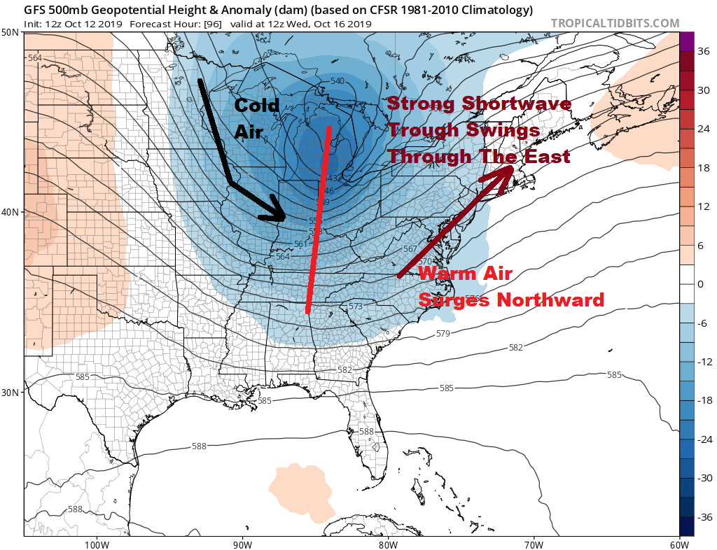
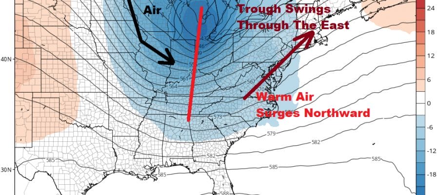
It looks like we have an opportunity for some rain here on Wednesday. Cold Canadian is driving southeastward into the Western Great Lakes ahead of a deep trough swinging eastward. Warm air surges up the East Coast with low pressure over the Great Lakes with a cold front and a second wave coming out of the south. This will eventually become a strong storm when it reaches Southeastern Canada Wednesday night and Thursday.
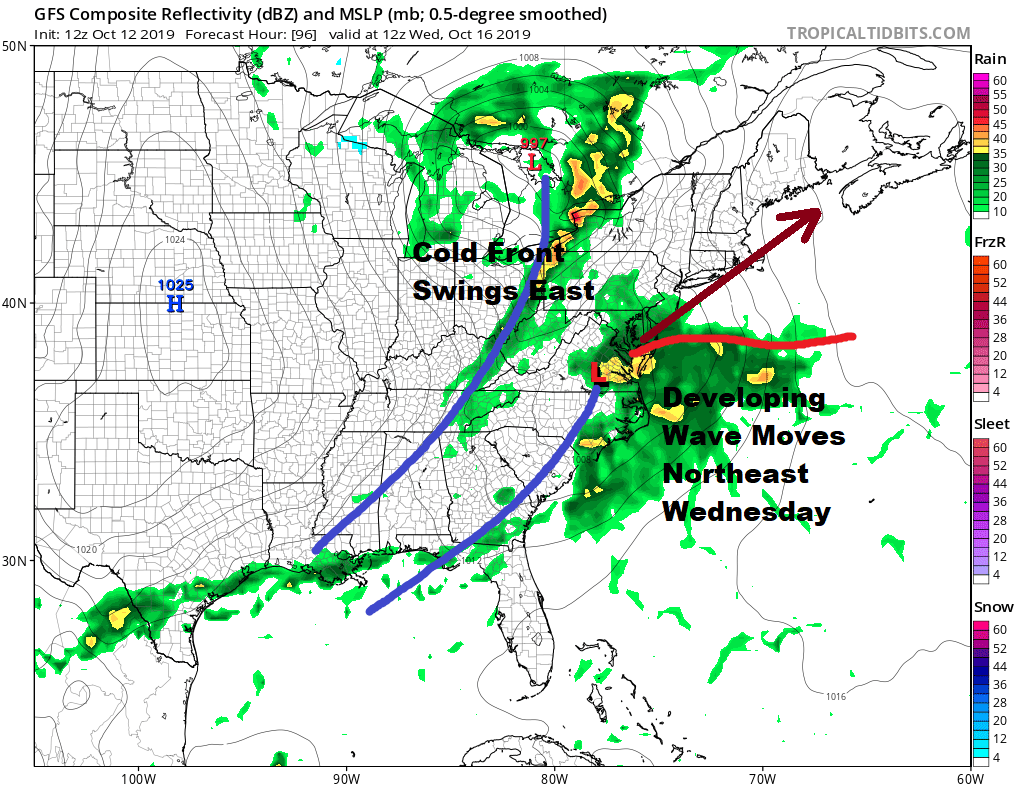
Rain will develop Wednesday morning. The two systems will remain separate until one low finally takes over. That will occur once the storm reaches Southeastern New England. Temperatures Wednesday will be in the 60s. Weather conditions will improve on Thursday with gust northwest winds and some sunshine. Highs Thursday will only be in the 50s to near 60 and we will be down in the 40s Friday morning. Friday looks nice and sunny but cool with highs again just in the 50s. Next weekend looks warmer with no rain forecast for now as high pressure will be off the East Coast and a southwest flow of air develops.
MANY THANKS TO TROPICAL TIDBITS FOR THE USE OF MAPS
Please note that with regards to any severe weather, tropical storms, or hurricanes, should a storm be threatening, please consult your local National Weather Service office or your local government officials about what action you should be taking to protect life and property.


