New Year’s Eve Rain Followed By A Gradual Turn to Colder Weather
Snow Risk Early Next Week

New Year’s Eve Rain Followed By A Gradual Turn to Colder Weather
Snow Risk Early Next Week
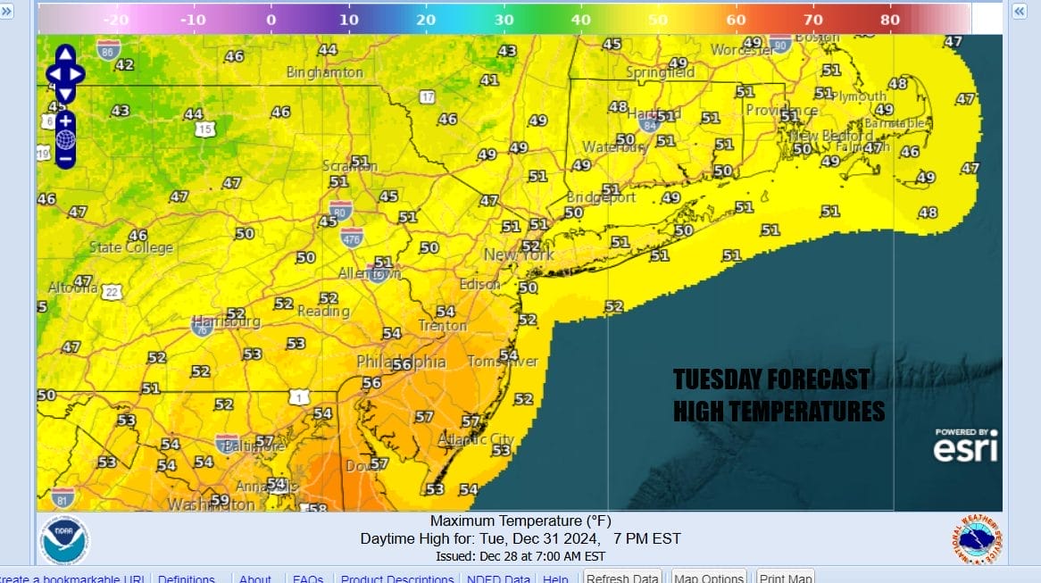
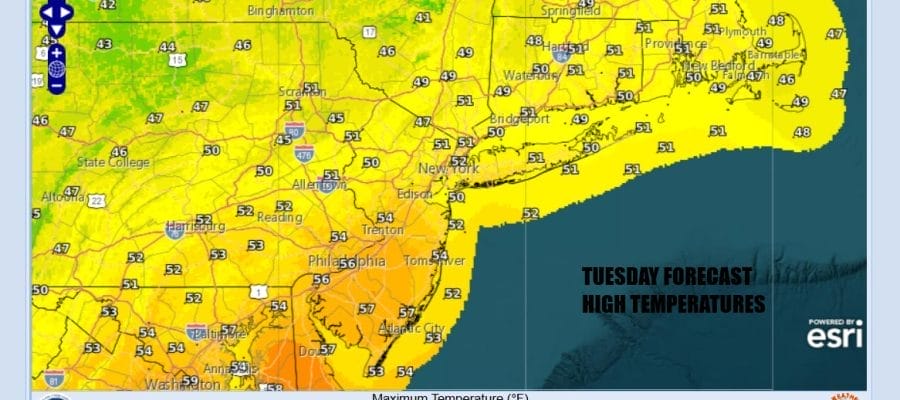
We are wrapping up 2024 today with low pressure moving across the Ohio Valley and heading into the Northeast tonight. Today will start dry with some sunshine but look for arriving clouds later today as the low and the front draw closer. Most highs today will be in the 50s. Gradaully as we go through the day you will see radar activity pick. Showery rains will arrive late in the evening and last into the early morning hours but the rain will come in bands so there may actually be short breaks between showers. It should be mostly done by daybreak Wednesday morning. Wednesday morning lows will be mostly in the 40s.
SATELLITE WITH LIGHTNING STRIKES

WEATHER RADAR

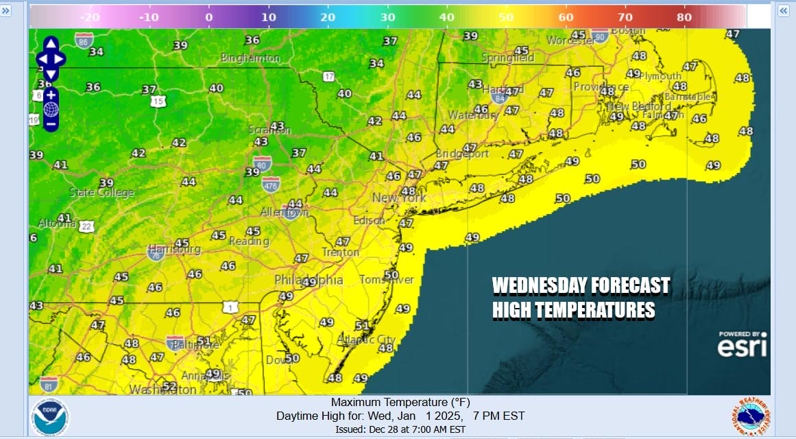
The low pulls away Wednesday however we still have to deal with the upper trough that won’t come through until late afternoon. This likely means we will have lots of leftover clouds around during Wednesday and there may even be some scattered afternoon and evening showers as the upper trough passes. Temperatures won’t be going much of anywhere New Year’s Day and some highs will be in the upper 40s to some middle 50s.
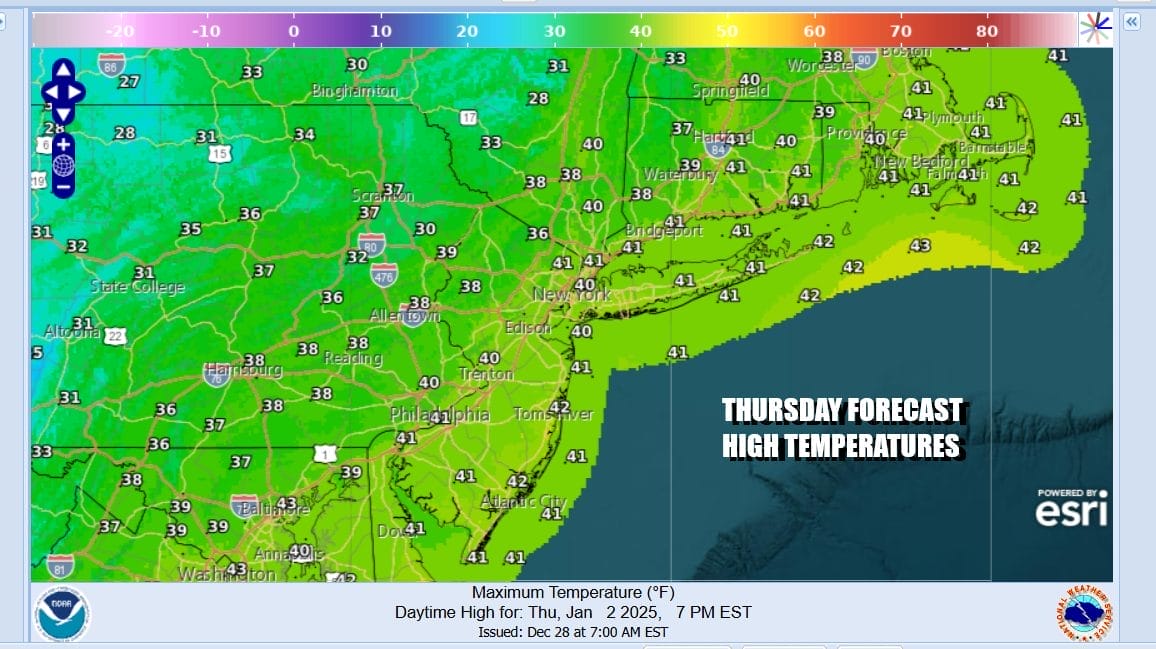
The general trend over the rest of this week will be a stair step decline in temperatures so the colder pattern doesn’t come in one big rush. We should see sky conditions improve Thursday with more in the way of sunshine but temperatures will be lower. Most highs will be in the low to middle 40s except as you head north of NYC in the Hudson Valley and interior Southern New England where highs will be in the mid to upper 30s.
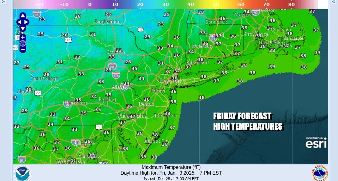
Another upper trough will be moving through Friday an a storm develops well offshore. This is a set up to bring down even colder air into the Eastern US and Friday will be the first day of below average temperatures and that is going to be the primary pattern going forward. Friday look for clouds and some sun, a gusty wind and temperatures no higher than the mid to upper 30s.
The weekend looks to be dry and cold with some sunshine for both Saturday and Sunday. look for highs in the low to mid 30s Saturday and upper 20s and lower 30s Sunday. Nights will be turning colder as well with lows Saturday morning in the low to mid 20s and Sunday morning lows will be in the upper teens and lower 20s. The colder than average weather pattern could yield some snow chances along the way and the first such chance will come next Monday.

Low pressure is going to develop over the weekend in the Southern Plains and then take a track eastward across the Lower Ohio Valley. The primary low will head into Southern West Virginia or Southwest Virginia and then redevelop just to the east of the Delmarva Peninsula. The blocking pattern means the new ocean low moves east northeast so there are questions here including how far north the snow gets. Also the strength of the system is in question as the upper air is not exactly ideal for a strengthening low offshore. We don’t have complete clarity on this yet and may not for a few more days. The timing here will be later Monday into early Tuesday morning and I would favor accumulating snows more to the south (Southern NJ, Southeast PA southward) verses areas to the north and northeast. That would be my early guess at this point. It is still a week away so models will likely start to come around on more specifics at the end of the week.
BE SURE TO DOWNLOAD THE FREE METEOROLOGIST JOE CIOFFI WEATHER APP &
ANGRY BEN’S FREE WEATHER APP “THE ANGRY WEATHERMAN!
MANY THANKS TO TROPICAL TIDBITS FOR THE USE OF MAPS
Please note that with regards to any severe weather, tropical storms, or hurricanes, should a storm be threatening, please consult your local National Weather Service office or your local government officials about what action you should be taking to protect life and property.


