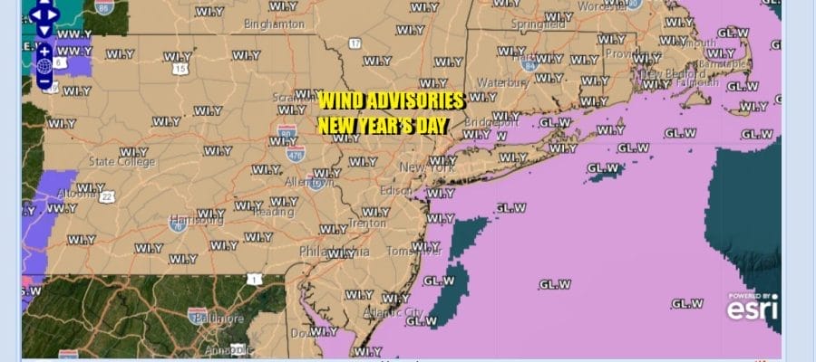
New Year Begins With Wind Advisories
Colder Air Arrives Friday & Lasts Through Next Week

New Year Begins With Wind Advisories
Colder Air Arrives Friday & Lasts Through Next Week
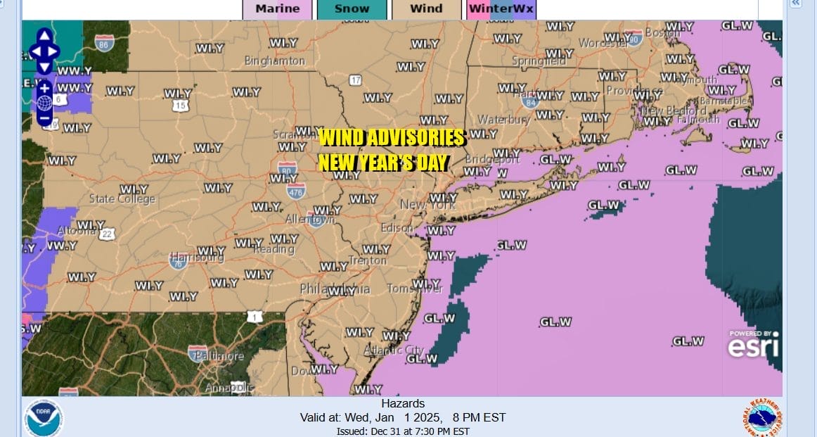
2025 begins with Wind Advisories posted for today right into Thursday. Strong gusty winds to 40 or even 50 mph are possible especially this afternoon. Low pressure that brought rain and thunderstorms last night is now to the Northeast in New England. The pressure gradient is tightening up and therefore, winds increase.
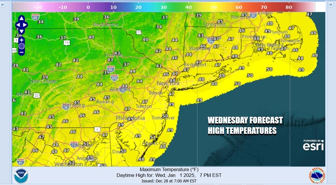
All of the shower activity is done based on the radars but we could see the odd scattered inland shower this afternoon as lake effect snow shields come inland in Western NY and NW Pennsylvania. Sometimes a stray band makes it east but it will be too warm today for flurries so we throw in the chance for a scattered shower. Otherwise skies should be partly sunny and temperatures this afternoon will be in the upper 40s and lower 50s. It will turn colder tonight with most lows will be in the low to mid 30s.
SATELLITE WITH LIGHTNING STRIKES

WEATHER RADAR

Progressively colder air will continue to move southward behind the strong storm to the east and high pressure coming south from Canada. Look for windy conditions again Thursday with gusts to 40 mph at times along with some sunshine and some passing clouds. Highs will be generally in the mid 30s to near 40 so temperatures really don’t go anywhere Thursday.

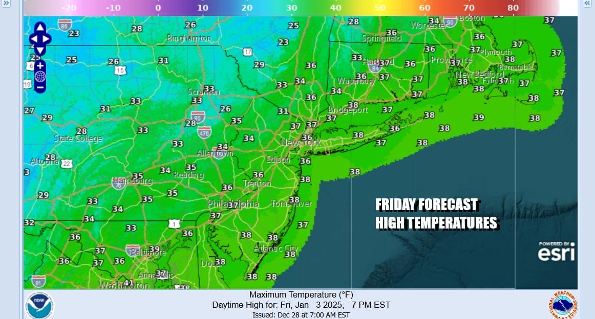
We will be down in the 20s at night. Friday will be a cold day with sunshine. Perhaps the winds will be a bit less. There is an upper air disturbance that will be crossing the Mid Atlantic states with some snow showers but we probably don’t see anything from that. Friday highs will be in the low to middle 30s.
Cold weather continues over the weekend with both Saturday and Sunday featuring sunshine. Saturday highs will be in the upper 20s and lower 30s. Sunday highs will be in the low to middle 30s. This is all ahead of a storm system that develops in the Southern Plains. Thanks to a strong blocking pattern, this low will track almost straight east across the lower Ohio Valley and then exiting somewhere off the Virginia coast during the day Monday.
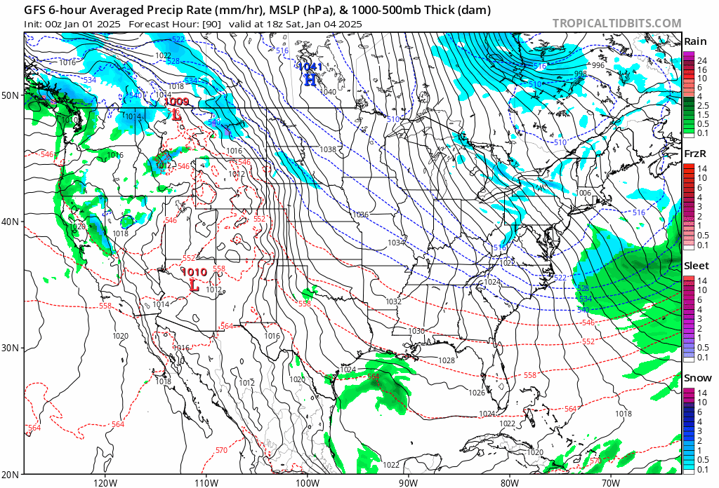
This system is likely to bring heavy snow just to the north of the track of the low center. Also due to the strong block in the North Atlantic, the low will have a tough time turning northward along the coast. That is likely to limit the northern extent of snow, cutting it off somewhere near or just south of the latitude of NYC. Right now it would seem that cities like Washington DC and Baltimore could be in line for a more significant snowfall though it is way to early to be specific. For now we will include the idea of a chance of a little snow Monday for Eastern Pennsylvania to Southern New England mainly south of Route 78 and watch to see if the block overwhelms or allows for an opening for a more northerly track.
BE SURE TO DOWNLOAD THE FREE METEOROLOGIST JOE CIOFFI WEATHER APP &
ANGRY BEN’S FREE WEATHER APP “THE ANGRY WEATHERMAN!
MANY THANKS TO TROPICAL TIDBITS FOR THE USE OF MAPS
Please note that with regards to any severe weather, tropical storms, or hurricanes, should a storm be threatening, please consult your local National Weather Service office or your local government officials about what action you should be taking to protect life and property.


