Year Ends With More Rain Tuesday Night
New Year Brings A Colder Winter Weather Trend

Year Ends With More Rain Tuesday Night
New Year Brings A Colder Winter Weather Trend
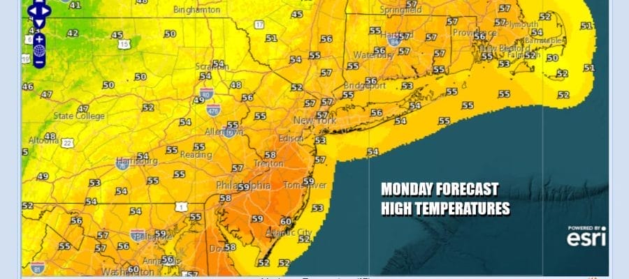
Overnight rainfall is exiting to the east and we will see gradual improvement as the day wears on. As radar activity heads offshore we will eventually go into a gradual clearing mode with leftover clouds giving way to some developing sunshine. Since the air behind the front is about the same as the air ahead of it, temperatures which are warm to begin with will remain on the warm side this afternoon. High temperatures will be mostly in the 50s to around 60 degrees.
SATELLITE WITH LIGHTNING STRIKES

WEATHER RADAR

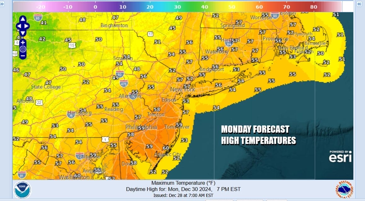
There are no weather issue for tonight as skies will be mostly clear. Lows Tuesday morning will be in the 30s to around 40 degrees. The dayside Tuesday will be dry with sunshine giving way to arriving clouds. Highs Tuesday will be mostly in the 50s The next low pressure area coming across the Ohio Valley is setting up for rain Tuesday night into the early morning hours Wednesday.
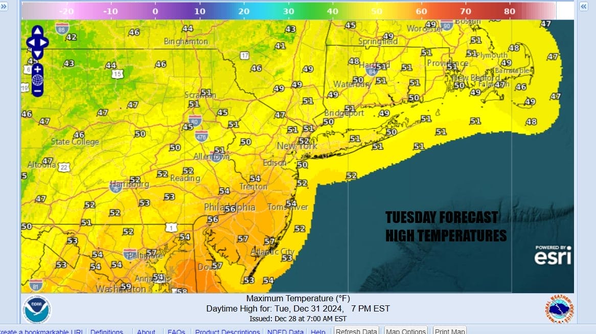
Behind this low will be colder air but it is not the arctic air that is still up in Canada. This will come down at some point next week so we will see temperatures trend toward seasonal averages for the rest of the week. Wednesday should see some sunshine. Temperatures New Year’s Day will still top out in the 40s to around 50 before it turns colder Wednesday night.
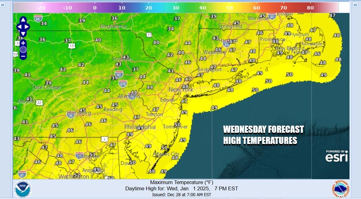
Thursday turns colder with no worse than partly sunny skies. Highs will be mostly in the mid to upper 30s. Friday we finish the week with some sunshine and high temperatures will be mostly in the mid to upper 30s. We will take another step down in temperatures over the weekend which will be dry and storm free. As far as the longer range is concerned there is still a lot of uncertainty regarding whether any storm systems bring snow next week. There will be a weather system that will approach early next week but weather models continue to gave problems with how this system plays out and there is a lot of volatility in the models from one run to the next.

Weather models can’t seem to decide weather the next low pressure area goes to the north or to the south or somewhere in between. Don’t expect clarity on this anytime soon. Also models are hinting at a stronger system coming after this one but here to there is much uncertainty and we deal with models showing a major storm one minute and then northing the next. We may have to wait until the weekend to know what exactly will happen with the system for early next week.
BE SURE TO DOWNLOAD THE FREE METEOROLOGIST JOE CIOFFI WEATHER APP &
ANGRY BEN’S FREE WEATHER APP “THE ANGRY WEATHERMAN!
MANY THANKS TO TROPICAL TIDBITS FOR THE USE OF MAPS
Please note that with regards to any severe weather, tropical storms, or hurricanes, should a storm be threatening, please consult your local National Weather Service office or your local government officials about what action you should be taking to protect life and property.


