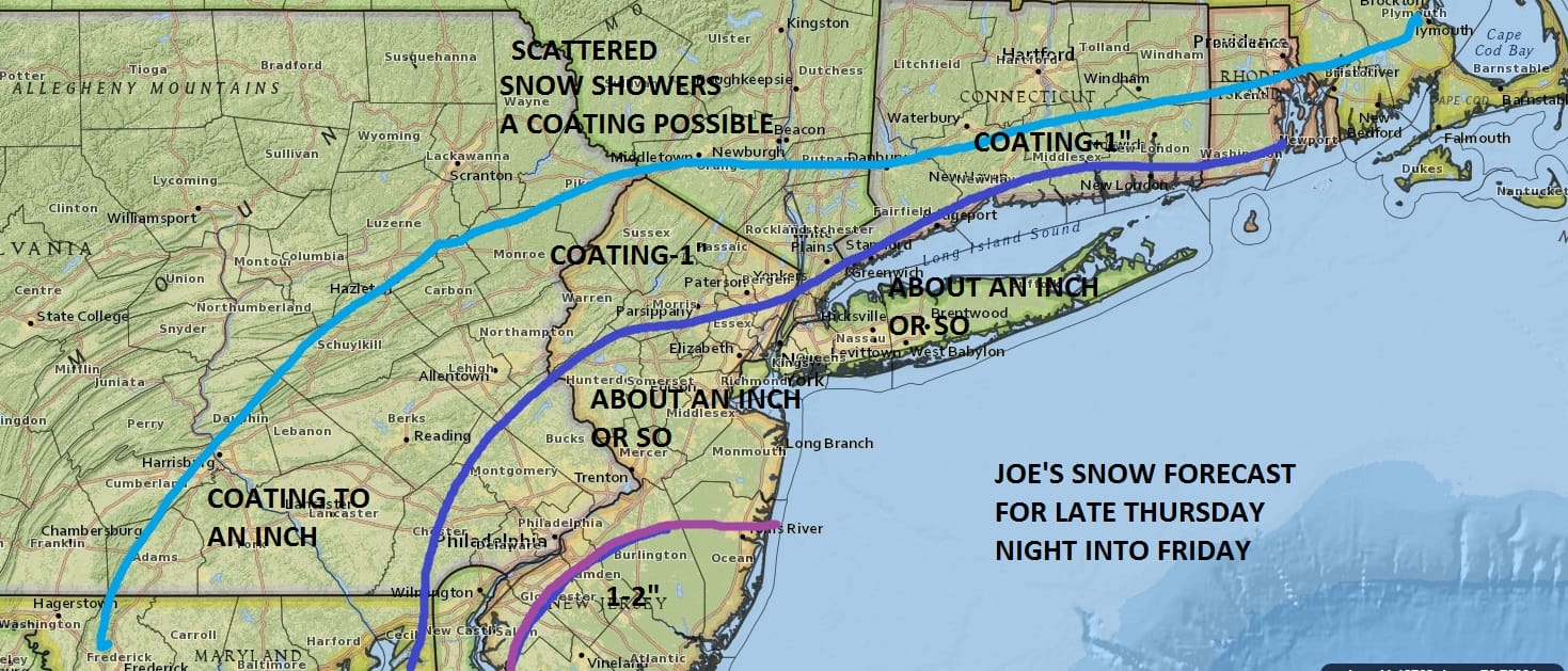
National Weather Service Snow Forecast Thursday Night
National Weather Service Snow Forecast Thursday Night
First off before we get to that you can see today’s system in the northeast with a solid soaking rain moving through and we should see rain taper off from south to north over the next few hours. Then we dry out on Wednesday and turn colder Thursday. You can also see a strong system on the radar moving into Northern California as energy continues to stream in from the Pacific. The next 2 weather systems for us a lining up for the snow threat.


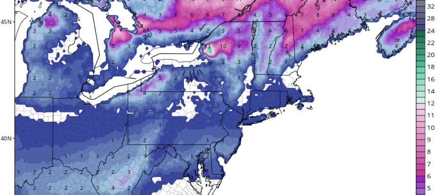
The maps below are the National Weather Service forecast snow maps with the most likely snowfall prediction. Most of the snow is forecast to be east and south. However the latest NAM model is a little more robust with its radar presentation
Thursday night so I feel comfortable with my forecast for the first event. These maps only cover any snow that falls into Friday morning. They do not include anything for the Saturday snow threat.


Be sure you check back later tonight as the National Weather Service does update these maps as new models are produced.
SNOW REMOVAL COMPANIES FOR YOUR WINTER NEEDS
LONG ISLAND ROCKLAND COUNTY Connecticut

![]()

ROCKLAND COUNTY TRI STATE SNOW REMOVAL jOHNSTOWN PA


