DOWNLOAD MY NEW FREE JOESTRADAMUS WEATHER APP FOR ALL DEVICES
Mother’s Day Rain Gloomy Days Ahead
Enjoy whatever sunshine you get today because we will likely have to wait until later Tuesday or Wednesday before it comes back. Yesterday’s cold front has now moved by and beginning to stall out to the south. Some clouds are around but we should see some sunshine today at least for awhile before clouds return. The satellite picture this morning shows large bursts of bright white high cloud tops to the immediate west and south and then another large area from the Western Lakes down to Texas. All of this plays out over us over the next few days. At least for today some sunshine should boost temperatures up to the 60s to near 70.
SATELLITE

REGIONAL RADAR

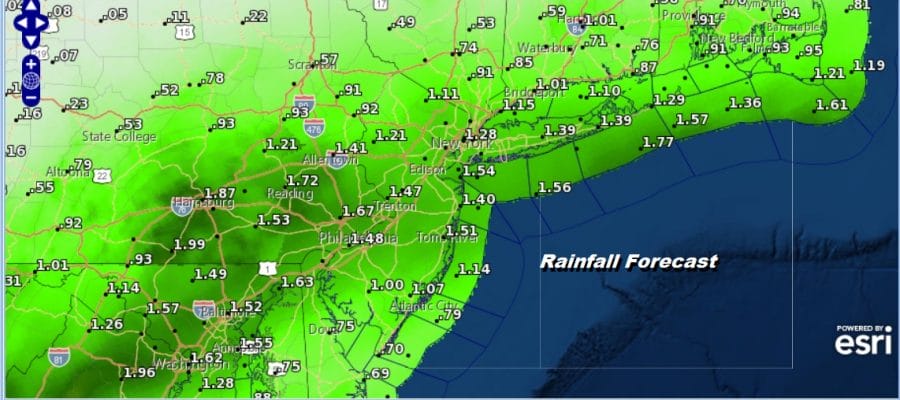
There is no rain to speak of on the radar near by but there is rain developing over parts of West Virginia and Virginia. This is setting up to move in overnight and into Sunday Mother’s Day. Lows tonight will be in the 50s. While it is raining Sunday we will have a raw northeast wind and temperatures will be in the 50s most of the day and some places will see temperatures actually settle in the 40s It will be a raw gloomy day from start to finish though there might be a break in the rain during the mid to late afternoon.
The first round of rains will move through followed by a bit of a break late Sunday afternoon and night. Then a second round of rain develops later on Monday and lasts into early Tuesday. When it is all said and done most areas will have received an inch to an inch and a half of rain from Sunday through Tuesday.
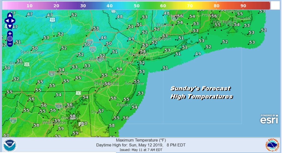
Monday will be another gloomy day with temperatures just in the 50s and Tuesday with low pressure pulling away offshore, a northeast wind and a ton of clouds we will still be mainly in the 50s. We should see some improvement on Wednesday with some sunshine and highs in the 60s but then clouds return with another low tracking to our south with clouds and the chance for showers on Thursday.
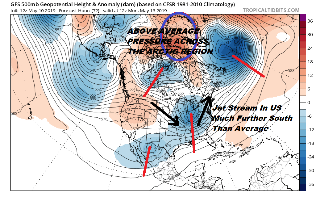
The overall weather pattern continues to be dominated by higher pressures across the polar region and lower pressures and a jet stream suppressed well to the south of where it should be for this time of year. This means a continuation of opportunities for rain but also with cool Canadian air and an onshore flow which creates gloomy conditions that last for days at a time. This pattern just doesn’t want to go away anytime soon.
MANY THANKS TO TROPICAL TIDBITS FOR THE USE OF MAPS
Please note that with regards to any tropical storms or hurricanes, should a storm be threatening, please consult your local National Weather Service office or your local government officials about what action you should be taking to protect life and property.


