Mostly Quiet Week Ahead Weekend Could Bring Snow Ice & Rain

Mostly Quiet Week Ahead Weekend Could Bring Snow Ice & Rain
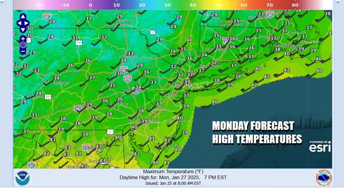
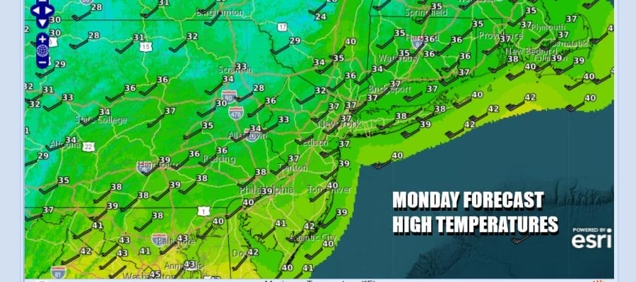
This is going to be a quiet weather week across Eastern Pennsylvania to Southern New England. Satellite loops show two streams of clouds and precipitation. The northern stream runs from the Central Canada to the New England. The southern stream runs across the Gulf States and straight east and offshore. As long as the two streams stay separate, storm systems are unlikely to develop and move up the East Coast. That said it leaves us today with no worse than partly sunny skies with a bit of a gusty wind developing late today and tonight. Temperatures today will top in the upper 30s and lower 40s.
SATELLITE WITH LIGHTNING STRIKES

WEATHER RADAR

We have 3 weather systems that will be moving through over the next 7 days. The first one is Tuesday as low pressure in Eastern Canada sens a cold front southward. Look for the pressure gradient to tighten overnight into Tuesday as winds go west northwest and gust to 30 mph or more. There will be some snow showers and snow squalls with the front as it moves southward but they should mostly fall apart before reaching the coast.
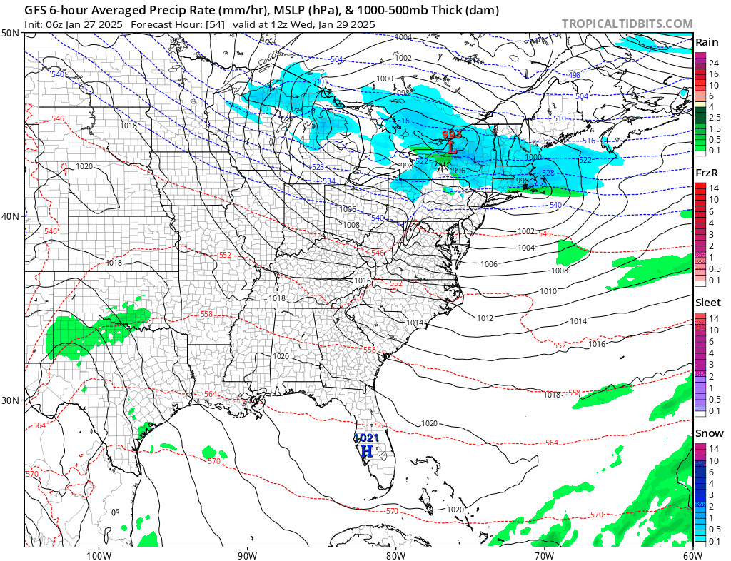
Next we have a weather system moving across the Great Lakes and into New England later Wednesday into early Thursday. All the snow with that goes to the north in Upstate NY and Central and Northern New England. South of the low track, it is bone dry. The third weather system comes over the weekend and that is going to be coming out of the southern portion of the jet stream. Low pressure in the Southwest US will get kicked east northeastward. That could bring some risk of snow ice and rain over the weekend for the Northern Mid Atlantic to New England but how much cold air will be around is going to be the nagging question.
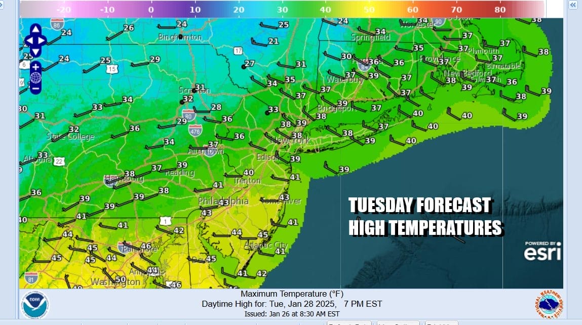
Ahead of all this, Tuesday looks to be a partly sunny to mostly cloudy day with gusty winds and temperatures in the upper 30s to lower 40s. Ahead of the system for Wednesday, temperatures will warm up into the 40s with no worse than partly sunny skies. There could be some light precipitation is forecast from the weather front that moves through in the form of rain or snow showers. Wednesday night will be in the mild 40s.

Colder air comes in for Thursday and Friday so temperatures will trend lower however we are not going back to extreme cold. Some sunshine will be around Thursday with highs in the upper 20s inland and low to mid 30s coast and south. Friday will be sunny to partly cloudy with highs mostly in the 30s. Over the weekend as we mentioned earlier there is the risk for snow ice and/or rain depending on how the low coming our way from the southwest behaves and how much cold air remains over New England into the Northern Mid Atlantic.
BE SURE TO DOWNLOAD THE FREE JOE CIOFFI WEATHER APP &
ANGRY BEN’S FREE WEATHER APP “THE ANGRY WEATHERMAN!
MANY THANKS TO TROPICAL TIDBITS FOR THE USE OF MAPS
Please note that with regards to any severe weather, tropical storms, or hurricanes, should a storm be threatening, please consult your local National Weather Service office or your local government officials about what action you should be taking to protect life and property.


