Mostly Quiet Weather Week Ahead
Chance For Snow Rain Showers Monday Night Early Tuesday
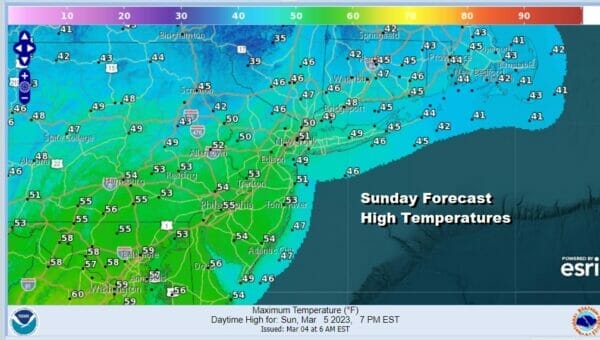
We have what is going to be a mostly quiet weather day. A weather system over the Eastern Great Lakes is weak and moving eastward across Upstate NY and into New England. This will put us on the edge of some cloud cover today but there should also be some sunshine in the mix. Highs will be generally in the upper 40s to lower 50s. We are seeing some precipitation showing up on the regional radar to the north but most of it is aloft and we don’t expect this to be an issue today or tonight. Skies will be mainly clear tonight with morning lows in the chilly upper 20s to middle 30s.
SATELLITE

WEATHER RADAR

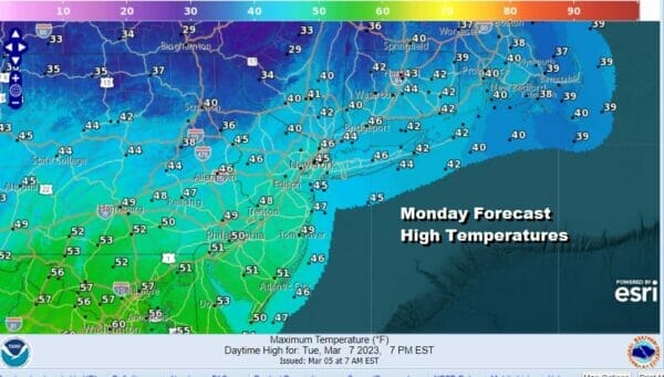
Monday will be a slightly colder day with sunshine to start and then clouds will start to increase some late in the day from northwest to southeast. Most highs Monday will be in the low to middle 40s but in South Jersey and Southern Pennslyania and points south, highs will be in the upper 40s to lower 50s.
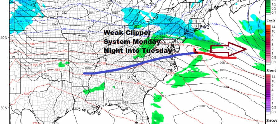
We do have a weak weather system that is coming out of the Great Lakes and will track southeastward to the Delaware/NJ coast Monday night and Tuesday. Actually the system is not weak at the moment and is producing snow and winter storm warnings are up for parts of the Northern Plains. This system will weaken by the time it reaches Eastern Pennsylvania to Southern New England.
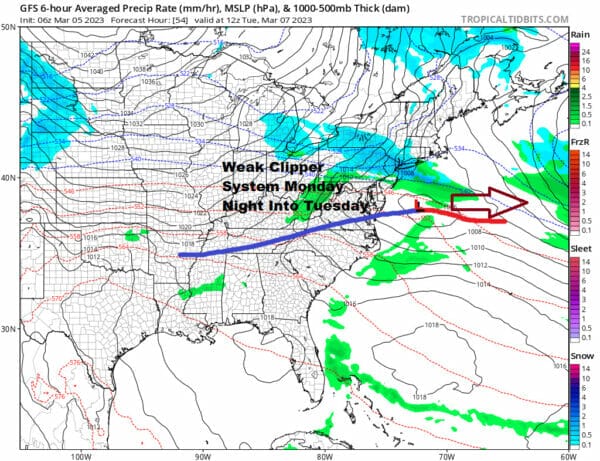
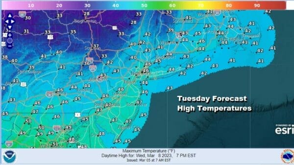
There will be some colder air that will come in with the system but models are all over the place with this. The European is further south and even weaker and would suggest that there wouldn’t be much of anything with this sytem. The NAM model is further north and also implies we see little or nothing from it. The GFS is right in the middle and brings a period of light rain and snow Monday night into Tuesday morning that doesn’t amount to much. We will for now put in the chance there could be a little precipitation and leave it at that for now. Once this system moves east it will be absorbed by a stronger storm south of Nova Scotia and Newfoundland. This leaves us with leftover clouds and some sun for later Tuesday. Highs will be in the low to middle 40s.
Colder high pressure over Canada is strong and rather large in scope. This will keep us with near normal temperatures Wednesday through Friday and it should be dry all three days. Daytime highs will be in the low to mid 40s and nighttime lows will be in the 20s to near 30 which is about where we should be this time of year. Next weekend we may have a storm system to deal with but it is too early to tell regarding the timing and the nature of this storm system.
BE SURE TO DOWNLOAD THE FREE METEOROLOGIST JOE CIOFFI WEATHER APP &
ANGRY BEN’S FREE WEATHER APP “THE ANGRY WEATHERMAN!
MANY THANKS TO TROPICAL TIDBITS & F5 WEATHER FOR THE USE OF MAPS
Please note that with regards to any severe weather, tropical storms, or hurricanes, should a storm be threatening, please consult your local National Weather Service office or your local government officials about what action you should be taking to protect life and property.


