Coastal Storm Winds Down Today Weak System
Monday Night Into Tuesday Morning

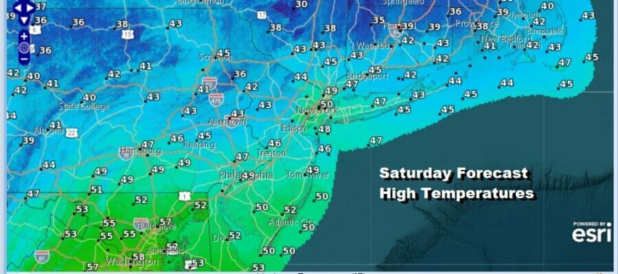
Today we will see the storm from overnight begin to pull away to the east. Low pressure straddling the south shore of Long Island will make its way well to the east of Cape Cod by late today. Improvement today will come slowly. Rain and wind is tapering off from west to east and we will likely settle in with lots of leftover clouds today and temperatures that will be mostly in the 40s to around 50 in areas from South Jersey southward. Finally tonight as the whole complex of this storm system moves to the east we should see some partial clearing of skies. Sunday morning lows will be in the upper 20s well inland and low to middle 30s along the coast.
SATELLITE

WEATHER RADAR

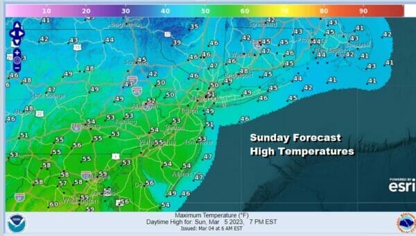
Let’s move on to Sunday which should be a much better day of sunshine and defintely the better of the two weekend days. As has been the case many times this winter, there is very little in the way of cold air behind these storm systems so temperatures should climb up into the 50s in many areas.
Next week will be a weak of relative calm as we have no major storms to deal with at least through Friday. The only issue will come later Monday night into Tuesday morning as low pressure moves southeast from the Great Lakes and passes offshore to our south. Normally this might be more of an issue but today’s storm will be stalling offshore to the east and that leaves little room. This system will weaken and not amount to much.
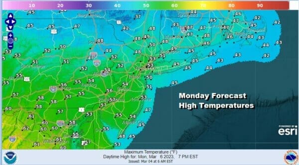
Monday will be a nice mild late winter day with sunshine and highs reaching the low and middle 50s. Monday night into Tuesday as thsi weak low heads from Lake Huron to Southern New Jersey, look for clouds and a few light rain showers into Tuesday morning. There is some colder air behind this system so it is possible that some areas inland could see some snow showers or a brief period of wet snow that won’t amount to much. Later Tuesday we will see some improvement. Highs will be in the upper 40s to lower 50s, likely to be reached early in the day. The rest of the week looks to be dry and colder than average with highs by day in the low to mid 40s and nights down in the 20s with some sunshine each day. Next weekend we could see the next storm system head our way and of course a week away leaves us with some uncertainty regarding this.
BE SURE TO DOWNLOAD THE FREE METEOROLOGIST JOE CIOFFI WEATHER APP &
ANGRY BEN’S FREE WEATHER APP “THE ANGRY WEATHERMAN!
MANY THANKS TO TROPICAL TIDBITS & F5 WEATHER FOR THE USE OF MAPS
Please note that with regards to any severe weather, tropical storms, or hurricanes, should a storm be threatening, please consult your local National Weather Service office or your local government officials about what action you should be taking to protect life and property.


