
Mostly Dry Weather Next Seven to Ten Days, No Major Storms,
Just Quiet Mid Winter Weather

Mostly Dry Weather Next Seven to Ten Days, No Major Storms,
Just Quiet Mid Winter Weather
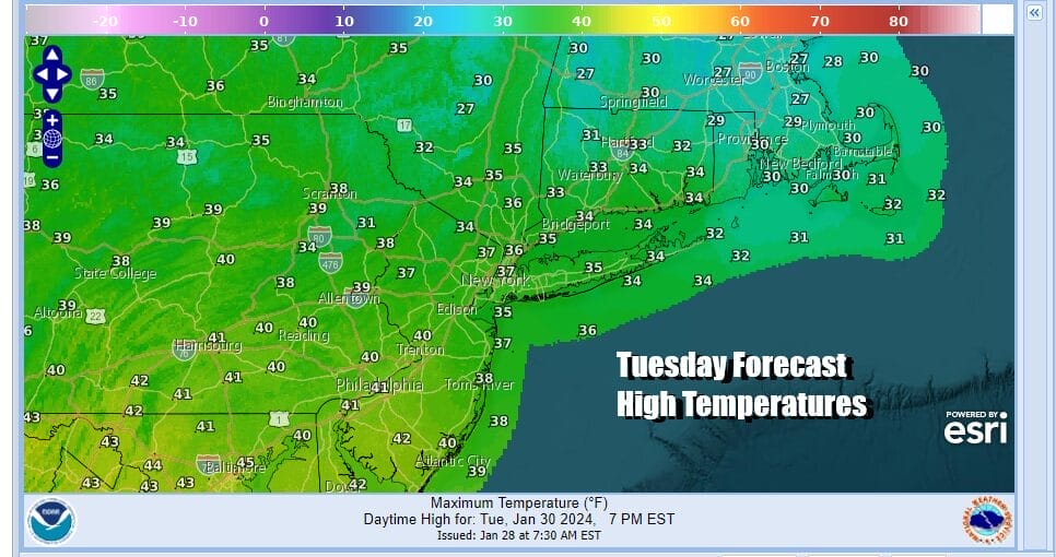
After two months of storm system after storm system, and, for the most part heavy rain after heavy rain, we have finally arrived at a dry stretch of weather. It will not exactly be picture perfect today as we do have an upper trough that is moving through as well as another trough that is dropping southeastward from the Great Lakes. This will create a day of self destructive sunshine and developing clouds but I don’t think we see much in the way of precipitation. Highs today will be in the mid to upper 30s in most places. Radars are looking rather quiet for the most part.
SATELLITE WITH LIGHTNING STRIKES

WEATHER RADAR

Over the next 7 days at least and possibly the next 10 days, we will see our weather dominated by a dry northwest flow out of Canada. There is also a deep trough in the Western US with two major storms coming into the West Coast. A very active southern jet stream set up will force one system Wednesday and Thursday to drop from the Great Lakes to the Carolinas and then head east toward Bermuda.

Energy and storminess coming into California will produce a major rain and snow storm that state. The low will move southeast and across the Deep South and Gulf States over the weekend but this system also will be forced to move east and and then southeast of the US Southeast Coast, passing south of Bermuda. The northwest flow in Eastern Canada and New England effectively blocks this system from moving up the East Coast.

This leaves us in a rather good place weather wise for the next 7 to 10 days with no major storms and little if any precipitation. Wednesday we will call it partly sunny with highs reaching the upper 30s and lower 40s across Eastern Pennsylvania to Southern New England. Thursday will be day where we warm up ahead of a cold front so highs will be in the low and middle 40s with some sun and clouds. There is the chance for a late day or evening shower as a front approaches and passes.


Models have also backed off the idea of a very cold air mass building into the Eastern US so that leaves us with clouds and some sun Friday, a gusty breeze developing and highs in the low to mid 40s. Saturday and Sunday should be dry with with some sunshine both days with highs mostly in the 30s. Next week we see no issues for the first half as a storm passes well to the south across the Gulf States and Southeast US.
BE SURE TO DOWNLOAD THE FREE METEOROLOGIST JOE CIOFFI WEATHER APP &
ANGRY BEN’S FREE WEATHER APP “THE ANGRY WEATHERMAN!
MANY THANKS TO TROPICAL TIDBITS FOR THE USE OF MAPS
Please note that with regards to any severe weather, tropical storms, or hurricanes, should a storm be threatening, please consult your local National Weather Service office or your local government officials about what action you should be taking to protect life and property.
(Amazon is an affilate of Meteorologist Joe Cioffi & earns commissions on sales.)


