
Quiet Week Continues Storm Moves Across the South Sunday Into Monday,
Not An Issue In the Northeast

Quiet Week Continues Storm Moves Across the South Sunday Into Monday,
Not An Issue In the Northeast

We have been locked into a gloom & doom pattern now for 7 days straight. There should finally be enough improvement today to allow for some breaks of sunshine. The satellite loop shows some promise though there are still a fair amount of clouds around. At least when it comes to precipitation, low pressure is forming off the coast of North Carolina today and that low will move straight east or even east southeast taking rain in the Carolinas with it to the east. There are no issues from this system in the Northeast and Northern Mid Atlantic.There should be enough sunshine this afternoon to take highs into the low and middle 40s just about everywhere. There could still be a few sprinkles or flurries around this morning but that should fade by midday.
SATELLITE WITH LIGHTNING STRIKES

WEATHER RADAR

We continue to focus on the northwest flow from Canada to the Northeast. This flow of air is blocking weather systems from moving up the East Coast and it will continue to do so into next week. We see low pressure coming into California bringing very heavy rain and heavy mountain snows there. This low will track eastward and undercut the northwest flow across the Deep South late in the weekend and early next week.
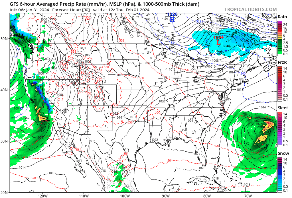
in the meatime we will see partly sunny skies Thursday with highs in the mid to upper 40s. A cold front approaches and moves through Thursday night with maybe a shower or two of rain. Then we will chill down a bit Friday and through the weekend but it will be rain free Friday into next week. Friday temperatures will be in the 40s. Saturday we will see highs in the upper 30s and lower 40s, and low to mid 40s Sunday. All three days will feature some sunshine. The storm that moves across the deep south will head off the Southeast US coast Monday and Tuesday and head out to sea. There is no chance this system moves up the coast. We may actually be dry all of next week and into next weekend before we see any important weather system and any major change in the long range pattern.
BE SURE TO DOWNLOAD THE FREE METEOROLOGIST JOE CIOFFI WEATHER APP &
ANGRY BEN’S FREE WEATHER APP “THE ANGRY WEATHERMAN!
MANY THANKS TO TROPICAL TIDBITS FOR THE USE OF MAPS
Please note that with regards to any severe weather, tropical storms, or hurricanes, should a storm be threatening, please consult your local National Weather Service office or your local government officials about what action you should be taking to protect life and property.
(Amazon is an affilate of Meteorologist Joe Cioffi & earns commissions on sales.)


