
More Ups & Downs Warmer Saturday Much Colder Sunday Plus The Week Ahead
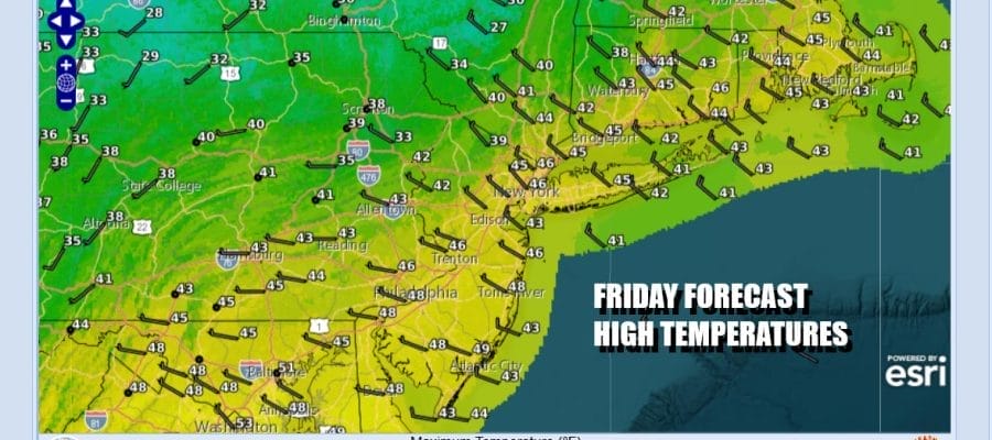
We have arrived at the doorstep of the weekend and a cold front is well offshore. Drier air is all in for today and we will see sunshine along with some clouds in the mix. Temperatures yesterday did not rise as high as advertised thanks to the slow moving front and the gloom & doom cloud cover. Highs will be in the upper 40s to lower 50s this afternoon. Radars are mostly on the quiet side. We do have a mild night ahead as the next weather front approaches. Saturday morning lows will be in the upper 30s and lower 40s.
SATELLITE WITH LIGHTNING STRIKES

WEATHER RADAR

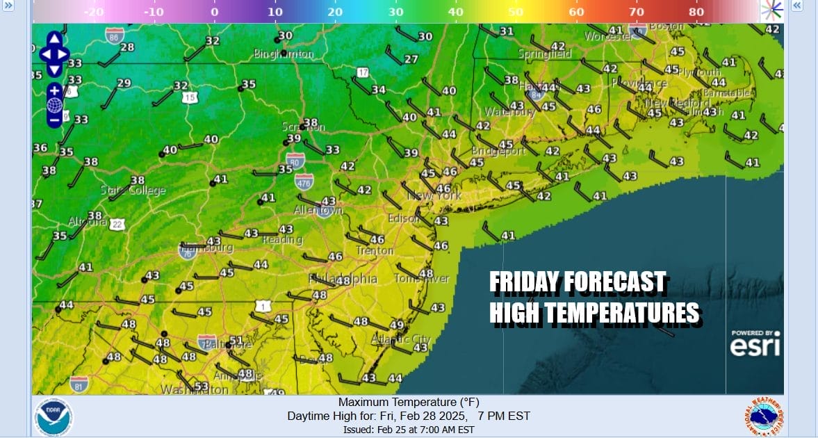
The cold front that moves through Saturday extends southward from low pressure moving across Upstate NY and New England. It is lacking moisture so we do not expect anything other than perhaps an isolated shower as the front passes. Otherwise Saturday will feature clouds with some sun and highs will be in the 50s to near 60 degrees in some warm spots. Winds will be picking up as the day wears on.

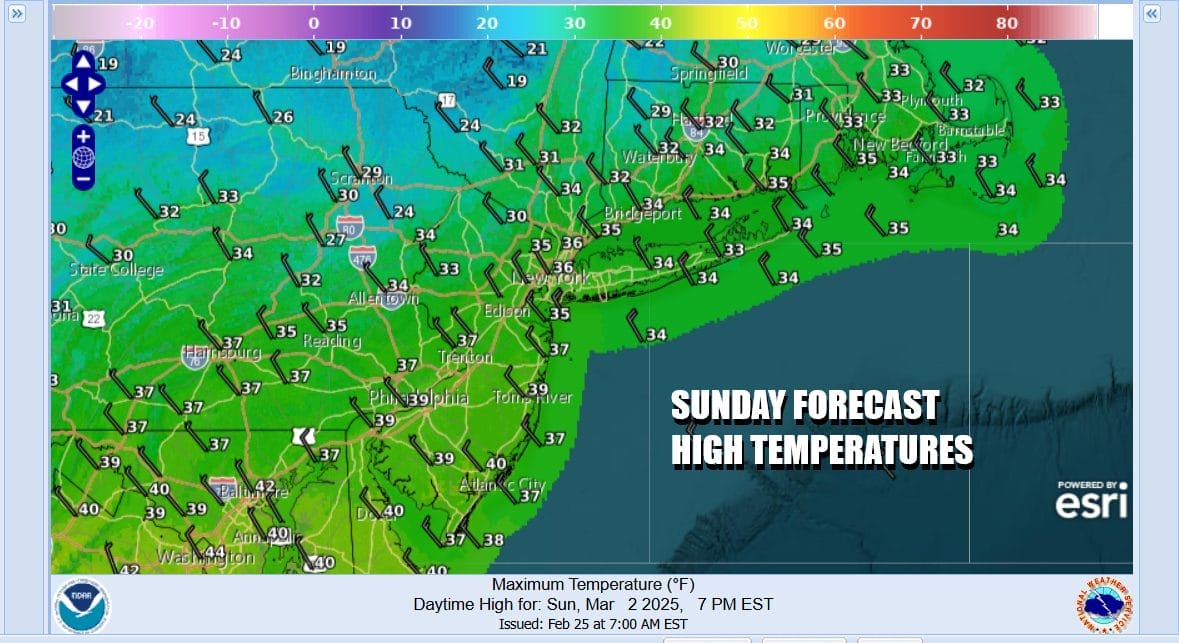
Behind the front strong northwest winds will bring down much colder air and by Sunday morning temperatures will be in the upper teens and lower 20s and wind chills will be about 10 degrees lower. Sunday will be a windy day with ineffective sunshine. Highs will just be in the low to mid 30s. Gusty winds will start to ease Sunday night. Monday morning lows will be in the teens.
Monday will be a cold day but the core of the cold air will begin to slide out to the east. We should see sunshine with less wind and highs Monday in the 30s to near 40 in warm spots. The next storm system will begin to develop in the Central Plains Tuesday and this storm is going to be a bit of a powerhouse. We are setting up for a significant severe weather outbreak across the Deep South and Southeaster US. The Storm Prediction Center has already indicated elevated risk for these areas in their long range forecast which means they are taking it seriously.

For Eastern Pennsylvania to Southern New England we will see sunshine giving way to arriving clouds Tuesday with highs in the 40s to near 50. A warm front will move northward and we will see rain Tuesday night and Wednesday morning. Assuming the warm front passes to the north, look for strong south winds to develop Wednesday afternoon and the likelihood of showers and thunderstorms. In fact the Storm Prediction Center is indicating a slight risk reaches as far north as Southern New Jersey and we might see that adjusted further north once we get closer to next Wednesday.
BE SURE TO DOWNLOAD THE FREE METEOROLOGIST JOE CIOFFI WEATHER APP &
ANGRY BEN’S FREE WEATHER APP “THE ANGRY WEATHERMAN!
MANY THANKS TO TROPICAL TIDBITS FOR THE USE OF MAPS
Please note that with regards to any severe weather, tropical storms, or hurricanes, should a storm be threatening, please consult your local National Weather Service office or your local government officials about what action you should be taking to protect life and property.


